Curated OER
Crater Lakes and the Volcanoes of the Cascade Mountains
Students study volcanoes. In this Earth science lesson plan, students read, discuss and take notes on the volcanoes of the Cascade Mountains. This lesson also includes an art project.
Curated OER
Paper Modeling: Volcanoes
Students build volcanoes. In this visual arts lesson, students use various materials to create paper model volcanoes.
Curated OER
Volcanoes
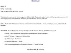
Fourth graders complete a WebQuest about volcanoes. They study vocabulary, label diagrams, list volcano types and benefits. They write an essay telling where volcanoes are located and why.
Curated OER
Vulcan's Revenge-Volcanoes
Sixth graders research various types of volcanoes. They explore the various emissions that come from them. Offer some explanation why some erupt by "quietly" puring lava, while others blast out chunks of rock and clouds of ash and gases.
Curated OER
Volcanoes and Urban Planning
Students analyze satellite image data of Volcan Villarica. In this earth science lesson, students identify dangerous areas surrounding the volcano. They propose a new safe location for the town.
Curated OER
Volcanoes: Shield or Composite?
In this volcano worksheet, students read a 1-paragraph selection regarding shield and composite volcanoes and then identify the 8 errors in the paragraph.
Curated OER
Shake, Rattle, and Roll: Mt. St. Helens - Lesson Plan 2
Students compile information on volcanic activity at Mount St. Helens. In this earth science activity, students use the information they gathered on Mount St. Helens to answer questions and create charts in Excel. Then...
Curated OER
Where Am I?
Students identify volcano locations by latitude and longitude. They analyze a world map, and complete a "Volcano Event Locations Chart."
Curated OER
Ring of Fire
Pupils locate some of the 1,500 active volcanoes on a world map. Then by comparing their maps with a map of the world's tectonic plates, they discover that volcanoes occur because of the dynamic nature of the Earth's lithosphere.
Curated OER
Hill of Fire
Students examine Paricutin eruptions. In this science lesson, students locate Paricutin on a map and take a virtual tour of volcanoes around the world. Students email questions to a geologist and create a news report on the original...
Curated OER
Forcasting the Path of Mudflows
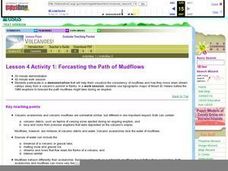
Students visualize consistency of mudflows and how they move down stream valleys away from a volcano's summit. They use topographic maps of Mount St. Helens before the 1980 eruptions to forecast the path mudflows might take during an...
Curated OER
Explosive Ideas: Oregon quarter reverse
Explore Earth and her amazing layers with this instructional activity on planetary change. Learners will research the ways in which Earth's layers cause change. They will complete a "Tectonic Puzzle" and use a worksheet to answer...
Science Matters
Earthquake Waves: Wave Notes
A multi-part lesson opens with a review of p waves and s waves. Then scholars use a simple s wave simulator to view the way the wave travels. Next, pupils use cups and various fluids to simulate p waves moving through different...
Science Matters
Wattsville and Mercalli Booklet
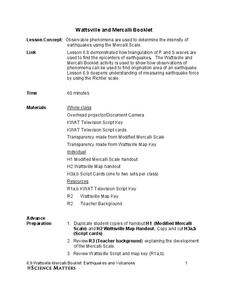
There has been an earthquake! Can you listen to the description of damage given by callers in order to determine the epicenter? The 11th of 20 lessons has pupils read a script of one emergency caller. The class records the information on...
Curated OER
This Is Tanzania
Students explore Tanzania. In this geography skills lesson, students read This is Tanzania by Richard Lupinsky, Jr. and discuss the impact that volcanoes have had on the nation. Students analyze the imagery in Lupinsky's piece and create...
Oregon State
World Map of Plate Boundaries
Young geologists piece together the puzzle of plate tectonics in an earth science lesson. Given a physical map of the world, they search for land formations that indicate the location of different types of plate boundaries.
It's About Time
Effects of Plate Tectonics
Explore our world from within as you lead young scientists on a thrilling adventure. Pupils examine the location of plate boundaries to determine earthquake and volcano distribution around the globe and explore the cause of hot spots in...
It's About Time
Volcanic Hazards: Flows
Did you know the largest volcano in our solar system is on Mars? Young scholars measure and experiment with how to predict lava and mud flows. This knowledge leads to better evacuation, safety, and preventative methods.
NOAA
Mapping the Deep-Ocean Floor
How do you create a map of the ocean floor without getting wet? Middle school oceanographers discover the process of bathymetric mapping in the third installment in a five-part series of lessons designed for seventh and eighth graders....
Radford University
Fun with Solids
Unlike a volcano, the lesson won't blow up in your face. Young mathematicians use dried beans to discover the relationship between the volumes of cones and cylinders and to write a formula for the volume of a cone. They then research...
Annenberg Foundation
Geometry 3D Shapes: Surface Area and Volume
Whether you wrap it or fill it, you're using geometric concepts. Classmates use an interactive approach to learn how to find volume and surface area of cylinders and prisms in the second lesson in a five-part series. The online lesson...
Brooklyn Children’s Museum
Rocks and Minerals in Our Lives
Young geologists discover the important role that rocks and minerals play in our everyday lives through this series of hands-on activities. Starting off with a lesson that defines the difference between plants, animals, and...
Curated OER
Volcanic Unrest
Students explore the Ring of Fire. In this volcano lesson, students discuss active volcanoes in the world and explore viscosity as they participate in a hands-on classroom activity.
Curated OER
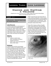
Making and Mapping a Volcano
Students build a baking soda volcano model. In this earth science lesson, students identify the sequence of lava flows. They make a volcano map using their models.


