PBS
Pbs Learning Media: Observe Images of Different Climate Zones
Interact with this world map from McDougal Littell/TERC to highlight different climate zones and see a photograph of each one. Ten climate zones are represented, including tundra, desert, humid subtropical, and others.
Other
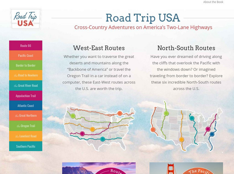
Road Trip Usa: Cross Country Adventures on America's Two Lane Highways
Learn all about America without ever leaving home. Select a driving tour, then find colorful information about what all the small towns have to offer. Many fun facts about famous historical destinations are given. Based on Jamie Jensen's...
Library of Congress
Loc: Japanese American Internment
What was the World War II experience like for the thousands of Japanese Americans living on the West Coast? The activities in this instructional activity are designed to provide a window into the war years. Using primary sources,...
Wikimedia
Wikipedia: Intercolonial Railway
A comprehensive site that examines the building of the railway from the east coast to the west coast of Canada. The section under History describes Canada's desire to have an intercontinental railway to secure Canada's future during the...
Digital History
Digital History: Defending American Interests in Foreign Affairs
A look at the foreign affairs that were dealt with by the Monroe Administration. Read about how the United States gained territory from Spain in Florida, why Russian settlements on the west coast were troubling, and why the Monroe...
Other
The Object of History: Behind the Scenes With Curators of the Nmah: Gold Nugget
Take a look at and lend an ear for primary sources featuring the California Gold Rush. Men and women from around the world landed in the United States and flocked to the west coast in search of nuggets of gold.
Annenberg Foundation
Annenberg Learner: A Biography of America: World War Ii 1941 1945
Interactive feature deals with the morality of total war, and its effects on those who fought, died, and survived it, focusing on Japanese Americans living on the West Coast. Was the wartime internment of Japanese Americans appropriate?...
University of Washington
University of Washington Libraries: Japanese Canadian Internment
A concise account of the evacuation of Japanese Canadians from Canada's West Coast. Of particular interest is a poster directed at all Japanese people.
Other
Wild Things: Seven Swinging Sand Dollar Facts
Written by a wildlife reporter for a newspaper, this blog entry about sand dollars briefly explains behavioral and feeding aspects of sand dollars on the west coast of the United States.
American Geosciences Institute
American Geosciences Institute: Earth Science Week: Monitoring Life in the Rocky Intertidal Ecosystem
This activity will allow young scholars to learn the sampling techniques used in the field by citizen scientists who participate in LiMPETS, five national marine sanctuaries along the West Coast.
Read Works
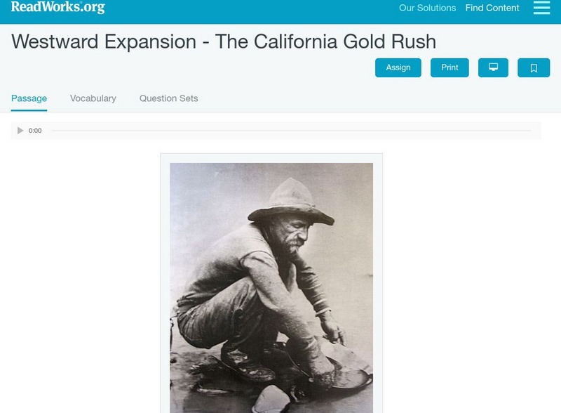
Read Works: Westward Expansion the California Gold Rush
[Free Registration/Login Required] An informational text about the discovery of gold along the West Coast. A question sheet is available to help students build skills in reading comprehension.
Other
California Missions Resource Center
Peruse this thorough resource featuring historical California missions stretching from San Diego to San Francisco as the Spanish established themselves on the west coast of North America between 1768-1853. Read stories of the early...
Countries and Their Cultures
Countries and Their Cultures: Sakalava
The Sakalava inhabit an expansive region of Madagascar; their territory today encompasses nearly all of the west coast of this large Indian Ocean island. "Sakalava" is a compound term meaning "the long valleys" or "rivers." A noun as...
Curated OER
Etc: Maps Etc: Mexico, Central America, and the West Indies, 1898
A map from 1898 of Mexico, Central America and the West Indies. The map includes an inset map of Cuba and the Isthmus of Nicaragua. "The surface of the Rocky Mountain highland in Mexico is quite similar to that of the great plateau...
Curated OER
Educational Technology Clearinghouse: Maps Etc: Colonial West Africa, 1920
Map of Western Africa in 1920 showing the Upper Guinea States of Gambia, Portuguese Guinea, Sierra Leon, Liberia, British Gold Coast, Togo, Dahomey, Northern and Southern Nigeria, Kamerun, and Spanish Guinea. The map also shows the...
Curated OER
Educational Technology Clearinghouse: Maps Etc: West India Island Chains, 1890
A map from 1890 of the West Indies region showing the highland structure of the island chains and groups, and illustrating the Caribbean Sea as an enclosed basin. This map also shows the Bahamas as a separate structure not related to the...
Curated OER
Etc: Maps Etc: Mexico, Central America and the West Indies, 1852
A map from 1852 of Mexico, Central America, and the West Indies. The map shows territorial boundaries at the time, including the Mexican States, capitals and major cities and ports, railroads, rivers, lakes, mountain systems, and terrain...
Curated OER
Etc: Maps Etc: Australia and the West Pacific in the Ice Age, 20,000 To10,000 Bc
A map showing Australia and the Western Pacific in the Glacial Age (the Maximum of the Fourth Ice Age, about 50,000 years ago - Wells). While the waters were held up in the polar ice caps, the sea-level was low enough to enable...
Curated OER
Etc: Early Voyages of Spaniards in the West Indies, 1512 1580
A map of the Gulf of Mexico and Caribbean showing the voyage routes of the early European explorers in the region between 1512 and 1580. The map shows the routes of Alonzo de Ojeda to Darien Colombia, Balboa to the Pacific, Juan Ponce de...
Other
La Litterature Ivoirienne
Personal site specializing in the literature of Ivory Coast. Good list and description of women authors from that West African country.
Countries and Their Cultures
Countries and Their Cultures: Edo
"Edo" is the name that the people of the Benin Kingdom give to themselves, their language, and their capital city and kingdom. Renowned for their art of brass and ivory and for their complex political organization, the Edo Kingdom of...
American University
American University: Ted Case Studies: Hudson Bay Company Fur Trading in 1800s
This site gives an overview of the fur trade with Northwest Coast native peoples in the 1800s, and the impact the fur trade and contact with outsiders had on the natives' way of life.
Countries and Their Cultures
Countries and Their Cultures: Mossi
The Mossi are the most prominent ethnic group in the modern nation of Burkina Faso (formerly Upper Volta). They are also well known in the anthropological literature as a society with an especially high rate of labor migration to...
Other
Vancouver island.com: Gulf Islands, British Columbia
Between the B.C. mainland and Vancouver Island are a number of islands called the Gulf Islands. Each has its own history, unique scenery, artisans and artists, and outdoor recreation. Visit the islands on this web site, and find out...


