Curated OER
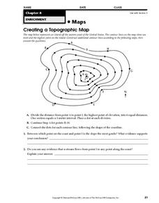
Creating a Topographic Map
In this topographic map learning exercise, students add contour lines to a topographic map using instructions provided. Once topographic map is finished, students complete 2 follow-up short answer questions.
Curated OER
Mapping Gymnosperms and Angiosperms
In this plant worksheet, students create a map of a familiar area such as their yard, a nearby park, or the school grounds showing the major plants. On their map they identify the plants in three ways following the example provided. ...
Curated OER
Mapping Exercise
In this mapping worksheet, learners are given data of children exposed to health risks and their geographical location. Students plot each child's home and the risk factors using an (x, y) grid. They answer 2 questions about the...
Curated OER
Making Maps
First graders create a map of their classroom that can be used to find a hidden treasure. They examine two- and three-dimensional objects and discover characteristics.
Curated OER
Using a Concept Definition Map
Learners define "natural disaster" by offering examples and charting them to discover what a concept definition map is. Then students create their own maps using the word "city".
Curated OER
Southern Africa Map Quiz
In this online interactive geography quiz worksheet, students examine the map that includes 15 Southern African countries. Students match the names of the countries to the appropriate locations on the...
Curated OER
French and Indian War: Make A Map
Fifth graders create a map of the battles that occurred during The French and Indian War. In this history lesson plan, 5th graders read about the war in their text books, then divide into groups to create a detailed map of a famous...
Curated OER
South America and Central America Capitals Map Quiz
For this online interactive geography quiz worksheet, students examine the map that includes all of Central and South America's countries. Students match each of the country names to the appropriate locations on the map.
Curated OER
Mapping the Library
Learners compare their school library with another library such as: town library, for example, or a virtual library and identify the most important features. Students use their observations to create a map of the school library that can...
Curated OER
Make Your Map
In this map making worksheet, students make their own maps, draw symbols and place them in the map key area, and draw a compass rose to show directions for the map.
Curated OER
Maps Can Help Us
First graders explore the geography of Montana by analyzing geographic maps of the area. For this Native American reservation lesson, 1st graders discuss the similarities and differences between reservations in the state of Montana....
Curated OER
Australia and Oceania Map Quiz
In this online interactive geography quiz worksheet, students examine the map that includes 23 countries, territories, and dependencies of Oceania. Students match the names of each to the appropriate...
Curated OER
South America and Central America Map Quiz
In this online interactive geography quiz worksheet, students examine the map that includes all of Central and South America's countries. Students match each of the country names to the appropriate locations on the map.
Curated OER
Asia Map Quiz
In this online interactive geography quiz worksheet, students examine the map that includes 26 Asian countries. Students match the 26 country names to the appropriate locations on the map.
Curated OER
Weather, Data, Graphs and Maps
Students collect data on the weather, graph and analyze it. In this algebra instructional activity, students interpret maps and are able to better plan their days based on the weather reading. They make predictions based on the type of...
Curated OER
The Tone Map
Students listen carefully to a portion of the Poetry Out Loud CD. They focus on the tones the poet uses in his recitation of a poem. Then they map a poem of their own so that a classmate can read it using the tonal qualities intended...
Curated OER
Cause And Effect Map
In this Language Arts worksheet, students create a cause and effect map. Students describe three causes, one event or situation, and three effects.
Curated OER
Sequencing Map
In this Language Arts worksheet, students create a sequencing map of a story or book. Students describe six scenes or ideas from their book that happen in a chain of events.
Curated OER
Caribbean Map Quiz
For this online interactive geography quiz worksheet, high schoolers examine the map that includes 20 Caribbean countries and territories. Students identify the names of the countries and...
Curated OER
Canada Outline Map
In this Canada political map worksheet, students examine the province boundaries of the nation. The province names are labeled on the map.
Curated OER
United States Map
In this United States outline map learning exercise, students make note of the political divisions of 50 states of the nation. This map may be used in a variety of classroom activities.
Curated OER
United States Map: Capitals
In this United States outline map worksheet, students make note of the political divisions of 50 states of the nation. This map is labeled with the 50 state capitals.
Curated OER
Mexico: Political Map
In this Mexico political map activity, students examine state boundaries. The map also highlights major cities in Mexico. This map is unlabeled.
Curated OER
Europe Labeled Map
In this Europe political map worksheet, students examine the national boundaries. The map also highlights each of the nation's capitals with a star. The countries and capital cities in this map are labeled.
Other popular searches
- Using a Map Key
- Using a Map Scale
- Reading a Map Key
- Read a Map Legend
- Reading a Map Scale
- Create a Map Rubric
- Using a Map Legend
- Create a Map Interactive
- Mind Mapping a Story
- Mapping a Story
- Concept Mapping a Theory
- Fill in the Map From a Story


