National WWII Museum
On Leave in Paris: Maps as Primary Sources
Primary sources—even those that seem mundane—offer a window into those who experienced history. Using a Red Cross map offered to soldiers stationed in Paris after World War II alongside worksheet questions, scholars consider what life...
Just Health Action
Environmental Justice Matters: Mapping Cumulative Impacts (Part 2)
A case study enables class members to confirm whether different geographic parts of Seattle, Washington have disproportionate environmental burdens and benefits. Groups use the EPA's Cumulative Health Impact Analysis formula and...
ESRI
Juneteenth: An American History through Maps
An interactive website traces the history of Juneteenth celebrations from their origin in Galveston, Texas, on June 19th to the present day. Using interactive maps, learners can find information about the African-American...
Raymond C. Jones
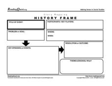
Story Mapping History Frame
Map out the conflicts throughout history with a graphic organizer. It includes a section for kids to list the participants in an event, the problems or goals, and the theme or lesson learned.
CK-12 Foundation
Whole Number Multiplication: Multiplication Map
How many miles did a car travel if it traveled at 55mph for three hours? What are the factors for this multiplication sentence? These are the questions young mathematicians must solve using a multiplication map.
Concord Consortium
Understanding Probability Maps
What's the likelihood of your class understanding probability maps? Young scientists explore the concept using a virtual dartboard in an interesting simulation. The darts establish a pattern around the bull's-eye, which provides a visual...
NASA
Mapping the Watery Hills and Dales
How does GPS know where everything is located? Pupils read about satellites that are mapping the ocean and the question on how satellites know where they are. Readers discover the workings of the Global Positioning System and create...
Curated OER
Working With Electronic Topography Maps
Junior geologists examine topographic maps online and learn how to read them. they answer seven associated follow-up questions. This lesson plan is only a general outline and does not provide the details or the websites that you...
Curated OER
Project Ahupua`a: Map Construction
Fourth graders construct a relief map of the Big Island of Hawaii. They work in groups to conduct research, design and construct the map. Students use clay, gessoed boards and reference maps in their projects.
Curated OER
New York Map
In this state map learning exercise, students identify the state map of New York. Students fill in the state capital, major cities, and other state attractions.
Curated OER
Acadiana Map (Map of Acadians in Louisiana) PowerPoint Slide
Is your class studying the state of Louisiana? This slide provides a good visual of Acadiana Louisiana, or as it is otherwise known; the Historic Cajun Country. The 22 parishes that make up this French-influenced region are numbered on...
Curated OER
Nebraska Map
For this Nebraska worksheet, students explore the state of Nebraska. Students are given a blank map of the state of Nebraska and are to fill in the capital, major cities, and any other state attractions on the map.
Curated OER
Wisconsin Map Activity
In this Wisconsin map worksheet, students fill in the capital, major cities and other state attractions on a blank map of Wisconsin. A reference web site is given for additional activities.
Curated OER
Alabama Map
In this Alabama worksheet, learners explore the state of Alabama. Students are given a blank map of Alabama where they are to label the capital city, other major cities, and any other important state attractions on the map.
Curated OER
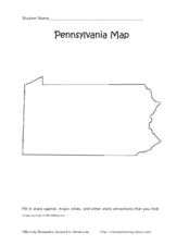
Pennsylvania Map
In this state maps instructional activity, students identify the map of Pennsylvania. Students fill in the state capital, the major cities, and other state attractions.
Curated OER
Walking on Maps
Learners are introduced to the various types of maps and their functions. As a class, they play a game similar to twister to review map concepts. They answer questions about the map and use the internet to view larger maps of the world.
Curated OER
Making a Map
Students are introduced to maps by examining the various types and practice using a key to find information. They each create their own map with a key and graph information. As a class, they read the story "Henny Penny" and share their...
Curated OER
Organization of a Territory, Map Elements
Third graders compare printed and online maps and use proper geographic terminology to answer questions.
Curated OER
Introduction To Topographic Map Activities
Students discuss different types of maps, their similarities and differences. Using a Topographical Maps CD-rom program students create their own map.
Curated OER
Mapmaker, Make Me a Map!
Pupils are introduced to the state quarter program and examine the Colorado state quarter. They locate Colorado on a map and create a map with a key. They discuss the state motto and examine pictures of the state's geographical features.
Curated OER
What You Can Learn From a Map
Students discover how to interpret maps. In this geography skills lesson plan, students explore geographic themes as they complete worksheet activities regarding road maps, shaded relief maps, and topographic maps.
Curated OER
Map It With Pixie
Fourth graders use the computer program 'Pixie' to create a topographic, detailed map for the state they live in. In this mapping skills lesson, 4th graders use Pixie to make a map of their state that includes topographic features, state...
Curated OER
Map Keys
Third graders examine maps and map keys. In this locating map features lesson, 3rd graders use crayons, markers and colored pencils to label maps. Students work in partners to read map keys and locate given places and things.
Curated OER
Edible Maps
First graders, in groups, identify major geographical features of Texas. They form a topographical map of Texas using edible dough, candy, etc. They present and then eat their maps.
Other popular searches
- Using a Map Key
- Using a Map Scale
- Reading a Map Key
- Read a Map Legend
- Reading a Map Scale
- Create a Map Rubric
- Using a Map Legend
- Create a Map Interactive
- Mind Mapping a Story
- Mapping a Story
- Concept Mapping a Theory
- Fill in the Map From a Story


