Curated OER
Geo-Class Mapping My Neighborhood
Students create a map of the school and surrounding neighborhood. In this mapping lesson, students discover their school's location and learn about its past. Students use math skills and the steps in the design process to...
CK-12 Foundation
Topographic and Geologic Maps: Topographic Maps
Maps are great for helping you get where you're going, but what does that place actually look like? Geology scholars compare and contrast the features of topographical and geologic maps using an interactive lesson. The resource describes...
NASA
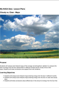
Cloudy vs. Clear - Maps
Find out the science of how clouds keep Earth cooler on hot days. Using guided discussions, investigators analyze and interpret maps of how much solar energy Earth receives at different times of the year. Participants draw conclusions...
Curated OER
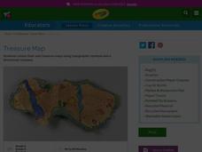
Treasure Map
Students study and recognize topographical symbols on maps. They create their own topographical Treasure Maps using symbols they learned or invent new ones. They create a bird's-eye view and include landscape details such as mountains...
World Globes & Maps
United States Map- Intermediate Directions
Learners identify the four intermediate directions. For this map skills lesson, students use post-it notes to label the four intermediate directions on a map. Learners locate various states using intermediate directions.
Curated OER
John Smith’s Map of the Chesapeake Bay
Young geographers travel back through time with primary source and map analysis and envision Captain John Smith's arrival at the Chesapeake Bay.
Cedar Ridge Elementary
Thinking Map Templates
Help your class understand and organize concepts, facts, ideas, and events with a set of graphic organizers and flow charts. Included in this packet is a bridge map, multi-flow map, flow map, double bubble map, bubble map, circle map and...
Curated OER
Use Google Maps to Teach Math
Capture the engagement of young mathematicians with this upper-elementary math lesson on measuring time and distance. Using Google Maps, students first measure and compare the distance and time it takes to travel between different...
Population Education
Population Map
Here is a very interesting graphic of a world map where each country's size is adjusted accordingly to its population. The bottom row of the document also includes several maps depicting the major shifts and growth of the world...
Nebraska Department of Education
Goal Maps
High school freshmen are asked to think about their future goals and reflect on what they have learned about the barriers they may face and the resources they have to overcome these barriers. Individuals then respond to questions on a...
All Things PLC
Curriculum Map
Chances for the success of any venture are often improved with careful pre-planning. Here's a preplanning curriculum map that identifies for professional learning communities (PLC) the key factors that must be part of any instructional...
Curated OER
Orienteering - Lesson 1 - Maps & Map Scales
Lesson 1 of 10 lessons in this orienteering unit is about maps and map scales. After all, orienteering is all about maps, compasses, and finding ones' way around. It is imperative to be able to read maps and understand the relevance of...
Curated OER
Orienteering - Lesson 2 - Topographical Maps
One of the most important skills in orienteering is being able to read a topographical map. Understanding the contour lines and symbols and the scale of the map will make planning your route so much better. In this lesson, partners get...
Curated OER
Maps and the Pictures in Our Heads
Geographers of all ages examine different types of maps. They draw maps of their environment, utilizing both three-dimensional and picture maps. They interpret map information, noting how it can sometimes be misleading. Some good...
Curated OER
Mapping Perceptions of China
Students discuss what types of things are included on a map. They compare and contrast maps of China with a map they create and practice using different types of maps. They write analysis of their classmates maps.
Curated OER
Using Different Kinds of Maps
Third graders explore the landforms and population diversity. They read maps and examine geographic terms. Students create their own map of the United States and answer questions about the location of people. After exploring the map, 3rd...
Curated OER
Magical Maps
Second graders discuss the importance of using maps and how they are used. After they listen to a folktale, they develop their own story line maps and write their own folktale to accompany a map. They also identify and locate the seven...
Curated OER
Mapping Mistakes
Students examine early European maps and explore geographic errors. They also view maps of the geography of North America. Students discuss the obstacles faced by early explorers in mapping unexplored territory. They consider what the...
Curated OER
What Do Maps Show?: Lesson 1 Introduction to Maps
Students brainstorm a list of the different types of maps they have seen or used. Using the activity sheet, they look through a social studies book to find all the maps and to determine what they are used for. Using a poster, they review...
Curated OER
Finding Your Spot in The World; Geography, Maps, Multi-Culturalism
Students use a variety of maps to locate their home, their school and the origin of their ancestors.
Curated OER
Just Draw Me a Map!!!!
Students draw a map to give directions to someone rather then give them too many relative locations.
Curated OER
Orienteering: Map Skills
Students use a map to locate six specific landmarks on a course using a map. They identify how maps can help us and write a paragraph describing how to get from one landmark to another on the map.
Curated OER
Map Skills
Do you need to practice map skills? Children with a range of abilities will complete a KWL chart about maps, practice important map vocabulary and then read a few pages from their textbook. They will use their vocabulary words and...
Curated OER
Mapping America
While learning about the Louisiana Purchase, pupils practice map skills. This motivating lesson has them answer questions about the Louisiana Territory and the United States. It provides a quick and easy way review of skills and the...
Other popular searches
- Using a Map Key
- Using a Map Scale
- Reading a Map Key
- Read a Map Legend
- Reading a Map Scale
- Create a Map Rubric
- Using a Map Legend
- Create a Map Interactive
- Mind Mapping a Story
- Mapping a Story
- Concept Mapping a Theory
- Fill in the Map From a Story


