Curated OER
Lorna Doone
Students examine life in the early 17th century by viewing a film called "Lorna Donne". They identify the politcal scene at the time while noting the major characters. They practice using new vocabulary as well.
Curated OER
Ralph McGill: the "Conscience of the South"
Young scholars view a film, "Dawn's Early Light: Ralph McGill and the Segregated South." As groups of students observe the movie, they list key dates, significant persons interviewed, and cultural characteristics. Upon completion of the...
Curated OER
Using Oral History to Understand Immigrant History
Learners use oral history to comprehend how life chaned for men, women, and childern when they immigrated to the United States. Students conduct interviews with immigrants in an attempt to interpret hardships, lifestyles, careers, and...
Curated OER
Militia of the American Revolutionary War
Students explore the role of the colonial militia n the American Revolutionary War. Using traditional and internet resources, students, complete a research worksheet designed to provide information about the militia. Worksheet is...
PBS
Pbs Learning Media: South America Interactive Map
This interactive map explores the continent and countries of South America. Through political, physical, population, and climate map layers and individual country views, learn about the boundaries that define the continent's 12 sovereign...
Curated OER
University of Texas: Bahamas: Political Map
Here you will find a map showing the many islands that make up the Bahamas. Click on the map to enlarge it. The several islands are named and the major cities are identified. From the Perry-Castaneda collection.
Curated OER
University of Texas: Dominican Republic: Political Map
On this map of the Dominican Republic you can find the province boundaries, major highways and cities, and its position on the island of Hispaniola. Clicking on the map will enlarge it. From the Perry-Castaneda collection.
Curated OER
University of Texas: Belize: Political Map
Click on this map of Belize to enlarge and see great detail.
ClassFlow
Class Flow: Maps of the United States
[Free Registration/Login Required] This is a collection of physical and political maps of the United States broken up by region.
University of Texas at Austin
Univerisity of Texas: Maps of the Americas
A large collection of maps of all countries in the Americas including relief maps, political maps, and reference maps.
University of Texas at Austin
The Perry Castaneda Library Map Collection
This collection contains more than 250,000 maps covering all areas of the world, and ranging from political and shaded relief maps to the detailed and the historical. Select from a region of the world or an area of highlighted interest.
University of Texas at Austin
University of Texas: Perry Castaneda Library: Brazil Maps
Presents a great collection of maps all having to do with Brazil. There are country maps, city maps, and thematic maps that cover topics such as politics, geography, economy, land use, population, climate, and more.
PBS
Amazon: South America
Map of South America in which students can use the interactive site to explore political, physical, climate and populaton features.
University of Washington
University of Washington: Socialist Party of America History and Geography
Two dozen interactive maps and charts reveal the changing strength and geography of the Socialist movement.
Curated OER
University of Texas: Political Map of Cuba
Provides a map of Cuba that when clicked on, the details become enlarged.
The Newberry Library
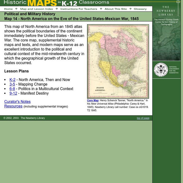
Newberry: Political and Military History: Map 14: u.s. Mexican War, 1845
Lessons for students in K-12 depicting North America prior to the United States and Mexico War, 1845. Students explore the mid-century political and cultural context in which the U.S. experienced growth and expansion.
Annenberg Foundation
Annenberg Learner: A Biography of America
Learn about the full sweep of U.S. history at this comprehensive site based on a PBS series and telecourse. The series compresses several centuries of events, issues, and people in U.S. history into twenty-six half-hour programs. A team...
Curated OER
University of Texas: Netherlands Antilles and Aruba
See this map of Aruba and the other two of the ABC islands along with an inset of the other islands in the Netherlands Antilles. Clicking on the map will enlarge it. From the Perry-Castaneda collection.
Curated OER
University of Texas: Dominica, Guadeloupe, and Martinique
Click on this map of Dominica, Guadeloupe, and Martinique to zoom in on the island of Dominica. You can find the few roads that encircle this island.
PBS
Pbs Learning Media: Elections 1896 & 1900: Interactive Map: Biography of America
This interactive map and video from A Biography of America will help compare how key issues in the elections of 1896 and 1900 influenced geographical patterns in both presidential and congressional election results. Although the...
Curated OER
Etc: Maps Etc: South America Political Formation, 1911
A map from 1911 of South America showing the political boundaries of the time, major cities, terrain, rivers, and coastal features. The map is color-coded to show the Spanish, Portuguese, Dutch, and French possessions about the end of...
Curated OER
Etc: Maps Etc: West Indies and Central America, 1872
A map from 1872 of the West Indies and Central America. The map shows political boundaries at the time, capitals, major cities, and ports, railroads, main steamship routes, rivers, terrain and coastal features, and banks. The map shows...
Curated OER
Educational Technology Clearinghouse: Maps Etc: Northwestern South America, 1916
A physical and political map of northwestern South America in 1916 showing the boundaries for Columbia, Venezuela, the Guianas, Ecuador, Peru, and Bolivia at the time. The map uses color-contouring to show elevations from sea level to...
Curated OER
Perry Castaneda Map Collection: Latin America Map
This political map of Latin America and South America is in color and features major cities.


