Curated OER
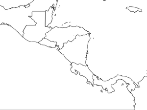
Central America Map wtih Country Borders
In this blank outline map worksheet, students explore the political boundaries of Central America and the nations there. This map may be used in a variety of classroom activities.
Curated OER
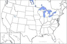
United States Map
In this United States outline map learning exercise, students make note of the political divisions of 50 states of the nation. This map may be used in a variety of classroom activities.
Curated OER
United States Map: Capitals
In this United States outline map worksheet, students make note of the political divisions of 50 states of the nation. This map is labeled with the 50 state capitals.
University of Pennsylvania
Using Political Postcards to Teach a Revolution of Political Thought
Discuss how political postcards affected everyday people's thoughts and beliefs. Pupils continue a unit on the Dreyfus Affair as they engage in class discussion, watch a video, view a PowerPoint presentation, and fill out worksheets to...
Curated OER
Fossil Fuels (Part I), The Geology of Oil
Junior geologists work through three mini-lessons that familiarize them with the formation and location of fossil fuels. Part one involves reading about petroleum and where it comes from via a thorough set of handouts. A lab activity...
Curated OER
Mapping South America
Students explore South America. In this South American lesson, students use their geography skills to create population, terrain, biomes/vegetation, and major exports maps. Students present their finished maps to their classmates and...
Curated OER
Welcome to the Americas
Students research and map the North and South American continents. In this geography lesson on the Americas, students can locate North, Central and South American countries and states. Students choose a location to research and prepare a...
Curated OER
North America: Three Countries Map
For this North American political map worksheet, learners examine the boundaries of the three countries of North America.
Curated OER
USA Map
In this United States political map worksheet, students examine state boundaries. The map may be used in a variety of classroom activities.
Curated OER
Colonial America and Roots of Government
Young scholars identify 50 States and the major geographic features, regions, and political representation of each. In connection, they investigate the causes and effects of European colonization on North America. They identify the...
Curated OER
Countries of South America
Students focus on the geography of the countries of South America. Using a map, they identify the European countries who claimed the South American countries and research the influences they had on South America. To end the lesson,...
Baylor College
Mapping the Spread of HIV/AIDS
Where is HIV/AIDS most prevalent and what are the current trends regarding HIV? Have groups work together to map the world's HIV/AIDS rates, then create a class map with all the data. Lesson includes cross-disciplinary concepts including...
Curated OER
Map Keys
Third graders examine maps and map keys. In this locating map features lesson, 3rd graders use crayons, markers and colored pencils to label maps. Students work in partners to read map keys and locate given places and things.
Curated OER
Waldseemuller's Map: World 1507
Learners investigate the 1507 word map. For this world geography lesson, students examine the details of each section of the map and then draw conclusions about how the people of 1507 understood the world. Learners are evalated on...
Curated OER
A House Dividing: The Growing Crisis of Sectionalism in Antebellum America
Students explore the debates over American slavery and the power of the American federal government for the first half of the 19th century and how the regional economies and political events produced a widening split between the states.
Curated OER
Political Legends and Map Symbols
Students identify the legend and map symbols. In this map skills lesson, students use a world map to find various locations using a map key.
Curated OER
Waldseemüller’s Map: World 1507
Young scholars take a closer look at historical maps. In this primary source analysis instructional activity, students examine the first world map produced by Martin Waldseemuller. Young scholars complete the included map analysis...
Curated OER
Rivers, Maps, and Math
Middle schoolers use maps to locate and label the major rivers of North and South America. Using the internet, they identify forests, grasslands, mountain ranges and other landforms on the continents as well. They compare and contrast...
Curated OER
Mexico and Central America Map
In this blank outline map worksheet, students study the political boundaries of Mexico and Central America. Each of the counties is labeled and the capital cities are starred.
Curated OER
Summertime Travel
Third graders write about a summer event they participated in. In this paragraph writing lesson plan, the teacher models how to write about a place they have visited. Students then write their own paragraphs. Students will point...
Curated OER
South American Outline Map
In this blank outline map instructional activity, students study the political boundaries of the continent of North America and those of the countries located there.
Curated OER
Canada Outline Map
For this blank outline map worksheet, students study the political boundaries of the North American country Canada as well as those of the provinces located there. The capital cities of the provinces are listed.
Curated OER
Mexico and Central America Map
In this outline map activity, students study the political boundaries of Mexico and the Central American countries. This map is labeled with the country names.
Curated OER
Mexico Map
For this blank outline map worksheet, students study the political boundaries of the North American country of Mexico. This map may be used in a variety of classroom activities.


