Curated OER
The Interconnectedness of Ancient Peoples Map Study
Seventh graders begin this lesson by viewing various maps of the Ancient World. As a class, they take notes on the changes of different areas in Europe and Asia as their teacher lectures to them. They answer questions about the...
Curated OER
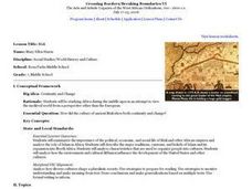
The Ancient Civilization of Mali
Students explore the ancient civilization of Mali and examine various historical and cultural aspects of the civilization. In this ancient civilization of Mali lesson, students examine trade with respect to geographic locations, discover...
Curated OER
Medieval African Kingdoms
Seventh graders examine the geography and political history of West Africa. They role-play as applicants to a company that transports customers to any historic time period. Working in teams, they create promotional products encouraging...
Curated OER
Cyberspace Safari
Middle schoolers go on an information gathering hunt on the Internet to study West African empires. They work in teams; meteorologists, bankers, writers, and archaeologists. They collect data on all sorts of topics related to West...
Curated OER
Primary Sources and Archaeology in the Study of Ancient Mediterranean Trade
Tenth graders begin the lesson by plotting trade routes, major empires and items traded. Using primary sources, they examine their own values regarding trading items for royality. They participate in a role-play exercise in which they...
Curated OER
The Global Grid System-World Map Activity
Students demonstrate how to use the global grid system. In this map skills lesson, students use a world map to locate various locations. Students identify locations based on the global grid system. Students complete a worksheet as an...
Curated OER
Trekking to Timbuktu: Trade in West Africa (Lesson 2)
Students examine the importance of trade in West Africa. Using a virtual time capsule, they travel back to ancient times and travel along with a caravan. They answer specific questions related to the journey and items they are trading....
Curated OER
Immigration and American Life on African-Americans
Students examine how human migration started in Africa, and draw maps of Africa and place the names of the countries and capitals on the maps. They write essays on how Africans came to America.
Curated OER
Mufaro's Beautiful Daughters - Mapping the Story
Learners listen to John Steptoe's story, "Mufaro's Beautiful Daughters" and create a story map.
National Geographic
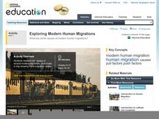
Exploring Modern Human Migrations
Using maps, images, websites, and handouts, learners work to understand the nature of human migrations. They compare and contrast human migration from the past to the present, identify causes for migration, and trace migration routes on...
Curated OER
Trekking to Timbuktu: The Geography of Mali -Teacher Version
Learners investigate the geography of Mali. They locate Mali on a satellite map, explore various websites, describe the landscape and climate, label a map, and write an essay about the Niger Riger.
Curated OER
Introduction to African Folklore
Young scholars are read "Anansi the Spider" to begin their discussion on continents. Using a map, they locate the continent of Africa and the country of Ghana. They discover who the Ashanti people are and view examples of their artwork....
Foreign Policy Research Institute
A Geography Lesson
Fewer and fewer people have a strong grasp of world geography, but this activity helps students understand geopolitics by creating their own original historical map. The activity requires selecting a country from the list provided,...
Curated OER
East to West: Africa's Influence on Mexico
Your historians and social anthropologists study the relationship between peoples of ancient Africa and ancient Mesoamerica. They relate in written or verbal form the African presence in the ancient Americas. They create their own...
Curated OER
Examples of Justice Systems and Practices in Western Africa
Tenth graders explore African belief systems. In this West African lesson, 10th graders research these belief systems. Students create a wooden figure that represents these beliefs.
Curated OER
Mali
Seventh graders begin the lesson by reading primary sources about the country of Mali. Using maps drawn in the past, they discuss what they can gather about the country from the map and how it has changed over time. They use a graphic...
Curated OER
Animal Invasion
Middle schoolers research and illustrate the natural habitats and evolution of giraffes and other animals imported into ancient Rome. They draw a map of Europe, North Africa, and West Asia and draw the animals from each region in their...
Curated OER
Africa's Climatic Regions
Learners are introduced to the different climates and vegetation of Africa, and compare them to similar climatic regions found in the United States.
Curated OER
Trekking to Timbuktu
Students view a television show to provide a context for conducting research into the location and culture of Timbuktu. The students complete a report on the subject in the form of a research paper.


