Curated OER
Mapping with a Compass: A Simulated Survey
Students use compasses and grids to map the locations of artifacts found in a simulated dig site. In groups, they role-play as future archeologists excavating a school site. Groups begin at their assigned datum and site the artifacts...
Curated OER
Introduction to Archaeology
Students view a PowerPoint presentation called, Archaeological Terms then discuss the job of an archaeologist and new vocabulary. They view the teacher made "artifact grid" and photograph the grid from different angles. They work in...
Curated OER
Mapping a Site Using a Coordinate Plane
Learners map their playground as if it were an archeological site. They locate objects on the playground and determine their location using coordinate points. A related lesson is Coordinate Grid: Mapping an Archeological Site.
Curated OER
How To Think Like An Archaeologist
High schoolers take a field trip to historical Jamestown. Using artifacts given to them, they must identify them and discover who would have used them and for what purpose. They create a database to organize the information and share...
Dig-It Games
Mayan Mysteries
Who is Ladrone? Join Fiona and Charlie as they accompany their Uncle Alex to Guatemala to help Chief Mateo determine the identity of the elusive Ladrone and solve Mayan mysteries. Players of this interactive game learn much about Mayan...
Curated OER
Subtracting Fractions
In this math worksheet, students subtract the fractions using unlike denominators. The answers are used for the coded message at the bottom of the page.
Curated OER
Gridding a 2 x 2 Meter Unit
Learners use the internet to examine what happens at an archeological dig site. In groups, they practice measuring a 2x2 meter square unit and gridding it out as an archeologist would do. They review the possible solutions at the end of...
Curated OER
"how To Think Like an Archaeologist" Suggested Pre-visit Activity for Historic Jamestowne
Students study grocery receipts to simulate the archaeological activity of classifying items. They discuss the receipts as if they were find lists.
Curated OER
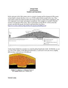
Mound Math
Students examine the many different burial mounds in Wisconsin. In groups, they use the internet to discover how long it took to build a specific mound. They must calculate the measurements of the mound to make a scale model.
Curated OER
Investigating Pot Sherds
Sixth graders measure pot sherds and use their knowledge of Pi to infer possible uses of pottery. They also infer possible functions of ancient ceramics. After tracing rounded pottery pieces onto paper, 6th graders use compasses to...
Curated OER
Grid Frame Mapping
Students map and describe small area of the schoolyard and discuss habitats.
Curated OER
Big Bones, Little Bones
Learners investigate archeology. In this archeology lesson, students research the process of excavation. Learners participate in a mock-excavation and sort objects by physical properties.
Curated OER
Mapping and Excavating a Jello Mold
Fifth graders, in groups, map the three layers of different colored jello layers in molds and note the placement of fruit in them. On the grid paper they draw each grape, raisin, or other object and carefully remove each layer. After...
Curated OER
Petroglyphs and Pictographs
Fourth graders make necklaces out of petroglyphs that they stamp into clay. In this petroglyphs lesson plan, 4th graders draw designs and explain where they come from as well.
Curated OER
"Adding It Up" at James Fort
Students discuss jettons and their archaeological importance at Jamestown. They then practice using historic counting sheets and artifacts to understand the calculating methods of the early 17th Century, and identify their similarities...
Curated OER
Primary Sources and Archaeology in the Study of Ancient Mediterranean Trade
Tenth graders begin the lesson by plotting trade routes, major empires and items traded. Using primary sources, they examine their own values regarding trading items for royality. They participate in a role-play exercise in which they...
Curated OER
The Demise of Copper's Trading Power
Eighth graders evaluate statistical equations. They examine data from archaeologists at Jamestown, complete statistical equations using the sets of data, and graph the results.
Curated OER
Functions and Graphs -- Pattern Detection #1
Students discuss the job of an archaeologist by determining how people have used their environment. Using a graph, they analyze the patterns and functions of Native Americans in Arizona using maize. They work together to answer...
Curated OER
A Day Full of Popcorn
Pupils use the "tool" popcorn with activities in Language Arts, Math, Social Studies, P.E., Music, Art, Science and EATING.
Curated OER
Where is it?
Students use a coordinate grid. They investigate and discuss what caused certain objects to be in specific places. They choose a room in their home to map and place objects in specific locations.
Curated OER
"it's All in the Cellar"
Seventh graders examine the process of constructing a site plan map at archaeological sites. They discuss the process of mapping techniques and calculation of percentages, create a plan site map of a cellar at Jamestown, and calculate...
Curated OER
Investigating the Mammoth Mystery
Fourth graders go on a virtual dig to find out where the mammoth bones found in a rural U.S. county came from. They determine whether the bones were created by humans or were they the actual remains of mammoths who walked the area during...
Curated OER
Gridding a Site
Learners make observations of effigy mounds and record them in a notebook. In groups, they must determine the scale of measurement and create their own grid to scale part of the Effigy Mounds National Monument. They also practice using...
Curated OER
Archeologist Frieze Patterns
Learners construct frieze patterns using translations and rotations. They will discuss how frieze patterns are similar to jigsaw puzzles and use Cabri Jr. to build a triangle frieze pattern using rotations, translations, and reflections.


