Curated OER
Latitude and Longitude
Fifth graders study latitude and longitude. They estimate the latitude and longitude of their hometown and find the latitude and longitude of other cities using a map. They use a website to find out the cities' actual latitude and...
Curated OER
Destination Investigation!
Students interpret a map or Atlas. They determine latitude, longitude, and absolute location and create and evaluate a travel itinerary. They identify the benefits and drawbacks of an itinerary and conduct online research as a means to...
Curated OER
Fish Around the World
Learners use a globe to answer questions such as which continent they live in and the country in which they live. They identify at least two bodies of water near their state and two foreign countries. In groups, they complete a...
Curated OER
Lesson 2: Mapping With Words
Students demonstrate an understanding of the personal relationship that Wabanaki peoples had with the land by analyzing selected Wabanaki place names. They practice map-reading and map-making skills.
Curated OER
Plotting A Hurricane Using latitude and Longitude
Students explore map and plotting skills by tracing the movement s of hurricanes through the Earth's systems. a hurricane map is developed from daily media reports.
Curated OER
Environment: Water & Air
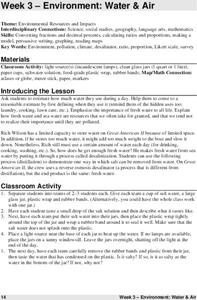
The introduction to the lesson mentions a sailor's limited capacity to store drinking water on his ship. Pupils then set up an overnight experiment to remove freshwater from salt water by distillation. There is a math and map activity to...
Curated OER
Where in the World War? Mapping WWII in the Pacific
Students study the geography of the Pacific theater of World War II. They study maps to examine the geography and features of the land.
Curated OER
Where in the World War? Mapping WWII in the Pacific
Students explore the Pacific Theatre of War. In this World War II lesson plan, students use reference material to access information about significant locations in the Pacific Theatre of War. Students identify the locations of the listed...
Curated OER
Historical Research on Explorers of Canada
Eighth graders study an online atlas of Canada to research an early explorer.
Curated OER
Iraq, Where's That?
Students identify the Middle Eastern countries on the map and the oil-producing countries of OPEC in the region. They examine whether the presence of important producing oil fields qualifies as a characteristic of this region.
Curated OER
You Can Find It!
Students locate different places including U.S. cities using longitude and latitude coordinates. In this longitude and latitude lesson plan, students locate 10 different locations.
Curated OER
Chinese Lion Dance
Students celebrate the Chinese New Year and listen to the story behind the Chinese Lion Dance. In this Chinese New Year lesson, students research the geography and culture of China. Students create puppets, dance the Lion Dance and...
Curated OER
Canada's Landform Regions
Students use a atlas to identify and describe Canada's Landform region. Using the information they collect, they create a thematic map of the region and describe all of the physiographic regions and the processes that formed them. They...
Curated OER
Canada's Landform Regions
Students identify and describe the processes that created the landform regions in Canada. They map the regions and research one region to discover more about it. They present their findings to the class.
Curated OER
Where in the World...?
Young scholars use longitude and latitude to locate various cities, regions, landforms, and bodies of water around the globe. They use The New York Times Learning Network's crossword puzzle 'Longitude and Latitude' to sharpen their atlas...
Curated OER
Welcome to the Americas
Students research and map the North and South American continents. In this geography lesson on the Americas, students can locate North, Central and South American countries and states. Students choose a location to research and prepare a...
Curated OER
Around the World in 5 Days
Students explore continents, draw map, discuss cultures, use research to learn geography, and investigate cultures.
Curated OER
What Color is the Ocean?
Students view satellite pictures of the ocean, and discuss the presence of phytoplankton and the colors of the ocean. Students compare/contrast ocean satellite images with maps and globes, then color world maps to replicate the satellite...
Curated OER
Treasure of the Tar
Learners, using an atlas, locate the region known as the "Tar Sands" in the Central Plains of Canada. They hypothesize about the future economic potential of this natural resource. They create a poster about the Tar Sands industry in...
Curated OER
State of Arkansas Travel Brochure
Eighth graders design a travel brochure to persuade others to visit Arkansas. They depict particular points of interest they decide are the best in the state.
Curated OER
Know Your Area
Students investigate transit by analyzing their school surroundings. For this local geography lesson, students identify their school in relation to the rest of their state, country and globe. Students discuss their personal travel habits...
Curated OER
Uncharted Territory
Students examine what were preconceived perceptions of the areas Lewis and Clark explored. They compare and contrast past and modern maps of North America. They accurately place route and site information on the map.
Curated OER
Where In the World Are We?
Fifth graders read postcards and find their locations on maps. They use the pictures and text on the postcards to write about imaginary vacations. They compute the mileage and compare it to TripMaker data.
Curated OER
The Challenges Ahead
Students examine the physical obstacles that the Lewis and Clark expedition encountered on its journey. They report what challenges these physical obstacles might have posed. They review a modern-day map and explain if the obstacles...


