Curated OER
Terrestrial Ecozones, Population Density and Species at Risk
Tenth graders navigate and use the online Atlas of Canada. They explain the cause and effect relationship between human settlement and the natural environment and wildlife species. They utilize a worksheet imbedded in this plan.
Curated OER
The Exploration and Settlement of North America
Learners locate place in Canada and explore highlights of early of early American exploration and settlement. In this North American history instructional activity, students locate provinces, major cities, and physical features of...
Curated OER
Community Cartography
Students use an inflatable globe which they wrap in plastic wrap. They use a permanent marker and outline the continents, and label major oceans and trace the equator. Students bring heir globes and use their projection for a discussion...
Curated OER
Mapmakers' Perspective
Students examine several maps and consider mapmakers' perspective in early depictions of North America.They determine how the spherical shape of the earth makes any north-south and east-west orientation a matter of perspective. For...
Curated OER
Underground Sleuths Discover Riches Beneath the Plains
Students identify Alberta, Saskatchewan, and Manitoba on map, and use Canadian Atlas to locate regions of natural resources in Central Plains, which have vital impact upon the economy. Students then complete scavenger hunt worksheet.
Curated OER
Snow Cover By Latitude
Students create graphs comparing the amount of snow cover along selected latitudes using data sets from a NASA website. They create a spreadsheet and a bar graph on the computer, and analyze the data.
Curated OER
The Geography of Maine Tourism
Learners study topographical maps of Maine to identify the important physical features. They work in groups to create tourism pamphlet highlighting a region of the state.
Curated OER
Geography: Snow Cover on the Continents
Young scholars create maps of snow cover for each continent by conducting Internet research. After estimating the percentage of continental snow cover, they present their findings in letters, brochures or Powerpoint presentations.
Curated OER
Discovering the Past Using the Future: Remote Sensing and the Lost City of Ubar
Learners use a video, maps, worksheets and Internet research to explore the role that sensing played in locating Ubar - the lost city of Arabia.
Curated OER
Anza and Font in Search of Latitude
This is an integrated lesson that incorporates Social Studies, Science, and Mathematics. In Social Studies, 7th graders complete an online interview and complete an online worksheet about latitude of sites on the Anza trail. In Science...
Curated OER
A Comparison of Cloud Coverage Over Africa
Students use a NASA satellite data to contrast amounts of cloud coverage over different climate regions in Africa. They explore how Earth's major air circulations affect global weather patterns, and relate to local weather patterns.
Curated OER
Canada's Geographic Position
Ninth graders investigate the characteristics of the geographic position of Quebec and Canada in the World. They study Canada's land and water boundaries, surface area and time zones.
Curated OER
Understanding Canadian Weather Extremes
Students research and analyze the causes and sources of Canada's extreme weather conditions. They conduct an experiment, complete a worksheet and predict the most likely locations for extreme weather conditions.
Curated OER
Scuba Diving in Belize
Students plan a scuba diving trip to Belize. In this planning a scuba diving trip to Belize lesson, students research about the barrier reef in Belize. Students make travel plans that involve finding distance, time, and cost of traveling...
Curated OER
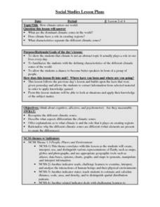
How climate enters our world
Students recognize the different climatic zones. They describe what aspects differentiate the climatic zones. Students offer explanations as to what climate is and the role that it plays on creating regions. They rationalize why the...
Curated OER
Where in the United States Are We?
Learners spend the lesson identifying the location of the fifty states and the capitals. Using a software program, they retrace te outline of each state numerous times. To end the lesson, they write a story about a state and city of...
Curated OER
Design Your Own Building
Students explore the use of design principles in the real world. They evaluate how problems can be solved using design principles. In groups, students design the floor plan for a building of their choice.
Curated OER
Who We Are: To Know the Characteristics of a Population Within Certain Domains
Young scholars, through research, discover the characteristics of the population of Quebec and compare them to those of Canada as a whole. They create a class presentation about information they found.
Curated OER
World Continents
Students identify the continents of the world. In groups, students create a three-dimensional clay representation of their assigned continent. Using KidPix software, they draw and color their continent. Students research their continent...
Curated OER
My Own Private Idaho; Using Social Studies to Explore Idaho
Students engage in several activities to explore Idaho and Social Studies themes. Using an variety of media, students become familiar with Idaho's geography and geology.
Curated OER
Fourth Grade Social Studies
For this social studies worksheet, 4th graders answer multiple choice questions about George Washington, early America, natural resources, and more. Students complete 8 questions.
Curated OER
Climographs
Students identify trends and characteristics of climate zones and specific places within. Then, they graph annual climate trends (primarily Temperature and Precipitation) and create, interpret and extrapolate information based on...
Curated OER
You're Invited to a Ceili: Exploring Irish Dance
Students recognize a Ceili as an Irish dance of celebration and investigate Ireland while studying the dance. In this Irish dance lesson, students search the geography of Ireland, read poetry, identify costumes, draw and perform a dance.


