Curated OER
World Map Labels
For this geography skills worksheet, students identify the countries and bodies of water labelled on the maps of the world, Africa, Asia, Canada, Europe, the Caribbean, the Middle East, North America, Australia, and South America.
Curated OER
History/Geography
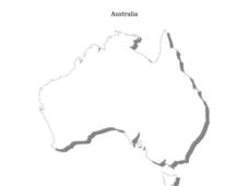
Students review North America, Africa, Europe and Asia. They identify Australia as the smallest continent. They identify Australia as an island continent nicknamed "the land down under." They color a map of Australia.
Curated OER
Australia: the Land Down Under
Students give a solid history and geographic explanation of the country of Australia and explain why it is important. They use some creativity in designing their own island, by using the physical features of this particular country.
Curated OER
World Map and Globe - Lesson 15 Mountains of the World
Students locate major world mountain ranges. In this geography lesson, students identify major mountain ranges on 6 on of the 7 continents on a large world physical map.
Curated OER
Geography Worksheet
In this geography skills activity, students respond to 14 short answer questions by using maps and atlases. The maps and atlases are not included.
Curated OER
BOLTSS Map
In this geography worksheet, students identify the six features always used on maps. They identify each of these features by the acronym BOLTSS. Students examine the Melbourne Cricket Ground shown and respond to the 4 questions that follow.
Curated OER
Australia
In this map of Australia worksheet, learners research and study a map of Australia. Students label Australia's regions, major states and important landmarks.
Curated OER
Australia States, Territories and Capitals Map Quiz
In this online interactive geography quiz worksheet, students respond to 14 identification questions regarding the shapes of countries and capitals of Australia.
Curated OER
Math with Maps and Globes
Students round out their math skills with these ‘round the world' ideas. In this math and geography lesson, students try out time zone sticks, a polar race, and tic-tac-globe to engage them in learning more about globes and the...
Curated OER
Motivating Activities for Geography Week
Here is a great way to pique your students' interest in geography, and help them learn about their world.
Curated OER
Map Keys
In this geography activity, students identify who a cartographer is and what they do specifically. They study an outline map of a fictitious island and then, respond to the three questions that follow. Finally, students add three more...
Science 4 Inquiry
Edible Plate Tectonics
Many people think they can't observe plate tectonics, but thanks to GPS, we know that Australia moves at a rate of 2.7 inches per year, North America at 1 inches per year, and the Pacific plate at more than 3 inches per year! Scholars...
Curated OER
Australia
In this Australia map, students research and locate the main regions, states and important landmarks found on the map and discuss them with their classmates.
Curated OER
Australia
Sixth graders study the continent of Australia. In this Geography lesson plan, 6th graders create an Australian city using their knowledge of Australian cities. Students participate in a game about the continent.
Curated OER
Australian Aboriginal Art and Storytelling
Young explorers investigate Australian Aboriginal culture by listening to traditional Dreamtime stories and examining dot paintings created by Aboriginal artists. In addition, they locate the country on maps, discuss the geography of...
Mr. Head's 6th Grade Classroom
Absolute Location
How do we know where we are in the world? A presentation for middle schoolers explains absolute location and other geography terms such as relative location. It also gives scholars the opportunity to practice finding absolute location on...
Curated OER
Mapping Australia
In this mapping Australia instructional activity, students locate and label various features and places on a blank map, 10 total. A reference web site is given for additional activities.
Cornell University
Too Much of a Good Thing?
Continuing their study of beneficial insects, young entomologists discover where in the world some of these bugs are. By labeling, coloring, and using the scale on a map, pupils explore the territories and arrival of the Asian lady...
Curated OER
Australia Map Resource Sheet
In this Australia map resource worksheet, students use the map of Australia to supplement their study of the country. They see a map labeled with Australian cities, and the surrounding countries and water bodies.
Curated OER
Map of Australia
In this geography of Australia worksheet, students color and label a map with major states, cities and physical features. The Australian state borders are shown but not labeled.
Curated OER
Sign a Map
In this geography activity, students think and identify the different features and landforms that an explorer would come across the continent of Antarctica. They use body gestures to communicate their list of items to a partner and then,...
Curated OER
Land Use in Australian Agriculture
Seventh graders research and map agricultural practices of Australia. They complete a worksheet about their research.
Curated OER
Introduction to the World Globe
Students examine a globe and the world map to see what constitutes the differences. In this world map introductory lesson, students discuss what they see when they view the globe. Students then, look at a world map and compare the...


