Curated OER
Touring the Regions of the United States
Fifth graders explore the regions of the United States. For this geography skills lesson, 5th graders examine the landforms, climates, and economies of the regions of the United States. Students conduct Internet research in order to...
Curated OER
Catch Me If You Can: Over and Under
Students read a story. In this vocabulary skills lesson, students read The Gingerbread Man, use flannel cut outs to re-enact the gingerbread man running over and under.
Curated OER
Spherical Geometry: A Global Perspective
Students investigate spherical geometry using a globe and an apple. In this spherical geometry lesson plan, students translate Euclidean geometry terms to spherical geometry terms using a globe. They answer 3 questions about spherical...
Curated OER
African Country Study and PowerPoint Presentation
Students investigate the geography of Africa. In this African culture activity, students research the lifestyles of African residents and create a PowerPoint presentation based on a single African country. Students share...
Curated OER
Using Maps To Make Public Health Decisions Case Study: Wildfires in Mexico 2000
Students study environmental health. Using actual NOAA satellite imagery, students investigate the basic concepts of mapping. They explore the relationship between monitoring satellite images and public health decision making.
Curated OER
Mapping With MapPoint
The class is engaged through a discussion of mapping. They determine what they believe makes a good map and what the essential elements of a map are. Students work independently to complete a worksheet on mapping. They follow clear...
Curated OER
Where in the World War? Mapping WWII in the Pacific
Students study the geography of the Pacific theater of World War II. They study maps to examine the geography and features of the land.
Curated OER
ESOL Necessary Skills
Students view flash cards with basic vocabulary pictures on them and match them to the vocabulary words. They cut the pictures apart and glue the words on the back. They play concentration with a partner matching the word with the...
Curated OER
The Lincoln-Douglas Debates of 1858: Interactive Map Activity
Young scholars utilize an interactive map to explore the 1858 Senate campaign in Illinois. They examine how factors such as population, transportation, and party strongholds can affect campaign strategies. Students write an essay...
Curated OER
Life Map
Students compose plans for their futures. In this writing lesson plan, students create life maps of past events and predict future events. They brainstorm events of their lives and decide which ones are most pertinent to the...
Curated OER
Maps
First graders look at their classroom or school setting. They use positional word to describe where things are located in the school. Students discuss a map and why they are important. They read the story "Taylor's New School" and...
Curated OER
The Lincoln-Douglas Debates of 1858: Interactive Map Activity
Eleventh graders utilize an interactive map to explore the 1858 Senate campaign in Illinois and how factors such as population, transportation, and party strongholds can affect campaign strategies.
Curated OER
Latitude on World Maps
Sixth graders examine the purposes of maps. In this Geography lesson, 6th graders practice using latitude and longitude on a map.
Curated OER
Basic Geometry Ideas and Angle Measurement
Seventh graders explore the concept of basic geometry. In this basic geometry lesson, 7th graders identify the correct picture for a given vocabulary word such as midpoint, line, ray, or parallel lines. Students discuss examples of...
Curated OER
People and Places
Fifth graders investigate how the geography of the land effected the human experience of the Lewis and Clark Expedition. They research using primary and secondary sources, design a map.
Curated OER
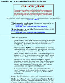
Navigation
Students study the basic methods for finding one's position on Earth. Latitude can be deduced from the height above the horizon of the pole star or of the noontime Sun, while longitude requires an accurate clock giving universal time.
Curated OER
Organizing A Corporation And Paying A Dividend
Students engage in a lesson that is concerned with the establishment of a corporation. They apply accounting principles to different situations in order to make payments on a dividend. Students also investigate the basic accounting cycle.
Curated OER
Tracking Satellites Using Latitude and Longitude
Students investigate how to track satellites using latitude and longitude. They investigate what man learns from all the satellites currently being studied today. Students analyze the four basic types of satellite orbits.
Curated OER
Basics of the Korean War
Students research the key players and major events of the Korean War. Students assigned in groups, research a country involved in the Korean War. Groups then bring their information to the whole groups to explain their country's...
Curated OER
Choosing Plymouth - Pilgrim Study Unit
Students identify the principal physical features the Pilgrims considered when choosing the location of Plymouth. They create a postcard to send to a friend in Europe as if they were a Pilgrim; illustrating one aspect of the settling in...
Think Like A Programmer! Puzzlets Cork the Volcano Curriculum
Common Core Standards Connected
The standards listed below are standards from the Common Core Framework which map to learning opportunities with Cork The Volcano & Puzzlets.
Source Link:...
Curated OER
Twain: Steamboat's a-Comin'
Young scholars discover how rivers inspire creative expression. In this Mark Twain lesson, students list songs about rivers and discuss common characteristics. They locate the Mississippi River on a map and write a script in which...
Curated OER
Distinguished Discoveries: Florida quarter reverse
Florida's state quarter has an image of a space shuttle and a Spanish Galleon on its reverse side. Pupils will examine the state quarter and think about how the Spanish explorers and Space explorers are the same and different. The class...
Curated OER
Ecuadorian Rainforest
Have your class talk about the importance of the rainforest and the products that come from it. Learners watch a video showing the path of chocolate from the rainforest to the supermarket. They discuss how the rainforest and...
Other popular searches
- Basic Map Skills Worksheets
- Basic Map Skills Boston
- Basic Map Skills Vosstown
- Hiking Basic Map Skills


