Curated OER
ADULT ESOL LESSON PLAN--Transportation and Travel
Students, after defining a list of vocabulary words on the board, review and identify basic types of transportation (bus, taxi cab, car, plane, and ship) in the United States. In addition, they make a graph of all the different ways that...
Curated OER
Making the Invisible Visible
Students evaluate the various ways in which cyberspace is beginning to be mapped by geographers, cartographers, artists, and scientists and use their understanding of the information these new maps can convey to create their own maps of...
Curated OER
Town Mouse/ Country Mouse
Students recognize the difference between the city and the country. In this City Mouse, Country Mouse lesson, students listen to a story and describe and map differences between the city and the country. Students understand that people...
Curated OER
The Coldest Place at the Bottom of the World
Students research and trace Shackleton's actual and intended route on an area map. They analyze the altitude changes involved in a trek across Antarctica and complete a worksheet comparing Antarctica to their own state.
Curated OER
Seeing What You Cannot See--RADAR
Student imitate mapping the ocean floor using the basic concepts of radar. Then they explain what radar is and how it workds. All of their measurements are recorded on a data sheet. Then the data is entered into a spreadsheet program. A...
Curated OER
Wetland Food Webs
Students study life science. In this food webs and food chains comparison lesson, students examine the wetlands to discover the relationships that exist between the animals that live there. They participate in group activities and...
Curated OER
Water: Where in the Watershed?
Students become connected to their watershed by exploring a local water body and mapping its features. They focus on how the local watershed fits into the larger scheme of the watershed.
Curated OER
Master of His Domain
Students investigate the basic elements that comprise the Internet. They create illustrated posters demonstrating their understanding of how the Internet works and develop maps of their personal Web communities.
Curated OER
Life During the Civil War for Women and Civilians
Students follow an overview of the American Civil War from a film, the text and/or teacher direct instruction. They create a timeline with a large map of the U.S. in the 1860's available for student reference as they do the spider activity.
Curated OER
Navigating by the Numbers
Students observe how math is important in navigation and engineering. They study how surveyors use math and science to calcute, count, measure, label, and indicate distances on a map. They estimate specific distances.
Curated OER
To Eat or Not to Eat?
Young scholars identify various parts of plants and determine which parts people eat. They conduct a celery stalk experiment in which they determine the value and use of the stem, and how it helps the plant to meet its needs. Students...
Curated OER
It's a Beautiful Day in MY Neighborhood
Young scholars create and produce their own "WAlk Through" video about their neighborhood, develop script writing and on-camera narration skills, and gain knowledge and expertise about the landmarks in their own neighborhoods.
Curated OER
Time for Technology Glyphs
Students create a time for technology glyph using Kidpix4. They complete a circle map on things they like to do on while on the computer and write about their favorite thing to do while on a computer.
Curated OER
My Family Tree
Students create a family tree. In this ancestry lesson plan, students research a country that one of their ancestors is from. Students interview a grandparent and map out a family tree.
Curated OER
Hurricane Winds: A Spatial Hierarchy of Processes at Different Scales
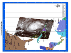
In this earth science lesson, students study a satellite image of hurricane Isabel and write answers to 5 questions that follow. They match predictions to the map locations.
Curated OER
Look! You're Wearing Geography
Sixth graders explore economic systems. In this economics lesson, 6th graders discover global markets. Students work in small groups to identify where their clothing and materials originated. Students locate countries on a map and...
Curated OER
Happy in My Habitat
Fourth graders create animal habitats and explain the biomes they live in. In this habitat lesson, 4th graders recognize the basic needs of animals, characteristics of animals differences and places where they live. Students complete...
Curated OER
Introduction to World Religions - Hinduism
Sixth graders explore Hinduism. In this world religions lesson, 6th graders listen to a lecture about the attributes of the religion and then listen to and perform parts of The Remayana. Students also complete a map activity based on the...
Curated OER
Migrating Across Borders
Young scholars research and map the migratory patterns of the golden-winged warbler. They develop a strategy to protect this species and, in teams representing different countries, negotiate treaties with each other to protect the bird.
Curated OER
Touring Ancient Egypt
Students study the geography and resources available to the ancient Egyptians and create a multimedia tour that demonstrates this learning to others.
Curated OER
Planning a Trip for Christopher Columbus
First graders plan a trip for Christopher Columbus. They use their math skills to construct a ship for Columbus' voyage. They show their ship and calculations to their classmates and build graphs to show the amount of supplies needed to...
Curated OER
War of 1812
Eighth graders locate the major land forms and bodies of water on a map of Louisiana. In groups, they discuss the role of the Mississippi River in the Battle of New Orleans and how land and water affect the outcome of battles. To end...
Curated OER
A Year (a Day or a Week) In My Life as a Shorebird
Learners describe the basic life history of one shorebird common to their area. They use the writing process which includes brainstorming, rough draft writing, peer editing, and re-writing to create a factually and grammatically...
Curated OER
The Mystery of Exploration
Students comprehend the history of European exploration of North America. They are introduced to basic reasearch techniques. Students focus on four explorers who visited New York State: Verrazano, Cartier, Champlian, and Hudson. They...
Other popular searches
- Basic Map Skills Worksheets
- Basic Map Skills Boston
- Basic Map Skills Vosstown
- Hiking Basic Map Skills


