Curated OER
What Does It Matter?
Learners define matter, the chemical properties of matter, and the physical properties of matter. They name physical and chemical properties of matter (by classifying using a Tree Map). Students determine the mass, volume, and density of...
Curated OER
Marvelouw Mongolia
Students are able to: tell basic information about Mangolia: locate it on a world map, locate its capital, name the countries surrounding Mongolia, read a Mongolian folk tale, and explore about the balalaika.
Curated OER
Manifest Destiny Lesson Plan
Learners examine how Americans justified Westward Expansion. In this American history lesson, your historians will watch a Manifest Destiny Powerpoint presentation and discuss each slide then participate in a class...
Curated OER
The Name Jar
Students participate in a lesson that focuses on the literature of Korea. "The Name Jar" is read by students to practice some essential reading skills. This would include the recognition of sequence in a story, characterization, and...
Curated OER
Easter Egg Orienteering Hunt
Students develop map reading and team building skills. After being divided into teams, students use a map of the school grounds to discover the location of Easter eggs. The first team to return with and eat their eggs wins the challenge.
Curated OER
The Chinese Massacre of 1871
Students investigate the historical Chinese Massacre of 1871. They conduct Internet research, analyze period maps of Los Angeles, read an article, design a timeline, and write a research paper.
Curated OER
Weather
Second graders study the basic components of weather. They construct a thermometer and anemometer to measure temperatures, precipitation, and wind speed. In addition, 2nd graders discover how to find these components on weather maps.
Curated OER
Star Quest
Seventh graders follow a "star map" of websites to locate information about legendary stars of bluegrass. They use the information to answer worksheet questions and write paragraphs as directed. They demonstrate their knowledge by...
Curated OER
Learning About the Basin
Students use watershed maps to explore the Lake Pontchartrain Basin in Louisiana. In this geography instructional activity, students identify important features such as elevation, vegetation, cultural, historical and land use on a map of...
Curated OER
Thematic Unit on Cats
Students discover in which climates the cats of the world live in. They review the different climates of the world and use maps and globes to help them locate continents.
Curated OER
The Queen of Sheba
Students discuss various versions of the myth of The Queen of Sheba and the basic characteristics of myths. They research how different cultures interpret the story and include it in their religious beliefs. They create projects about...
Curated OER
Science: Draining the Land - the Mississippi River
Students use topographic maps to identify parts of rivers. In addition, they discover gradient and predict changes in the channels caused by variations in water flow. Other activities include sketching a river model with a new channel...
Curated OER
Sending Messages, Then and Now
Students analyze how patriots created ways to communicate during the Revolutionary War. After reading about and discussing ways patriots communicated, students create a chart analyzing the way messages are sent today with the way...
Curated OER
My Neighborhood:
Students act as tour guides for their communities after conducting research about their neighborhoods. After conducting research, students write stories and create maps of their communities to share with classmates and community members.
Curated OER
How 9/11 Shaped U.S. Foreign Policy
Learners discuss the U.S. foreign policy and the components they consider important. They read and discuss President George W. Bush's speech of November 10, 2001. Students locate and mark countries President Bush identified in his speech...
Curated OER
Stitching Truth Lesson Two: The Arpilleristas in Pinochet's Chile
Students analyze arpilleras. In this Chilean history instructional activity, students examine social justice issues as they read and interpret arpilleras. Students study the tapestries to learn about Augusto Pinochet and his human rights...
Curated OER
The Geography of the Philippines
Students examine the geographic features and population distribution of the Philippines. They analyze maps, take a quiz, define monsoon, and discuss how the people in the Philippines have adapted to their environment.
Curated OER
"Pass the Potatoes" (But, where did they come from?)
Eighth graders explore various cultures around the world. In this cultural instructional activity, 8th graders prepare foods that belong to different cultures. Students examine the climate in the places of origin of their...
Curated OER
From Above
Students use maps and other geographic representations, tools, and technologies to acquire and report information from a spacial perspective.
Curated OER
Journey to Japan: An Elementary Geography Standards-Based Unit on Japan
Second graders compare and contrast Japanese customs and culture to those of Americans through research in this year long study. They determine the basic needs of all people in spite of cultural differences.
Curated OER
Wacky Web Tales
Students study the parts of speech and then review them. They identify each part of speech and place them on a tree map. Then they visit a website to create a "Wacky Web Tale" using information from the tree map. They print their tales...
Curated OER
Friends in the Community
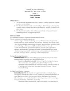
Second graders build a classroom community by getting to know each other better. They ask classmates various questions and use graphic organizer software and Microsoft PowerPoint. Students practice their oral language skills while asking...
Curated OER
Friends, Romans, Countrymen...
Students research an important person or place from Ancient Roame and communicate their findings in a report that includes a map and illustration. Students may publish their reports online.
Curated OER
Who Dropped What into the Melting Pot?
Students show the movement of people to the United States from other countries on maps. They study the geographic cultural roots of foods that contribute to the melting pot of food in America. They research where an ingredient comes from...
Other popular searches
- Basic Map Skills Worksheets
- Basic Map Skills Boston
- Basic Map Skills Vosstown
- Hiking Basic Map Skills


