Curated OER
W Is For Wyoming
Students engage in a lesson about the state of Wyoming. They complete a worksheet looking for facts and identify some common symbols used to represent the state. The symbols are used to practice sounds and give context to class discussion.
Curated OER
Stream Gages and GIS
students interpret recent regional-scale climate events based on current stream flow, monitor changes in time, and to consider additional interpretations that could be derived if other data were in map form.
Curated OER
Gridding An Archaeological Site
Students investigate using some of the basic skills of an archaeologist while using a Cartesian coordinate system. They establish a grid system for a dig site and determine the locations for different artifacts. Students use the...
Curated OER
A Brief History of Los Angeles
Students study the diverse cultures that make up the population of Los Angeles.
Curated OER
Wisconsin
Fourth graders brainstorm a list of places they have visited in Wisconsin. They watch a video "Cultural Horizons." Students use the CD and find on a map several locations in Wisconsin. Students bring in photos, pictures, and artifacts...
Curated OER
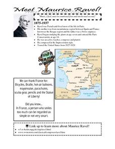
Pavane pour une Infante Defunte
Students describe the music in terms related to basic elements such as melody, rhythm, harmony, dynamics, timbre, form, style, etc. They identify timbres heard in "Pavane" by movement and respond by movement to timbre.
Curated OER
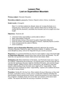
Lost on Superstition Mountain
Students review the concept of responsbility and relate it to the own lives. Using the internet, they research the search for gold on Superstition Mountain in Arizona and locate it on a map. They also examine the culture of Mexico and...
Curated OER
Going Places
First graders study directional words such as North, South, East, West, up and down.
Curated OER
Environment: Going Places
First graders learn directional words and apply this skill to map making. They record their steps on paper.
Curated OER
Mercer Mayer 2: Peer Experts Teach Kispiration
Students observe a model classroom of cooperative groups in action. After the video, students discuss how to organize the classroom to promote cooperative learning. They examine the difficulties in allowing students to work in small groups.
Curated OER
The Effect of Tides & Elevation on Wetland Plant Communities
Students comprehend how tides can impact shoreline plant communities through the study of a freshwater tidal marsh. They use actual tidal data to show that tidal ranges differ among geographic locations, even those relatively close...
Curated OER
The Hawaiian Islands
Fourth graders present information of people, places, and environments. They collect, organize, and analyze date to use with these representations.
Curated OER
Los Angeles Tourist Brochures
Young scholars investigate the history of Los Angeles. They conduct Internet research, select a specific topic, and create a tourist brochure that includes information, pictures, and maps.
Curated OER
Music - Touch the Wind
Students study the Oneida song "Touch the Wind". They discuss the meaning and sentiment of the piece. Students use important singing techniques including good breathing, dynamics, and pitch. Students illustrate of the meaning of the song.
Curated OER
Cultural America
Seventh graders investigate the cultural differences that can be found in America. They discuss what it means to be called an American. The patterns of migration to America are discussed with the use of maps and geographical terms....
Curated OER
Poetry
Fourth graders participate in reading and listening to poetry. They are exposed to a variety of poems and examine and identify basic elements of poetry. They write their own poems and recite a poem with enthusiasm, expression, and props.
Curated OER
This Place is Going to the Dogs
Students study different breeds of dogs. They watch a video, "Extraordinary Dogs", about special dogs and how they are categorized according to their adaptations. Then they create a digital video that demonstrates the qualities of dogs...
Curated OER
Our Goal Pole
Studnets discuss the meaning of exploration and investigate a map of the Louisiana Territory. They discuss Lewis and Clark's expedition and complete worksheets. They create a "goal pole" that represents their learning.
Curated OER
Hatching Chicks to Agriculture - Where does the feed come from?
Second graders examine the types of grain that goes into feed for chickens. They study other grain crops grown in Kansas and the foods that are made from them.
Curated OER
Which Side Is Which?
Students study the Louisiana Purchase and the journey of Lewis and Clark. They examine the Peace Medal nickel to differentiate between the heads side and tails side. They participate in a coin flip activity, graph the results and analyze...
Curated OER
A Share in America
Students examine map - reflect on why English colonist kept coming to America (scarcity of land in England / seemingly endless land in America)
Recite line from English poem. They discuss English attitude towards Indians and their lands.
Curated OER
Virtual Field Trip/ Gasoline Cost
Students complete a word problem to determine the cost of gasoline per mile of their virtual field trip. They determine the travel time and gasoline costs for two routes and record the information on a data sheet. They check their work...
Curated OER
Acid Rain Experiments
Students define the term acid rain, and the causes of acid rain. They locate regions where acid rain is most affected, and what can students deduce from maps of geology and soils in New York State. Students answer the questions why are...
Curated OER
Creative Expressions: Making Puppets
Students are introduced to the very basic geography of Indonesia. In groups, they examine the different types of puppets and decide on which one to make. They travel between various stations to complete their puppet in which they use...
Other popular searches
- Basic Map Skills Worksheets
- Basic Map Skills Boston
- Basic Map Skills Vosstown
- Hiking Basic Map Skills


