Curated OER
Follow the Falling Meteorite
Students use triangulation method to locate meteorite landing site on the map. In this earth science lesson, students participate in a meteorite treasure hunt set up by the teacher. They explain how this method is used by scientists to...
Curated OER
Elements of Civilization
Students create their own ancient civilizations based off of topographical maps of Egypt, Mesopotamia, the Indus Valley, and the Yellow River. In this social studies lesson, students are assigned one topographical map to use to create...
Curated OER
Geography Journey
Fourth graders examine the geographic features that define places and regions and answer questions about the state of California. They discuss the components of a map legend and answer worksheet questions using a map of California as a...
Curated OER
Unraveling the Web
Students consider how a message might be traced along a complex network, then explore backbone maps as a basis for understanding the purpose and structure of the Internet.
Curated OER
Which Way Is North?
Young scholars investigate the concept of finding locations with the use of a compass and a map. They practice the skill of bearing and set up courses of travel to different destinations around the school grounds. Students also practice...
Curated OER
Urban Geo Worksheet
In this urban geography worksheet, students respond to 20 short answer questions about urban geography after they have read a related article. The article is not included.
Curated OER
Mapping Your Community
Students define the boundaries of their community by comparing the community's official boundaries with other historical, political, physical, and perceived boundaries of the area and create a community map.
Curated OER
Mystery Lessons
Learn about mysteries with your readers. They will investigate plot, basic elements of mystery, famous characters, and become familiar with genre vocabulary. Bring in props and mystery books to begin and then have learners create story...
Curated OER
Esperanza Rising - Anticipation Guide
Learn about Mexican culture while simultaneously strengthening reading, writing and computer skills. In order to get the most out of Esperanza Rising, pupils should have prior knowledge of Mexican culture. Therefore, there are links to a...
Curated OER
A Colony is Born : Lesson 3 - Marking Time
Fifth graders refer to text and timeline to fill in a graphic organizer and timeline from 1492-1607. They participate in a class discussion that allows for speedy accumulation of events and fill in their own timelines. They work in small...
Space Awareness
How To Travel On Earth Without Getting Lost
Have you ever wanted to travel the world? Take a virtual trip with a geography lesson that uses longitude and latitude, the position of the sun, an astronomy app, and a classroom globe.
Curated OER
Max Knows Mexicao, United States and Canada
Students utilize their map skills to explore the regions of North America. They explore the physical characteristics and climates of the regions. Students label their map and prepare a presentation of their findings.
Curated OER
Follow the Light
Here is another in the interesting series of lessons that use the special State Quarters as a learning tool. During this instructional activity, pupils learn about lighthouses, maps, the cardinal directions on a compass, and U.S....
Curated OER
Hide and Seek with Geocaching
Learners locate objects using a Global Positioning System. In this global geography lesson, students explore latitude and longitude using a GPS in order to locate objects.
Curated OER
Ticky Plans His Trip to Antarctica to See Tacky
First graders participate in a creative problem solving activity to help Ticky get to the Atlantic Ocean. They identify Ticky's problem, brainstorm ways to solve the problem, and develop a plan. They write the steps Ticky needs to take...
Curated OER
Land or Sea?
Sixth graders access a database to search for desired information, using "and" or "or" connectors where necessary. They choose a connector and search a prepared database of European countries to locate which countries border certain...
Curated OER
Geotagging in school
Students create a digital photo map of the world. In this digital photo map lesson plan, students pick topics such as the Olympics, natural disasters, or trip planning and create a photo map on the computer.
Curated OER
Planning Your Essay
Students discover how to organize essays effectively. In this writing lesson, students construct a spider map to develop their ideas for an essay.
Curated OER
Attentive Listening
Students explore the concept of what it really means to listen. They play the "Candy Game" and complete a discussion. They develop basic business skills and explore a variety of business careers while increasing their listening skills.
Curated OER
Introduction to Canada
Ninth graders investigate the country of Canada by examining their media in this geography lesson plan. They use the Internet to research Canadian newspapers and analyze a topic covered by both US and Canadian media sources. After...
Curated OER
East Asia Country Project
Get your young historians thinking about East Asian culture and history during this partner research project, in which they analyze a variety of East Asian aspects to prepare for a presentation. After an initial "what do we already know"...
Illinois Department of Natural Resources
Section One: What is Biodiversity?
Four intriguing and scientific activities invite learners to explore the natural resources of their town. The activities cover concepts such as genetic traits, organizing species in a taxonomy, the differences between different species...
EngageNY
Informal Proofs of Properties of Dilations
Challenge the class to prove that the dilation properties always hold. The lesson develops an informal proof of the properties of dilations through a discussion. Two of the proofs are verified with each class member performing the...
Curated OER
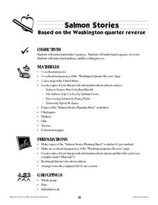
Salmon Stories
Work on author's purpose with this lesson, which focuses on sequence of events and audience as well. Middle and high schoolers describe the 50 State Quarters Program for background information. After discussing the images on the...
Other popular searches
- Basic Map Skills Worksheets
- Basic Map Skills Boston
- Basic Map Skills Vosstown
- Hiking Basic Map Skills


