Curated OER
Plan a Meal Fun
Discuss helping with the family grocery shopping. View a teacher drawn map of a grocery store and discuss where the breads, meats, and dairy products are located. Practice categorizing foods as breads and cereals, fruits, vegetables,...
Curated OER
Introducing NatureMapping
Students model the NatureMapping program in order to study habitats and biodiversity.
Curated OER
Paleo-Dig
Students will comprehend the use of simple grids and the basic principles and skills used on a paleontological dig, such as the Illampi Mound Colony. They incorporate a systematic investigation. Students analyze a variety of different...
Curated OER
The Solar System
Looking for a cross-curricular project for language arts and science? Use this lesson to reinforce knowledge of the Solar System, as well as expository writing skills. Elementary and middle schoolers choose one aspect of the Solar System...
Curated OER
Lewis and Clark: Equipping the Expedition
Students examine the preparations made by Lewis and Clark before leaving on their expedition. They make predictions about what they believe the two explorers took and organize the list into a venn diagram. They compare their predictions...
Curated OER
Exploring National Flags
Sixth graders examine the importance of flags throughout the world. Examining different countries, they determine the geographical and historical contributions in the past and modern times. They compare and contrast the flags of five...
Curated OER
Venn Diagram for Compare/Contrast
Use this lesson to focus on a compare and contrast writing structure in your middle school language arts class. Here, young writers compare and contrast two texts using graphic organizers. They use a double bubble format for their...
Curated OER
Invasives and Marsh Birds
Students are taught that invasive plant removal can have a variety of impacts. They are shown this by using graphs. Students view maps of vegetation change on Iona Island. They discuss implications of changes on marsh birds using data...
Curated OER
Native Americans - Searching for Knowledge and Understanding
What do you know about American Indians? Upper graders compose an informational essay based on the research they conduct. They choose a Native American group to study and, using the provided list of web links, gather information and...
Curated OER
Goods for You!
Have your class learn about Wisconsin and farming. Learners begin by listening to stories that describe farming and engage in a discussion of goods and services. They could also compare the goods and services provided in different states.
Curated OER
Measuring Precipitation
A little engineering design is mixed into this lesson on precipitation measurement. Groups plan and construct a rain gauge, and use it to collect precipitation. As part of the PowerPoint presentation, learners view a satellite map of...
Curated OER
Greetings
Students participate in greeting new people. In this greetings lesson, students greet people after modeling by the teacher. Sample rituals include, "Hello, how are you?; My name is...What is your name?". Students write a paragraph...
Curated OER
Estimation, Sampling, and Beyond
Students examine an ISS EarthKAM image of farm land in Texas and New Mexico. They select sample region of image and count the number of fields in that region. They estimate how many fields are in the entire region.
Curated OER
Ingredients of a Mystery
Students explore the concept of mysteries. For this mystery genre lesson, students identify the common characteristics of mystery books and use a story map to identify these characteristics in a given book. Students also discover the...
Curated OER
Testing the Waters
Students explore water in depth through discussion, research, and experiment. Students apply map skills to locating particular regions of the world as they relate to water. Students predict water quality based on information researched...
Curated OER
The Grand Excursion GPS Map
Eighth graders investigate the uses of a global positioning system. They create waypoints and have to find them using the system. Students must review the geographical concepts of latitude and longitude. The media requirements of the...
Curated OER
Life of a Mission - From Beginning to Now
Students research the history of a Spanish mission. They create a timeline showing the major events of the mission. They complete a worksheet to end the lesson.
Curated OER
The 21st Century Lewis and Clark Trail
Students create a better route through the Rocky Mountains for the Lewis and Clark expedition after tracing the original path.
Curated OER
"Where in the World is my School?"
Students learn new vocabulary and discuss what GPS is and does. They locate their school using the equipment.
Curated OER
Heads or Tails? Studying Regeneration in Planaria
Students view a video on stem cells and regeneration. In this investigative lesson students complete a worksheet while viewing the video.
Curated OER
Latitude, Longitude, Seasons
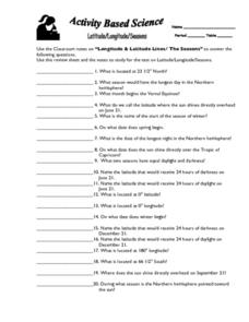
In this latitude and longitude worksheet, students use their classroom notes on both longitude and latitude lines as well as seasons to complete 20 fill in the blank questions.
Curated OER
Oregon Trail Maps
Fourth graders explore the Oregon Trail. In this Oregon Trail lesson, 4th graders collaborate to conduct Internet research regarding states along the Oregon trail route. Students present their findings to their peers.
Curated OER
Compass Rose: Dance and Quilt
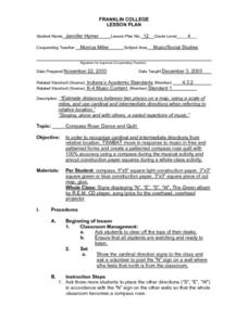
Fourth graders identify the cardinal directions by listening to a song entitled, "Stand," and by reviewing the lyrics to that song. They notice the cardinal directions that are posted around the classroom. They perform the motions as...
Curated OER
What in the World?
Eighth graders plot points of longitude and latitude on a world map. In groups, they create a model of the earth's interior and label the parts,
Other popular searches
- Beginning Map Skills Canada
- Beginning Map Skills Uk
- Geography Beginning Map Skills
- Beginning Map Skills Unit


