Curated OER
Orienteering Scavenger Hunt
Students take a reading with a compass and use the compass to reach multiple checkpoints in a scavenger hunt activity.
Curated OER
Themes to Encourage Awareness of Environmental Changes on the Shoreline of Connecticut in Elementary School Students: The Case of Kelsey Island
Students begin the lesson by developing a map of Kelsey Island by following specific instructions. In groups, they are given a block of ice in which they tie a rope around and drag over various rocks for different distances. They...
Curated OER
What's the Real Story?
Second graders investigate tall tales. In this literature lesson, 2nd graders complete a story element worksheet based upon the tall tale of Paul Bunyan. Students create a PowerPoint presentation about a tall tale.
Curated OER
MAPPING A RESEARCH SITE AND COLLECTING AND PRESENTING POPULATION DATA
Sixth graders are to answer research questions based on data they collect.
Curated OER
A Comparative Study of Bangor, Wales and Your Community
Twelfth graders research how a university in their local community changes the cultural landscape of the area. As a class, they discover how the town of Bangor, Wales was affected and compare that to a community in their local area. They...
Curated OER
MAPPING THE SCHOOL FOREST
Students measure distances and directions using paces and a compass. They determine their own pace, explore how to read a compass bearing, and how to take bearings on given sites.
Curated OER
Fall
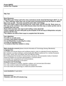
Students read "Red Leaf, Yellow Leaf" then they brainstorm words about fall that begin with the letters F, A, and L. They compose and decorate their own acrostic poem then they write a Fall story and complete a final copy in the computer...
Curated OER
BIGGER AND BIGGER: (We Live in a family, a neighborhood, a city, and the United States)
Students discover that they are part of bigger and bigger groups. They begin with families and work up to belonging to North America as they initiate a study of the whole country.
Curated OER
The First American Colonies
Fourth graders are introduced to the early colonial settlements of America by observing a map, filling in a map themselves and then researching information on their own.
Curated OER
Discovering the Physical Geography of Washington
Students develop a mental map of the state of Washington and draw it on paper. Using the Virtual Atlas, they identify the physical features of the state and draw them on their map. They also examine the populations and diversity of the...
Curated OER
Prepositional Phrases
Focus on prepositions and prepositional phrases, is the goal of this game of charades. The clues are based on maps that they have drawn out of a hat, and describe how to get to a certain location in a town using prepositions. Note:...
Curated OER
Are There Really Fifty-Three Nations Within Africa?
Students color a map showing that Africa consists of 53 nations and recognize the difference between a nation and a continent. The main objective of this lesson plan is for students to realize that Africa is a continent with many nations...
Curated OER
Chinese Zodiac
Fifth graders identify the basic elements of a narrative story, such as the beginning, middle, and the end; to analyze the character traits in the story to write a summary using the 5 Ws and How chart included; through sample stories...
Curated OER
Filling Up Florida
Students study factors controlling Florida's population growth and related environmental impacts. They research natural community types and construct maps (including a large-sized map of Florida) to be used for a simulation activity.
Curated OER
My Dream Job
Pupils write a research paper about their dream job. They organize their paper using research notes, and support their main idea with supporting details.
Curated OER
Finding the West
Students question the idea of a geographic space called 'the West.' They first examine a map of the United States and hypothesize what region constitutes the West, then read two passages that critically discuss the notion of a geographic...
Curated OER
School Yard Park/Ecosystem
Fifth graders observe and categorize different sections of a park and it's ecosystem. For this categorizing lesson plan, 5th graders collect different facets of nature from a nearby park (without disturbing the ecosystem). They map,...
Curated OER
The Yangtze River: Lifeline of China
Students locate the Yangtze river on a map, and label major cities and landmarks. Students identify and interpret the diversity of the people living along the Yangtze. Students explain the pros and cons of the
Three Gorges Dam project.
Curated OER
Michigan- Made Products
Students participate in studying about different Michigan-Made Products. They create a Hyper-Studio presentation that details six products that are made in Michigan. They research three different products in depth.
Curated OER
Atlantic Canada Report
Ninth graders create a report that will show an in-depth knowledge of the various geographical and climatic features of Atlantic Canada. They produce various items, on paper and using the computer, to demonstrate knowledge of outcomes,...
Curated OER
Natural Resources
Fifth graders begin the lesson by identifying the different types of natural resources. As a class, they discuss how environments are destructed and how the loss of one natural resource can affect the economy. Using a map, they label the...
Curated OER
Continents and Critters
Students investigate and identify the continents of the world. They identify and locate the seven continents on a map, and label a coloring page of a world map. Students then conduct research on an assigned continent, and write and...
Curated OER
Treasures of the Silk Roads
Young scholars examine and discuss art objects from the Silk Roads. They analyze images of artifacts, create a word map, and develop and write a short story or poem based on the slides viewed.
Curated OER
Discovering Your Community
Learners focus on the origins of the families that make up their community by exploring their family's origins through themselves, parents, and grandparents. Students create a map marked with family origins for the class.
Other popular searches
- Beginning Map Skills Canada
- Beginning Map Skills Uk
- Geography Beginning Map Skills
- Beginning Map Skills Unit


