Curated OER
Atlantic Canada Report
Ninth graders create a report that will show an in-depth knowledge of the various geographical and climatic features of Atlantic Canada. They produce various items, on paper and using the computer, to demonstrate knowledge of outcomes,...
Curated OER
Natural Resources
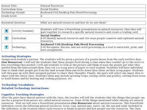
Fifth graders begin the lesson by identifying the different types of natural resources. As a class, they discuss how environments are destructed and how the loss of one natural resource can affect the economy. Using a map, they label the...
Curated OER
Continents and Critters
Students investigate and identify the continents of the world. They identify and locate the seven continents on a map, and label a coloring page of a world map. Students then conduct research on an assigned continent, and write and...
Curated OER
The Yangtze River: Lifeline of China
Students locate the Yangtze river on a map, and label major cities and landmarks. Students identify and interpret the diversity of the people living along the Yangtze. Students explain the pros and cons of the
Three Gorges Dam project.
Curated OER
The Great Migration
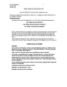
Students research the Great Migration and answer questions to discover where it took place, when it took place, who were migrating, and why in a 2 page paper. They use a map or atlas to plot out the routes and destinations of those...
Curated OER
Treasures of the Silk Roads
Students examine and discuss art objects from the Silk Roads. They analyze images of artifacts, create a word map, and develop and write a short story or poem based on the slides viewed.
Curated OER
Discovering Your Community
Students focus on the origins of the families that make up their community by exploring their family's origins through themselves, parents, and grandparents. Students create a map marked with family origins for the class.
Curated OER
An Ancient Greek and Roman Festival
Third graders label a map of ancient Greek and Roman civilizations and do a written report on one element of these two cultures. They participate in discussions of food, farming, daily life and government (among others). Students use the...
Curated OER
Mapmakers' Perspective
Students examine several maps and consider mapmakers' perspective in early depictions of North America.They determine how the spherical shape of the earth makes any north-south and east-west orientation a matter of perspective. For...
Curated OER
Sending Messages, Then and Now
Students analyze how patriots created ways to communicate during the Revolutionary War. After reading about and discussing ways patriots communicated, students create a chart analyzing the way messages are sent today with the way...
Curated OER
School Yard Park/ Ecosystem
Fifth graders examine ecosystems in their schoolyard. In this nature and ecosystem lesson, 5th graders map their schoolyard into workable plots. They classify plants and animals found in the plot. They revisit their site every two weeks...
Curated OER
The Science of Weather: Hurricanes
Students use this USA today activity to learn about hurricane season. In this hurricane lesson, students study the map of the earth and hurricane science. Students complete discuss questions. Students draw a map of the United States and...
Curated OER
Lesson on Ethnic Discrimination
Students study ethnic discrimination. For this discrimination lesson, students define ethnicity and ethnic discrimination in the global community as well as steps against it. Students examine their own ethnic backgrounds and examine the...
Curated OER
Where Oh Where on the Playground, Do I Love To Be?
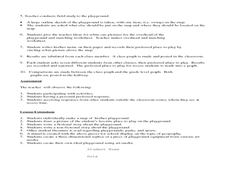
Students listen to poem, Where Oh Where On the Playground, Do I Love to Be?, and practice reading, interpreting, and making maps, charts, and graphs in surveying classmates and discussing their favorite places to play in school playground.
Curated OER
Absolute and Relative Location
Second graders understand the difference between relative and absolute location using the grid map as an example of an absolute location. They observe a class map showing longitude and latitude lines and learn that they provide exact...
Curated OER
Directionality
Second graders discuss the cardinal directions and intermediate directions and then look at the spooky map to locate different points on the map. They answer questions about where things are located in reference to another object and...
Curated OER
The Great Continental Drift Mystery
Students stud the concept of Pangaea by using Wegener's clues to construct a map of the continents joined together. They determine how fossil distribution can be used to enhance the study of continental drift. They locate the...
Curated OER
Sky 2: Shadows
students will explore making shadows and tracking the movement of an object over the course of a day to look for patterns. It is best to couple this shadow activity with reading the book, Bear Shadow, and making a map of Bear's...
Curated OER
Autobiographical Talking Sticks
Students begin the lesson by developing a map of their lives. Individually, they take this information and write a personal narrative. They create symbols to represent the various times in their lives and introduce them into their...
Curated OER
The Shot Heard Around the World
Fifth graders examine the events leading up to the beginning of the Revolutionary War. In groups, they put the events into chronological order and create a timeline. As a class, they discuss the reprecussions of the Stamp Act,...
Curated OER
Fictional Narrative Writing in Mathematics
Fifth graders discuss variety of fictional writing genres and connect each to familiar story that has been read, use creative and analytical skills to develop original piece of fictional writing that incorporates math skill, and share...
Curated OER
Geography Game
Second graders, in groups, selects a letter as a starting point and announces the direction in which he intends to move on a map. The team that closes a square takes possession of the square and marks it with their symbol.
Curated OER
Lesson 7 - Our Rivers and Streams
Students examine the major rivers in Northeast Florida and how they are useful. They study the St. John's River, its tributaries, and unique characteristics.
Curated OER
Giving and Taking Directions
Learners identify the difference between commands and a declarative sentence. They complete a diagram with verbs, prepositions and numbers. They follow directions using a map and give directions to another location.
Other popular searches
- Beginning Map Skills Canada
- Beginning Map Skills Uk
- Geography Beginning Map Skills
- Beginning Map Skills Unit


