Curated OER
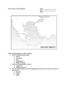
Ancient Greece Map Worksheet
Since the beginning of time, geography has shaped the development of human civilization, and ancient Greece is no exception. This learning exercise supports young historians with exploring this relationship as they first identify key...
Curated OER
Map of Town
Third graders draw a map of the town given different sites to locate on the map by the teacher. They explain that latitude and longitude are used to locate places on maps and globes, identify the distinctive physical and cultural...
Curated OER
Plotting a Hurricane Using Latitude and Longitude
Learners define and use "absolute location," latitude, and longitude. They locate on a map or globe the Earth's poles, circles, tropics, and beginning points of measurements for latitude and longitude.
Curated OER
Country Capitals
Students locate country capitals on a world map. In this map skills lesson, students review the definition of the word country and discuss what a capital is. Students locate and label capital cities on a world map using a map marker.
C-SPAN
The Electoral College and the Constitution
What is the purpose of the Electoral College? Is it antiquated, or does it have a place in today's political climate? High schoolers view a series of video clips as they analyze the parts of the United States Constitution that address...
Curated OER
United States Map - Lesson 9
Students explore the concept of cardinal directions. In this geography lesson plan, students identify the compass rose on a large U. S. map and then discuss the cardinal directions.
Curated OER
Studying Mind Maps Created at Other Schools
Students explore Africa and mind maps created by students from other schools. They discuss Africa and the number of countries, diversity of language, cultures, races, religions, and lifestyles and in groups study a mind map from another...
Curated OER
Countries of the World
Learners define the meaning of the word country. In this countries of the world map instructional activity, students identify boundaries, countries, and symbols within countries on the map. Learners distinguish the words country and...
University of Texas
Essential Reading Strategies for the Struggling Reader
Beneficial for beginning readers, struggling readers, and those in need of review, a set of language arts activities is a great addition to any foundational reading unit. Focusing on phonological awareness, fluency, instructional...
Curated OER
Math with Maps and Globes
Students round out their math skills with these ‘round the world' ideas. In this math and geography lesson, students try out time zone sticks, a polar race, and tic-tac-globe to engage them in learning more about globes and the...
Curated OER
United States Map - Lesson 4: States
Learners use a United States Map to locate their state and use map symbols to determine the boundaries of a state. In this states lesson plan, students learn the definition of a state and identify their own on a map.
Curated OER
Memorable Maps
Students draw an assigned map from memory about the United States or any other region they are studying. For this maps lesson plan, students draw a map from their memory at the beginning of the year, and do the same assignment at the end...
Curated OER
Countries of the World
Students identify countries on a world map. In this map skills lesson, students define the word "country" and use post-it notes to locate several countries on a world map.
National Research Center for Career and Technical Education
Transportation, Distribution, and Logistics: Tire and Wheel Assemblies
Is bigger really better? By the end of this lesson, learners will be able to apply formulas for computing the diameter of tires and wheel assemblies. Begin by showing a slide presentation that will review definitions for radius and...
Curated OER
A Soldier's View of the American Civil War
Study and research the American Civil War in this explanatory writing lesson. Middle schoolers complete six activities to learn about the American Civil War and soldiers' views of the war. The lesson includes several options to complete...
Curated OER
Where in the United States Are We?
Learners spend the lesson identifying the location of the fifty states and the capitals. Using a software program, they retrace te outline of each state numerous times. To end the lesson, they write a story about a state and city of...
National Wildlife Federation
I’ve Got the POWER Wind Energy Potential at Your School
The 20th lesson in a 21-part series connects the wind data and expectations of a turbine to whether such devices should be built in your area. Scholars begin with estimating the wind potential at school by using long-term climate data...
Core Knowledge Foundation
Columbus Sailed the Ocean Blue
Young adventurers embark on a journey, setting sail along the blue ocean with Christopher Columbus. Teachers will find that this unit makes their lesson planning smooth sailing!
Edgate
Great Grids
Learners use grid boxes as a measurement tool and discover how grids are used for mapmaking and scaling down an area. They begin by attempting to draw a model shape drawn by the teacher by using the gridding process. At the conclusion of...
Curated OER
The Gold Rush
Young scholars identify the routes involved in the Gold Rush on a map. In this map skills instructional activity, students use a United States map to locate the routes used to travel to California during the Gold Rush. Young scholars...
Curated OER
French and Indian War: Make A Map
Fifth graders create a map of the battles that occurred during The French and Indian War. In this history lesson plan, 5th graders read about the war in their text books, then divide into groups to create a detailed map of a famous...
University of Southern California
What Is The Ocean?
Go on a tour of the ocean through the lens of a scientist. Learners read maps of the ocean floor, study tide behavior, examine wave motion, and analyze components of soil. Each lesson incorporates a hands-on component.
Workforce Solutions
Workforce Solutions 2-3 Lessons
Four lessons and an at-home connection examine 12 jobs. Beginning with an interactive map, scholars view and discuss each one within their small group. Groups focus on the products provided and on their scarcity. Finally, pupils look...
Houghton Mifflin Harcourt
Surprise!: Extra Support Lessons (Theme 2)
Surprise! is the theme of a unit covering such topics as consonants, blending, short vowels sounds, high frequency words, and number words. The unit's lessons also include teachable moments covering story structure, illustrations,...


