EngageNY
Reading the Map and Beginning Chapter 1
Seventh graders begin their study of Linda Sue Park's A Long Walk to Water by discussing scenarios related to the novel with a partner. The discussion topics invite pupils to consider how various factors, such as war and poverty,...
Curated OER
Mapping the Transcontinental Journey
Students develop their geography skills. In this Lewis and Clark instructional activity, students collaborate to calculate the time and distance of different segments of the expedition. Students compare their estimate to Lewis and Clark's.
Curated OER
United States Map Lesson
Students explore basic map skills. For this United States geography lesson, students define "country" and "state," locate their state on a United States map, and identify and trace state boundaries defining their state and surrounding...
Curated OER
Geo-Class Mapping My Neighborhood
Students create a map of the school and surrounding neighborhood. In this mapping lesson, students discover their school's location and learn about its past. Students use math skills and the steps in the design process to complete the...
Curated OER
River Run Through It
With vocabulary lists, worksheets, and more, this lesson sets learners on an exploration of the Hudson River area. They read an essay about the area, analyze a relief map of New York State, and complete a worksheet.
Curated OER
Rivers Run Through It
Using a relief map of New York State, learners answer questions about the distance between different cities, identify bodies of water, and more. First, they discuss vocabulary related to the Hudson River area. Then, they complete a...
Curated OER
The United States and Its Capitals
Have your class learn about the fifty states in the United States and their capital cities. Learners play matching games, complete quizzes, and a variety of activities in order to cement their knowledge of the states.
National Endowment for the Humanities
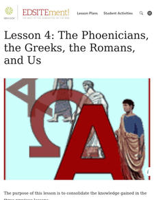
Lesson 4: The Phoenicians, the Greeks, the Romans, and Us
Learners review knowledge gained in the three-part unit on the history of the alphabet. Using maps and images, learners consolidate their understanding of ancient Greece, the Romans and the Phoenicians, and their respective impacts on...
Constitutional Rights Foundation
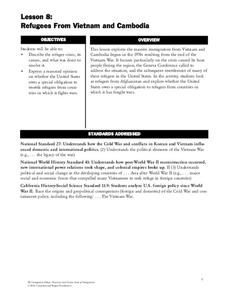
Refugees From Vietnam and Cambodia
The United States may have pulled its troops from the Vietnam War in 1973, but the conflict was far from over for the citizens living in Asia at the time. An informative resource lets learners know about the wave of over 220,000...
Curated OER
E-mailing the Chamber of Commerce
Encourage effective internet research and e-mail correspondence as scholars investigate a US capital city they've never visited to find pertinent and relevant information. They begin by picking a city, then visit that city's chamber of...
Curated OER
Grid Frame Mapping
Students map and describe small area of the schoolyard and discuss habitats.
McGraw Hill
Study Guide for Island of the Blue Dolphins
Dive your class into a reading of Island of the Blue Dolphins with this in-depth study guide. Breaking the novel into three parts, the resource begins each section with a focus activity that identifies a specific theme or question to be...
Curated OER
A View from the Ground
Students look at a park from ground perspective. In this map skills lesson, students are introduced to a story about a girl at a park and make observations about the park based on a picture. This prepares students for the next lesson in...
Curated OER
Map of Town
Third graders draw a map of the town given different sites to locate on the map by the teacher. They explain that latitude and longitude are used to locate places on maps and globes, identify the distinctive physical and cultural...
Curated OER
Plotting a Hurricane Using Latitude and Longitude
Learners define and use "absolute location," latitude, and longitude. They locate on a map or globe the Earth's poles, circles, tropics, and beginning points of measurements for latitude and longitude.
Curated OER
Country Capitals
Students locate country capitals on a world map. In this map skills lesson, students review the definition of the word country and discuss what a capital is. Students locate and label capital cities on a world map using a map marker.
C-SPAN
The Electoral College and the Constitution
What is the purpose of the Electoral College? Is it antiquated, or does it have a place in today's political climate? High schoolers view a series of video clips as they analyze the parts of the United States Constitution that address...
Curated OER
United States Map - Lesson 9
Students explore the concept of cardinal directions. In this geography lesson plan, students identify the compass rose on a large U. S. map and then discuss the cardinal directions.
Curated OER
Studying Mind Maps Created at Other Schools
Students explore Africa and mind maps created by students from other schools. They discuss Africa and the number of countries, diversity of language, cultures, races, religions, and lifestyles and in groups study a mind map from another...
Curated OER
Countries of the World
Learners define the meaning of the word country. In this countries of the world map instructional activity, students identify boundaries, countries, and symbols within countries on the map. Learners distinguish the words country and...
Curated OER
Math with Maps and Globes
Students round out their math skills with these ‘round the world' ideas. In this math and geography lesson, students try out time zone sticks, a polar race, and tic-tac-globe to engage them in learning more about globes and the...
Curated OER
United States Map - Lesson 4: States
Learners use a United States Map to locate their state and use map symbols to determine the boundaries of a state. In this states lesson plan, students learn the definition of a state and identify their own on a map.
Curated OER
Memorable Maps
Students draw an assigned map from memory about the United States or any other region they are studying. For this maps lesson plan, students draw a map from their memory at the beginning of the year, and do the same assignment at the end...
Curated OER
Countries of the World
Students identify countries on a world map. In this map skills lesson, students define the word "country" and use post-it notes to locate several countries on a world map.


