BBC
Bbc: News: Country Profile: Bhutan
BBC News features a general overview of the tiny South Asian kingdom of Bhutan. Focus is on history, country facts, political leaders, and news media. Provides access to a timeline of key events, recent news articles, and related...
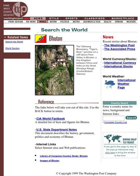
The Washington Post
The Washington Post: Bhutan
The Washington Post covers the latest news for and about Bhutan, as well as providing several references about the country.
Ducksters
Ducksters: Geography for Kids: Bhutan
On this site, students can learn about the history, capital, flag, climate, terrain, people, economy, and population of Bhutan.
Curated OER
Flag of Bhutan
Explore the geography, history, government and facts of Bhutan. Maps and current flag are included.
Curated OER
Map of Bhutan
Explore the geography, history, government and facts of Bhutan. Maps and current flag are included.
Curated OER
Association of Religion Data Archives: National Profiles: Bhutan
Learn about religion in Bhutan, in this Association of Religion Data Archives country profile, which includes general facts, history, and religious data.
Curated OER
Map of Bhutan
BBC News features a general overview of the tiny South Asian kingdom of Bhutan. Focus is on history, country facts, political leaders, and news media. Provides access to a timeline of key events, recent news articles, and related...
Curated OER
Flag of Bhutan
BBC News features a general overview of the tiny South Asian kingdom of Bhutan. Focus is on history, country facts, political leaders, and news media. Provides access to a timeline of key events, recent news articles, and related...
Khan Academy
Khan Academy: Introduction to the Himalayas
The Himalayas are the highest mountain ranges in the world, and from them flow the major rivers of Asia. The kingdoms of Nepal and Bhutan are located along the Himalayan ranges, and the Tibetan plateau lies to their north. Although the...
Other
Asia Society: Policy
A comprehensive storehouse of all types of information on Asia, both current and past: maps and statistics, Asian food, travel guides, photographs, articles, timelines, and more. Asia Source is the work of the Asia Society, a national...
PBS
Pbs Nova: Vanishing Into Thin Air
Glaciers are shrinking at an alarming rate. Witness the dramatic melting of Peru's Qori Kalis glacier. Investigate some of the benefits of glaciers as well as the negative effects that will result when the glaciers are gone.
Countries and Their Cultures
Countries and Their Cultures: Bhutanese
Provides an overview of the traditional culture and lifestyle of the Bhutanese. Gives basic facts about location, language, folklore, foods, social customs, family life, education, religion, pastimes, societal challenges, etc. (Note:...
Travel Document Systems
Tds: The Gambia: Economy
A brief discussion about Gambia's economy as well as a chart showing GDP, natural resources, trade, and percentages of economy in agriculture and industry. Information from the CIA World Fact Book.
Curated OER
Educational Technology Clearinghouse: Maps Etc: India, 1920
A map from 1920 of India, showing the political divisions and country boundaries at the time. India was officially British Raj, made up of British controlled provinces and dependent Native States or Princely states (Hyderabad, Mysore,...
Curated OER
Etc: Maps Etc: United and Central Provinces of India, 1912
A map from 1912 of the British provinces of Bengal, Assam, Bihar and Orissa, Central India and the United Provinces of Agra and Oudh at the time. The map also shows the countries of Nepal and Bhutan, and the Indian state of Sikkim. The...
Curated OER
Etc: Maps Etc: India at the Time of the Indian Rebellion, 1857
A map of British India at the time of the Indian Rebellion of 1857. The map is color-coded to show the British dominions extending from the frontiers of Beloochistan and Afghanistan in the west to Lower Burmah (Myanmar) and the Irrawaddy...
Other popular searches
- Nepal Bhutan Mandala
- Bangladesh, Bhutan
- Bangladesh Bhutan
- Bhutan Development
- Bangladesh\, Bhutan
- Nepal and Bhutan
- Bangladesh%2c Bhutan
- Acrostic Poem for Bhutan
- Bangladesh%25252c Bhutan
- Bangladesh\\\, Bhutan
- Bangladesh\%2c Bhutan


