Curated OER
World: Continents
In this blank outline map instructional activity, learners note the political boundaries of the continents of the world on a Robinson projection map.
Curated OER
Volcanoes!: The Dangers of Snow and Ice
Students observe a demonstration of how melting snow and ice can contribute to mudflows. They then observea list of continents with the number of snow and ice covered mountains on each continent and discuss. They then label a group of...
Texas State Energy Conservation Office
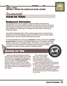
Investigation: Tour de Texas
Teams of Texas tourists gather into groups to analyze what they can do with $50 worth of an alternative fuel. They write checks, keep a balance sheet, and map out their sight-seeing route taking into consideration the location of...
Curated OER
Continents and Oceans on the Move
Learners create an awareness of the vast percentage of water covering the earth. They relate similarities/differences between topographical maps and other maps of various time periods. Students examine how to use a topographical map.
Curated OER
New: Around the World
First graders identify and demonstrate how symbols and models are used to represent features of the environment. They use a map and a globe to label where the students in the book came from, point out the continent, and show which ocean...
Curated OER
Sign a Map
In this geography worksheet, students think and identify the different features and landforms that an explorer would come across the continent of Antarctica. They use body gestures to communicate their list of items to a partner and...
Curated OER
Location, Location, Location!
Twelfth graders locate cities, states and countries on maps. They use the cardinal directions to locate places on maps. They describe where they were born by giving clues without naming the exact state. They trade papers and try to guess...
Curated OER
World Landforms
In this blank outline map worksheet, students note the major landforms of the 7 continents of the world on a Robinson projection map.
Curated OER
Latitude and Longitude- Online Interactive
In this maps worksheet, learners learn about longitude and latitude by reading a two paragraph text and studying two maps. Students answer 9 fill in the blank questions. This is an online interactive worksheet.
Curated OER
The Global Grapefruit - Representing a 3-Dimensional Globe on a 2-Dimensional Map
Students compare and contrast world maps and globes. They convert a 3-dimensional globe to a 2-dimensional map. They are introduced to the Mercator map projection. They observe map distortions of shape, area, distance, directions and angle.
Curated OER
Zones of Conflict
Students read maps and identify specific countries involved in conflict. They classify countries in cultural realms. They relate maps to what they know about world conflict.
Curated OER
Where In the World Are You?
Fourth graders fill in blank copies of the United States Map and then the World Map.
Curated OER
Let's Play Geography Twister
Students practice geography skills by playing a game based on Twister. Students manipulate their position on a map by placing their arms and legs on the appropriate state or country called out by the teacher.
Curated OER
Asia Crossword
In this geography worksheet, students complete a crossword puzzle on the continent of Asia. They answer 21 questions related to the type of government systems found, capital cities, deepest lake, and lowest population density.
Curated OER
Africa Unite!
Learners work in pairs to research assigned African countries. They compile their research to label a continent map of Africa, present their research to the class and design a game of trivia using their findings.
Curated OER
Physical Geography of Africa
Fifth graders investigate the topography of Africa. In this physical geography instructional activity, 5th graders research the six regions of Africa and complete a physical map. Students locate various landforms in Africa. Students...
Curated OER
The 50 States and its Holidays
Though the format of this ELL lesson is confusing (the standards listed are for plate tectonics, yet the objectives are for American geography and holidays), a teacher could glean some ideas from the main idea. Here, pupils complete a...
Curated OER
Oceans Away
Students explore oceans. In this science lesson plan, students locate oceans, seas and continents of the world, identify ocean-related occupations, and complete activities pertaining to food chains as well as pollution.
Curated OER
Latitude & Longitude Bingo
Young scholars practice map reading skills through a reinforcement game of bingo. They select any 24 of 30 listed cities to write on blank bingo cards. Then using atlases, locate a city based on the latitude and longitudinal...
Curated OER
Drifting Continents, Dynamic Results
Students plot earthquake and volcano data using a Compass Rose Plotting. They explain the relationship between plate movement and connection. They draw conclusions that earthquakes and volcanoes occur in predictable locations.
Curated OER
World Cities and the Olympics
High schoolers examine the various cities in which Olympics have been held. Using a map, they describe the reasons why those cities were chosen and choose their own city for the Olympics and state the reasons why. They examine...
Curated OER
Bank On It! Antarctica
In this vocabulary worksheet, students read an informational paragraph about Antarctica. Students then fill in the 17 blanks with words from the word bank.
Curated OER
Exploring Plate Tectonics
In this plate tectonics worksheet, learners complete 8 fill in the blank questions on plate boundaries, 9 short answer questions on the Earth's crust and 5 fill in the blank on continental drift. There are 3 follow questions at the end.
Curated OER
Gray Whales on the Move
Students study whale migration and their natural history. In this migration lesson plan students plot whale migration on a map and describe their ecosystems.


