Curated OER
Hemispheres & Continents
Students learn in cooperative learning groups to determine how the equator and the Prime Meridian divide the earth into hemispheres and use Venn diagrams. Students will locate and label the hemispheres, continents, and oceans.
Curated OER
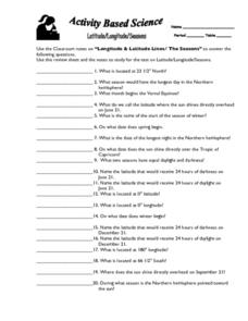
Latitude, Longitude, Seasons
In this latitude and longitude worksheet, students use their classroom notes on both longitude and latitude lines as well as seasons to complete 20 fill in the blank questions.
Curated OER
The Longitude and Latitude of the Night Sky: Declination & Right Ascension
In this longitude and latitude worksheet, students identify and write in the correct hours, minutes, and seconds for right ascension. Then they identify and write the correct + or - degree in the space for declination or latitude. There...
Curated OER
Great Cities of the Middle East
Students explore the cities of Cairo, Istanbul, Jerusalem, Mecca and Tehran. In this Middle East lesson plan, students complete a map, research one of the five the cities and prepare a presentation that includes details about the city. ...
Curated OER
Physical Geography of Africa
Fifth graders investigate the topography of Africa. In this physical geography lesson, 5th graders research the six regions of Africa and complete a physical map. Students locate various landforms in Africa. Students use their...
Curated OER
Around the World in 5 Days
Students explore continents, draw map, discuss cultures, use research to learn geography, and investigate cultures.
Curated OER
The Return of the Taliban
Students view a news program from Frontline. They discover who the Taliban are and identify their locations on maps. They compare and contrast the changes in Pakistan from 2004 to 2006.
Curated OER
Seven Daughters and Seven Sons: the Middle East Through
Sixth graders read "Seven Daughters and Seven Sons" and examine aspects of Middle East culture and geography. They define vocabulary from the book and map locations described in the book.
Curated OER
Civil War and Reconstruction
Learners examine the differences between the North and South during the pre-Civil War era. In this Civil War era lesson plan, students spent 7 days looking at things that were different between the Union and Confederate state before the...
Curated OER
Africa Unite!
Students work in pairs to research assigned African countries. They compile their research to label a continent map of Africa, present their research to the class and design a game of trivia using their findings.
Curated OER
Michigan Food: From Farm to You
Students recognize Michigan on a map and understand how its climate is affected by the Great Lakes. In this Michigan food lesson, students play a trivia game to identify the produce of Michigan. Students relate the climate in each part...
Curated OER
The 50 States and its Holidays
Though the format of this ELL lesson plan is confusing (the standards listed are for plate tectonics, yet the objectives are for American geography and holidays), a teacher could glean some ideas from the main idea. Here, pupils complete...
Curated OER
Help! I Am Lost at Fox Chapel
Sixth graders create a map to locate places on campus and share the map with another student. The other students use the map to locate certain places and validate for accuracy via a checklist. The parents use the completed map at open...
Curated OER
Weather Reporter
Fourth graders explore the components of a weather map, mark cities on the map and place the appropriate temperatures and weather conditions occurring in the cities on the weather map created.
Curated OER
Find the Way
Fourth graders, after discussing different places to visit and being given a map of Indiana, draw the route to his/her destination within Indiana. They tell the directions in their own words and formulate pertinent questions to ask along...
Curated OER
Lesson: Journey of a Tree
Third graders explore the operation of a Christmas farm and how trees are shipped. After taking a tour of a Christmas tree farm and researching transportation, location and cost issues, 3rd graders create a map to show the distribution...
Curated OER
Australia
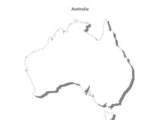
In this Australia map, students research and locate the main regions, states and important landmarks found on the map and discuss them with their classmates.
Curated OER
Seasons and Day Time
Learners label a diagram of the Earth rotating about the sun and indicate the direction of the rotation and the seasons at each location. They indicate the seasons, the poles, the hours of daylight at each pole, the direction of rotation...
Curated OER
The Sun's Path
Starting with questions about the tilt of the Earth and apparent motion of the sun, a learning exercise provides instructions on how to figure the paths of the Sun on certain dates. Learners answer three more questions, complete with...
Mathematics Assessment Project
Linear Graphs
A line is a line is a line. As a middle school assessment task, learners first identify graphs of given linear equations. They then identify the equations that represent real-world situations.
Curated OER
Molecular Biology and Primate Phylogenics
By counting differences in amino acids, biology stars examine the relationships between different primates. With information gleaned, they map out a phylogenic tree and discover common ancestry. You will need to create printable versions...
Curated OER
Did You Feel That? Earthquake Data Chart
Students plot earthquakes on the world map using coordinates of longitude and latitude. They designate the earthquakes magnitude with a symbol which they include in the map key.
Curated OER
Minnesota Road Trip
Students plan a week-long trip around the state of Minnesota. They write a detailed itinerary for their trip and fill in a blank map of Minnesota with the places and routes listed in their itinerary.
Curated OER
Indiana Travel Guide
Fourth graders, after exploring and researching the state of Indiana, create a travel guide about the state of Indiana including its capital, major rivers, governors and two famous people from the state. They utilize a variety of art...


