Curated OER
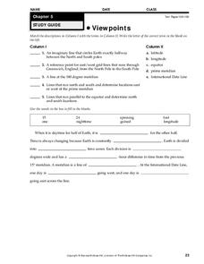
Viewpoints
In this map worksheet, students review latitude, longitude, equator, and prime meridian. This worksheet has 5 matching and 8 fill in the blank questions.
Curated OER
Latitude & Longitude Bingo
Students practice map reading skills through a reinforcement game of bingo. They select any 24 of 30 listed cities to write on blank bingo cards. Then using atlases, locate a city based on the latitude and longitudinal coordinates...
Curated OER
Constellation Study Guide
In this constellation worksheet, students choose a constellation to sketch and to determine the basic characteristics of that constellation including the magnitude and color of its brightest star. This worksheet has 1 drawing, 1 short...
California Academy of Science
California's Climate
The United States is a large country with many different climates. Graph and analyze temperature and rainfall data for Sacramento and Washington DC as you teach your class about the characteristics of Mediterranean climates. Discuss the...
Curated OER
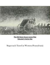
Old Stone House Lesson Plan
From stagecoach to railroad tracks, your class will discover how advancements in travel in the United States during the nineteenth century played an integral role in the industrialization and development of American society. The main...
University of California
Anti-Communism at Home
Have you ever been accused of something without cause? The sixth installment of an eight-part series asks scholars to create a museum exhibit on the anti-communist activities in the United States at the start of the Cold War. To make...
Curated OER
The 50 States
Fifth graders use maps and music to learn the 50 states. In this US Geography lesson, 5th graders map out a region of the United States and practice singing the song, The 50 States that Rhyme.
Curated OER
This Land is Your Land? This Land is My Land!
Students research the various territory acquisitions in United States history and create an annotated map that tells the history of U.S. expansion. Working in small groups, students outline the land acquisitions and purchases made by...
Curated OER
Filling Up Florida
Students study factors controlling Florida's population growth and related environmental impacts. They research natural community types and construct maps (including a large-sized map of Florida) to be used for a simulation activity.
Curated OER
The Yangtze River: Lifeline of China
Students locate the Yangtze river on a map, and label major cities and landmarks. Students identify and interpret the diversity of the people living along the Yangtze. Students explain the pros and cons of the
Three Gorges Dam project.
Curated OER
Place Names
Students investigate the meaning of various Native American names. For this Native American language lesson, students locate state names that come from Native American descriptions and mark them on a map. Students then suggest a name for...
Curated OER
Virginia's Five Geographic Regions
Tenth graders study the products and industries of five major geographic regions in Virginia. They use web based resources to examine maps of Virginia and to make a large classroom map which they label with the products and industries....
Curated OER
Weather
Fourth graders study a map and locate cities, read information and create a chart. In this weather lesson students place appropriate weather information on a map and write a script using their information to relay the weather to...
Curated OER
Canada...a Visual Journey
Students, in groups, research Canada's six natural regions (ecozones). They create a visual representation of each region on a large wall map of Canada and present it to the rest of the class.
Curated OER
American Settlement of the Great Plains
Seventh graders examine the Great Plains. In this American settlement lesson, 7th graders create a map of the settled areas in the United States. Students discuss the struggle between settlers and the Native Americans.
Curated OER
Canada...A Visual Journey
Learners work together to analyze the six natural regions of Canada. Using this information, they create a visual representation of each region on a large wall map and present it to the class. They must identify five key points of each...
Curated OER
Different Perspectives of Oregon's Forest Economic Geography
Young scholars map data on employment in wood products manufacturing in Oregon counties. In this Oregon forest lesson plan, students discover the percentage of people employed in the forest manufacturing industry. Young scholars create a...
Curated OER
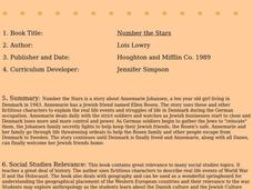
Number the Stars
Students read Number the Stars. In this social studies lesson, students read the story and use a map of western Europe and identify the countries involved in the war. Students locate the cities of Denmark that are discussed in the story.
Curated OER
Urban and Agricultural Settlements Why are They There?
Seventh graders identify types of human settlements, urban and agricultural, and determine geographic influence on why people settle where they did by use of maps and charts. They, in groups, identify the needs of a new settlement, which...
Curated OER
Animal Trackers
Students use space technology to monitor migratory species, map their movements, and gather data about their habitats and possible responses to climatic shifts.
Curated OER
New: Around the World
First graders identify and demonstrate how symbols and models are used to represent features of the environment. They use a map and a globe to label where the students in the book came from, point out the continent, and show which ocean...
Curated OER
Geography of Vietnam
Ninth graders examine the geography of Vietnam. For this Geography lesson, 9th graders create a physical and political map of Vietnam.
Curated OER
GPS Worksheet
In this GPS worksheet, students complete 6 fill in the blank questions about GPS satellite signals, receiver units and the acronyms used in GPS technology.
Curated OER
World Oceans
Students locate the world's oceans. In this geography skills lesson, students chart the locations of the Indian, Arctic, Pacific, and Atlantic Oceans on world maps.


