Curated OER
Lesson Plan on Map Skills for South Asia
Seventh graders observe and discuss an overhead transparency map of South Asia. In small groups, they label a blank map of South Asia, and listen to a lecture on the realm.
Curated OER
Geography of Canada
All about Canada! Learners explore the geography and providences of Canada by watching videos, studying maps and conducting internet research. By the end of this lesson, your class should be able to locate major areas and compare and...
California Academy of Science
Discovering Rainforest Locations
How many rainforests are there, where are they, and do global factors effect their locations? These are great questions that have great answers. Children in grades four through eight use several different maps to determine why...
Curated OER
Journey of Discovery and Rivers
Students investigate the rivers encountered and mapped by the Corps of Discovery. They analyze maps, outline and label rivers on a blank map, complete a chart, and answer discussion questions while watching a National Geographic video,...
Curated OER
Canada Map Quiz
In this online interactive geography quiz activity, students examine the map that includes 13 Canadian provinces and territories. Students identify the names of the provinces and territories in 2...
Curated OER
Do You Know Your 50 States?
Learners use the names and abbreviations of the 50 states to label a blank map of the United States.
Curated OER
Mollusks and Annelids Concept Map
In this mollusks and annelids concept map learning exercise, students complete a concept map on the characteristics of invertebrates. They fill in 13 blanks using the correct word from the list.
Curated OER
Introduction to Animals Concept Map
In this animal science worksheet, students complete a concept map on the features of animals. They fill in 12 blanks with the correct words from the list.
Curated OER
Fishes Concept Map
For this marine science worksheet, learners complete a concept map on the different types of fish. They fill in 8 blanks with the correct answer from the word list.
Curated OER
Birds Concept Mapping
In this biology worksheet, students complete a concept map about birds. They fill in 7 blanks with the correct terminology from the word list.
Curated OER
Virus Concept Map
In this biology worksheet, students complete a concept map on viruses. They fill in 9 blanks with the correct terminology from the word list.
Curated OER
Ecosystem Concept Map
How do ecosystems change? How do organisms keep their ecosystem going? Learners use a word bank to fill in 12 blanks that describe the functionality of ecosystems.
Curated OER
Mapping a Garden
Second graders recognize the components of a map, particularly the legend, the key, the symbols and the area. They develop their own map of a garden they be planting in their upcoming science lesson.
Curated OER
States On A Map
Third graders locate the states of Main and Kansas on a map. In this state location lesson plan, 3rd graders read the book Sarah, Plain and Tall and discuss what states she traveled through.
Curated OER
Maps in Kindergarten: Rosie’s Walk
Students are read, Rosie's Walk by Pat Hutchins. In this sequencing lesson, students discover the importance of knowing how to create a map and read it. They listen to the story and complete various map making activities.
Curated OER
Czech Republic Outline Map
In this blank Czech Republic outline map activity, students study the physical boundaries of the country. This outline map may be used for a variety of geographic activities.
Curated OER
Maps Puzzle
For this map information word puzzle worksheet, students fill in the blanks in 7 sentences with the words that correctly complete them. The sentences all pertain to maps.
Curated OER
NATO Geography & Language
The class receives background information on NATO, an atlas, and a blank world map. They color the original 1949 countries in red, the 1952 additions in green, and the 1990 additions in blue. This exercise would be a good starting point...
Curated OER
Where in the World Is Mexico?
Learners practice map-reading skills as they locate Mexico and its cities on a world map. By creating a puzzle out of a map of Mexico, students engage in a meaningful hands-on activity to help them explore that country's geography.
Student Handouts
Geography of Dr. Martin Luther King, Jr.
Young geographers follow Dr. Martin Luther King's journey during the civil rights movement by identifying major events on a map of the eastern United States, such as his birth in Atlanta, Georgia and his famous...
Curated OER
Map of Hawaii
In this map worksheet, students view a blank map of the Hawaiian Islands. Worksheet has no associated activities, but is a generic blank organizer/map. A reference web site is given for additional activities.
Curated OER
Outline Map of Turkey
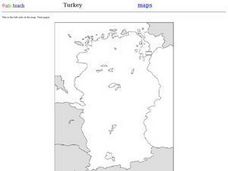
In this outline map of Turkey worksheet, students see a blank map of the country with the adjoining countries shaded in gray. There are no labels on the map.
Curated OER
Map of New York State
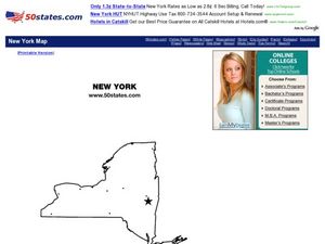
In this map worksheet, students view a blank map of New York. Worksheet does not come with any associated activities, but does have "dots" designating cities on the map.
Curated OER
Map of Papua New Guinea
In this geography of Papua New Guinea worksheet, students color and label a map with major cities and physical features. Students will need to do their own research to label this blank map.


