Curated OER
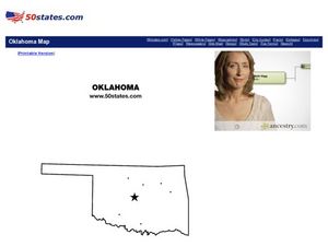
Map of Oklahoma
In this map of Oklahoma worksheet, students view a blank map of Oklahoma with dots on designated cities. Worksheet has no other associated activities.
Curated OER
Map of Montana
In this map of Montana worksheet, students view a printable version of a blank map. Worksheet is a generic graphic organizer with no associated activities.
Curated OER
A More Perfect Union: The Story of Our Constitution
Sit back, relax, and transport to 1787! This lesson on the Constitution begins with guided imagery of the Constitutional Convention. The class reads A More Perfect Union: The Story of Our Constitution in an interactive read-aloud...
Curated OER
Volcanoes!: The Dangers of Snow and Ice
Students observe a demonstration of how melting snow and ice can contribute to mudflows. They then observea list of continents with the number of snow and ice covered mountains on each continent and discuss. They then label a group of...
Student Handouts
Christopher Columbus Workbook
Youngsters gain ample reading comprehension practice while studying the history of Christopher Columbus with this great workbook! It includes word puzzles and comprehension checks of multiple assessment styles, including multiple choice,...
Curated OER
Lesson Design Archaeology- U.S. Map
Students examine the U.S. map and identify cultural areas. In this archaeology lesson, students locate cultural areas on the U.S. map and fill in the proper locations.
Curated OER
Spider Map
In this language arts worksheet, students examine a blank spider map which could help organize ideas for a report or book response. Students write their topic in the center circle and the main ideas on the slanted lines that connect to...
Curated OER
Regions of South Carolina
Third graders explore the 5 regions of South Carolina. In this regions instructional activity, 3rd graders locate the regions on a map and compare and contrast the areas. Students have sentence strips that have facts about the regions on...
Curated OER
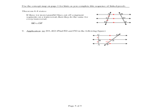
Logical Relationship of Postulates & Theorems
In this postulates and theorems instructional activity, students explore a concept map containing information about angles and sides, alternate interior angles, and diagonals of a parallelogram. They use the concept map to prove...
Curated OER
Where are We?
Fifth graders explore places visited by Lewis and Clark. In this geographical concepts lesson plan, 5th graders plot places on a map and put events in chronological order. Students find locations on a map using longitude and latitude....
Curated OER
"Yarning" About Latitude and Longitude
Students identify various locations using latitude and longitude. In this map skills lesson, students use yarn and labels to create a "human globe." Students identify the Prime Meridian, the Equator, and Northern and Southern Hemisphere.
Curated OER
Choose a Path
In this addition worksheet, students utilize data from a map to answer 6 fill in the blank questions where they provide the missing addends to addition problems.
Curated OER
Circulatory and Respiratory Systems
Eighth graders are able to write a paragraph describing each system based on the information retrieved in class. They trace a route from Holly Springs, MS to Greenwood using the maps that they were given. Students discuss the role of...
Curated OER
The Country of South Africa-Map Activity
In this South Africa map worksheet, students label given features and places on a blank map. A reference web site is given for additional activities.
Curated OER
Mapping Australia
In this mapping Australia worksheet, students locate and label various features and places on a blank map, 10 total. A reference web site is given for additional activities.
Curated OER
Mapping Mexico
In this Mexico map activity, students label features and places on a blank map of Mexico. A reference web site is given for additional activities.
Curated OER
Me On the Map
Second graders listen to Joan Sweeney's book, Me On the Map. They design a map of their bedroom and their house emphasizing the important characteristics.
Curated OER
Map Work About the Korean War
Young scholars use an interactive website that chronicles the occupation of the Korean peninsula by each year and complete a worksheet. This helps them to research the causes of the Korean War.
Curated OER
Animal Word Maps
In this animal vocabulary word mapping worksheet, students study a list of 8 animal names. In an opposite column, students are provided with blank word maps. Students match the words and place them into the map.
Curated OER
Circular Story Map
In this story elements map activity, students use the blank graphic organizer to plan a story they will write. Students will write a story that takes place in the country they choose to study. Students think of the setting, characters,...
Curated OER
North Africa & Southwest Asia Map Quiz
In this geography skills instructional activity, students examine the blank outline map of North Africa and Southwest Asia. Students label the countries located in the region.
NOAA
Into the Deep
Take young scientists into the depths of the world's ocean with the second activity of this three-part earth science series. After first drawing pictures representing how they imagine the bottom of the ocean to appear, students...
Edline
How Did the Unification of Germany Change the Course of World History?
Here you'll find a nice guided notes worksheet on Otto von Bismarck, which details Bismarck's plan to unify Germany, as well as asks learners to analyze his motivations and overall impact.
Big History Project
Human Migration Patterns
Humans have been on the move for millennia. Using an article from The Smithsonian, pupils chart human movement before written history on a world map. In addition, they examine the modes of transportation used by different waves of human...


