Curated OER
Bacteria Concept Map
In this life science instructional activity, students complete a concept map on bacteria. They fill in 7 blanks with the appropriate answer from the word list.
Curated OER
Class Amphibia Concept Map
In this class amphibia worksheet, students complete the concept map using words or phrases provided. They fill in 11 blanks with the correct answers.
Curated OER
Modern Reptiles Concept Map
In this life science activity, students complete a concept map on modern reptiles. They answer 13 fill in the blank questions using words from the list.
Curated OER
Evolution Concept Map
In this biology learning exercise, students complete a concept mp on the theory of evolution by natural selection. They fill in 8 blanks with the correct terms from the list.
Curated OER
Arthropod and Echinoderm Concept Map
In this biology learning exercise, students complete a concept map using the terms and phrases provided. They fill in 13 blanks with the appropriate words.
Curated OER
Phylum Arthropoda Concept Map
In this biology activity, students complete a concept map of the Phylum Arthropoda using the word list given. They fill in the 10 blanks with correct answers.
Curated OER
Shizuko's Daughter: Concept of Definition Word Map
Help your class use critical thinking when it comes to unfamiliar words. With vocabulary from Kyoko Mori's Shizuko's Daughter, kids write the word in the center of a graphic organizer, and find its category, comparisons,...
NY Learns
Geography of the Fertile Crescent by ECSDM
Using Google Earth, a vocabulary assignment, and map handout, your class members will outline the Fertile Crescent in Mesopotamia and identify the source of the Tigris and Euphrates rivers. They will then complete graphic organizers...
Curated OER
Getting to Know the Seven Continents
Young scholars are introduced to basic map and globe skills. Using the internet, they identify and locate the seven continents and complete a blank map to reinforce the names of the continents. They also distinguish between land masses...
Curated OER
"Label Me" Texas Map
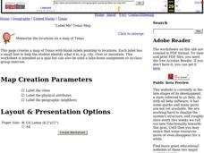
In this Texas map worksheet, students research, label and discuss the top ten major cities in Texas on a map, label the physical attributes and identify the surrounding states around Texas.
Curated OER
State to State Scavenger Hunt
In this states worksheet, students utilize the Internet to access one specific website to locate the answers to five fill in the blank statements about the states found on a United States map.
Curated OER
South America Layered
Seventh graders create an overlay map of South America. They show the relationships between population, landforms and economies with their maps.
Curated OER
Latitude and Longitude- Online Interactive
In this maps worksheet, learners learn about longitude and latitude by reading a two paragraph text and studying two maps. Students answer 9 fill in the blank questions. This is an online interactive worksheet.
Curated OER
Arthur's Tooth
Young scholars practice their reading comprehension by reading a story in their class. In this story map lesson, students read the Marc Brown book Arthur's Tooth and discuss the story, characters and setting. Young scholars create a...
Curated OER
Globe Skills Lesson 5
In this map skills worksheet, students read a text selection about locations during the American Revolution and then respond to 8 fill in the blank questions.
Curated OER
We Found It!
First graders identify and describe landforms. They demonstrate an understanding of the compass rose and a map key using the trail of Lewis and Clark and the Corps of Discovery. They generate a map key.
Curated OER
States and Capitals, Mountains and Rivers
Students identify geographical locations in the midwestern United States. For this geography lesson, students identify 12 states and capitals and geographical features in the region by using U.S. maps. Students use blank maps to fill in...
Curated OER
Orienteering - Introductory Lesson
Gain knowledge of directions and degrees while learning how to read a compass. NEWS - north, east, west, south, and everything in between. It's crucial to be accurate in reading a compass and understanding degrees and direction when...
Curated OER
Using Color as a Pre-Writing Tool
To better understand how to compose a clear and well-organized paper, learners read short passages, write summaries, and make colored graphic organizers. This is a fully developed three-day lesson with suggested assessments.
Curated OER
The Global Grapefruit - Representing a 3-Dimensional Globe on a 2-Dimensional Map
Students compare and contrast world maps and globes. They convert a 3-dimensional globe to a 2-dimensional map. They are introduced to the Mercator map projection. They observe map distortions of shape, area, distance, directions and angle.
Curated OER
Map Directions and the United States
Third graders search TDC database for images of a compass rose, a miles marker, and a US map. They identify cardinal and intermediate directions to help identify their state and other states on a US map.
Curated OER
On the Street Where You Live: Online Mapping
Students access the Internet and use Google Maps to pinpoint their home address and get directions to and from school. they write the directions in paragraph format.
Curated OER
Working with Contour Maps
In this contour maps worksheet, high schoolers use contour maps to determine the slope and steepness of different land masses. This worksheet has 16 fill in the blank questions.
Curated OER
Backyard Map- Measuring with Centimeters
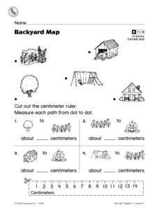
In this backyard map centimeter measurement worksheet, 1st graders cut out a centimeter ruler from the bottom of the page. They use the ruler to measure the path between objects which are pictures in the backyard map at the top of the...


