Curated OER
Virginia Geographic Regions
Third graders observe the five geographic regions of Virginia which have distinctive characteristics based on their landforms and bodies of water. They then describe the types of landforms and bodies of water in the region where they live.
Curated OER
The Edge of the Lake
Second graders explore the geography of Nevada. In this map-making lesson, 2nd graders use salt dough to create a relief map of Nevada. Students label the landforms and bodies of water that are studied and specified in the lesson.
Curated OER
Stream Chemistry Monitoring
Students become familiar with real-world gathering of chemical data. The experience how the science is done: the nature of analysis, data collection, interpretation, and presentation. They study a nearby body of water for their experiment.
Curated OER
Clarity And Turbidity
Learners measure the clarity of a body of water and identify possible environmental complications that can be attributed to clarity and turbidity.
Curated OER
Creating a Map of France
In this crating a map of France worksheet, students find and label important parts of France, bodies of water, mountains and surrounding countries.
Curated OER
Map of Egypt
In this map of Egypt worksheet, learners label the cities, bodies of water, surrounding countries and color the map according to the directions.
Curated OER
Exploring the Map of Morocco
In this exploring the map of Morocco worksheet, students find and label cities, islands, bodies of water, mountains, deserts and other countries around Morocco.
Curated OER
Map of Italy
In this map of Italy worksheet, students find, color and label cities, surrounding countries, bodies of water and landforms in the country of Italy.
Curated OER
How Wet Can You Get?
Students visit a swimming pool and brainstorm different water sports and what benefits swimming has over other types of exercise. They then discuss buoyancy and water pressure and when how objects sink or float before playing a game of...
Curated OER
"Tri-County" Project--Well in a Cup
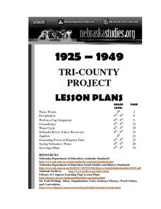
Students construct a model of a well to identify how water is brought to the surface. Signs of pollution are investigated.
Curated OER
Snapshot Day Definitions & Activities
For this watershed worksheet, students read through related definitions and complete 17 short answer questions about deposition and erosion in the Hudson River.
Curated OER
Mexico: Introduction to History and Literature
Students study the geography of Mexico (i.e. major cities, surrounding countries and bodies of water, mountain ranges, rivers, volcanoes), They take turns reading aloud information provided (xerox copies) about Mexico. After each...
Curated OER
To Protect Your Streams, Protect Your Mountains
Students build and experiment with a watershed to understand the effects of pollution. In this movement of water lesson, students work in groups creating rock formations and change the viscosity of the liquids falling down the mountain....
Curated OER
Zebra Mussels
In this zebra mussels worksheet, 7th graders read an article about zebra mussel populations in United States' lakes and rivers. Students read about the negative effects and some positive results and then answer several questions about...
Curated OER
Water Quality and the St. Mary¿¿¿s River Project Monitoring
Students list different parameters of water and explain how each is important to the balance of the St. Mary ecosystem. They identify the different instruments and explain what they test.
Curated OER
SAV Plants of the St. Mary¿¿¿s River Ecosystem
Students examine the importance of submerged aquatic vegetation in the St. Mary River ecosystem. They identify different characteristics of common eelgrass and discuss water quality, photosynthesis, habitat, oxygen production.
Curated OER
Watersheds and Wetlands
Students investigate watersheds and wetlands. In this watersheds and wetlands activity, students complete a 17 step lesson plan to build a watershed. Students then complete another 9 step activity to build a watershed with wetlands and...
Curated OER
Biomanipulation
Pupils explore the effects of aquatic trophic relationships on water transparency. They observe and explain the effects of reducing nutrient inputs on agal density on water transparency.
Curated OER
WONDERFUL, WATERFUL WETLANDS
Students list characteristics of wetland and describe the functions of a wetland.
Curated OER
Interpreting Aerial Photographs
Students interpret aerial photographs. They view aerial photographs or satellite-produced images to locate and identify physical and human features. They study satellite images and label their images for bodies of water, clouds,...
Curated OER
Understanding Salinity
Young scholars discuss why the ocean is salty. They discuss what salinity is. Students are told that is they want to know how much salt is in a body or water, they would use a special scientific tool. They complete an Estuarine Layers...
Curated OER
Current Events and Fish
Fifth graders examine current events impacting aquatic life in their communities. They search for newspaper, magazine and television reports for information about aquatic life in local bodies of water. Students can write letters to...
Curated OER
Big Blue Sky- Based on the Montana Quarter Reverse
Students use a Montana quarter to help describe geographical features such as landforms and bodies of water. Students read an article about Montana as a group and discuss examples of landforms and bodies of water. After reading,...
Curated OER
The Inside Current
Eighth graders explore ocean currents and wind patterns. They discover the concept of systems to show how change in one component of a body of water, causes change in other components in that system. Students describe positive and...


