Curated OER
The Race to Dominate the Known World
High schoolers describe cause/effect relationship of a European country's need for resources, exploration, colonization, and settlement of different regions of the world beginning in the 14th Century, and role play representatives of...
Curated OER
Nunavut, Our Communities
Students locate the communities of Nanavut on a territorial map and identify community characteristics. They research the online Atlas of Canada
Curated OER
Our 50 States
Students identify the location of the 50 states using an interactive map. They practice geography skills by playing a fun game. Pupils become familiar with the state abbreviations for the US states. Students become familiar with the...
Curated OER
The Mighty Hudson Stretches its Mussels
Students brainstorm possible causes of zebra mussel migration and population expansion. They identify the key causes and effects of the disturbance of the Hudson River ecosystem and research causes and effects in the disturbances of...
Curated OER
The Olympics
Students will research the geography and designa route form Columbia SC to an olympic competition, then follow local news and current events to track team perfomance.
Curated OER
The Ottoman Empire
Young scholars recognize that the Ottoman Empire was at its grandest during the reign of Suleyman the Magnificent. They use a map to draw in the extent of and the details of the Ottoman Empire during hie reign. In addition, they prove...
Curated OER
Sense of Place
Students identify the major folk regions of Louisiana and the relationship between folklife, geography, and ecology. They give deeper thought to what makes their own community unique, what their sense of place actually is. Students...
Curated OER
Dolphins At Daybreak
For this reading literature comprehension worksheet, students complete 35 questions. There is a short crossword puzzle, short answer responses, and matching. All pertain to Dolphins at Daybreak
Curated OER
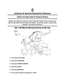
European History
In this world history worksheet , 5th graders look for information related to the history of Europe. They view the facts from a map and apply them to different activities.
Curated OER
United States: Physical Features Fun
In this map worksheet, students color and trace eleven listed features on a map of the United States. Students answer six additional questions about the map. A United States map is not provided. However, websites are provided to find...
Curated OER
Worksheet 14: Vocabulary Review, Page 1
This basic vocabulary activity could be used in upper elementary and ESL classes. After reading short sentences, learners identify the meaning of a word in 10 questions.
Curated OER
Jobs and Places
Students explore where jobs can be done. In this geography and careers instructional activity, the teacher presents the idea that some jobs are location specific while other are not, then students consider a list of jobs and determine...
Curated OER
Communities and Biomes
In this biomes learning exercise, students complete a crossword puzzle by figuring out the answers to 17 clues focused on communities and biomes.
Curated OER
State of Alabama
In this reading passages about the state of Alabama learning exercise, students read about the state's geography, history, exploration, industry, and people and use the information to answer multiple choice and true and false questions....
Curated OER
Our Changing Community
Students investigate how communities grow and change. In this communities lesson, students discuss how their community has changed and construct a model of a community.
Curated OER
Empires of Early Africa
Ninth graders examine the Nile's role in the birth and growth of Egyptian civilization. In this World History lesson, 9th graders explore how archaeologists have learned about life in Ancient cities. Students present a report...
Curated OER
Great Cities of the Middle East
Students explore the cities of Cairo, Istanbul, Jerusalem, Mecca and Tehran. In this Middle East lesson plan, students complete a map, research one of the five the cities and prepare a presentation that includes details about the...
Curated OER
North American Biomes
For this Science worksheet, students color a biome map of North America. Students color the map by solving the clues listed on a separate sheet of paper.
Curated OER
Native Americans
Students explore Native American cultures. In this cultural comparisons lesson, students participate in several activities that compare and contrast the culture of the Hopi and Comanche Tribes.
Curated OER
Regions of the USA
Fourth graders research the physical characteristics of the four regions of the United States. In this geography lesson, 4th graders research the four regions and use a quilt square organizer to record notes. Students complete the quilt...
Curated OER
Winter Holiday Activities Extravaganza
Students define culture and explore elements that are part of the custom or culture of a place. In this holiday lesson, students identify the cultures they participate in. Students identify the differences in people's...
Curated OER
Country facts
In this science facts worksheet, students pick a country and research science facts to put into this graphic organizer. Students complete 10 facts.
Curated OER
Quilt Squared
Learners study West Virginia quilts. In this mathematics lesson, students use symmetry, geometric shapes, and patterns to create their own quilt square.
Curated OER
Places on the Planet: Latitude and Longitude
Middle schoolers locate different places on globes and maps by learning about latitude and longitude lines. In this latitude and longitude lesson plan, students identify specific locations based on the degrees of latitude and longitude.
Other popular searches
- Landforms and Bodies of Water
- Major Bodies of Water
- Bodies of Water/rivers
- Bodies of Water Lesson
- Identifying Bodies of Water
- Different Bodies of Water
- Bodies of Water 101
- Water Bodies
- Bodies of Water Word Scramble
- Landforms and Water Bodies
- Earth's Bodies of Water
- Healthy Bodies Water


