Curated OER
Multivariable Calculus: Multiple Integration
In this multiple integration worksheet, students define coordinate rectangle, explore what it means to be "bounded on a set," and define the Riemann integral. They find the volume of a graph with specified boundaries and curves. ...
Curated OER
Multivariable Calculus: Extrema of Multivariable Functions
In this multivariable function worksheet, students determine the extrema of multivariable functions, classify critical points, and solve functions with given boundaries. This two page worksheet contains five multi-step problems as well...
Curated OER
Kazakhstan Outline Map
In this blank Kazakhstan outline map activity, students study the political boundaries of the country. This outline map may be used for a variety of geographic activities.
Curated OER
North America Outline Map
In this blank North America outline map worksheet, students study the political boundaries of the continent. This outline map may be used for a variety of geographic activities.
Curated OER
North America Outline Map
In this blank outline map worksheet, students investigate the political boundaries of the continent. This map may be used for a variety of classroom activities.
Curated OER
Europe Outline Map
In this blank outline map learning exercise, students explore the political boundaries of the continent of Europe and those of the countries located there.
Curated OER
Czech Republic Outline Map
In this blank Czech Republic outline map worksheet, students study the physical boundaries of the country. This outline map may be used for a variety of geographic activities.
Curated OER
Romania
In this blank outline map worksheet, students explore the political boundaries Romania located in Europe. This map may be used in a variety of classroom activities.
Curated OER
World Political Map
In this blank outline map worksheet, students note the political boundaries of the nations of the world on a Mercator projection map.
Curated OER
United States 1860
For this United States historical map worksheet, students examine the state and territorial boundaries as well as the large cities of the nation in 1860.
Curated OER
North America Map
In this North America outline map worksheet, students examine the political boundaries and identify the countries of North America.
Curated OER
World: Continents
In this blank outline map worksheet, students note the political boundaries of the continents of the world on a Robinson projection map.
Curated OER
North America: Three Countries Map
For this North American political map worksheet, learners examine the boundaries of the three countries of North America.
Curated OER
States: United States Map
In this United States political map worksheet, learners examine state boundaries. The map is labeled with the names of each of the 50 states.
Curated OER
World: Continents Map
In this outline map worksheet, students note the political boundaries of the continents of the world. The map is labeled with the names of the 7 continents.
Curated OER
United States Map
In this United States political map worksheet, students examine national and state boundaries. The map also highlights the location of each of the state capitals and the national capital.
Curated OER
USA Capitals Map
In this United States political map worksheet, learners examine state boundaries and locations of each of the state capitals.
Curated OER
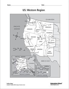
US: Western Region Map
In this United States Western Region learning exercise, students examine the state boundaries and landforms found in this region. The map also highlights each of the state capitals.
Curated OER
Colonial America 1776 Map
In this United States historical map worksheet, students examine the colonial boundaries in 1776 as well as the Proclamation Line of 1763.
Curated OER
The 13 British Colonies Map
In this United States historical map worksheet, students examine the 13 colonial boundaries and noted major cities.
Curated OER
South America Map
In this South American political map worksheet, students examine both national boundaries and national capitals.
Curated OER
The 13 British Colonies
In this British colonies historical map activity, students examine the political boundaries of the 13 original colonies.
Curated OER
Eastern Hemisphere Map
In this Eastern Hemisphere polar map learning exercise, students examine the Eastern Hemisphere including the political boundaries formed by the countries in this region of the world.
Curated OER
Americas: Political Map
In this North America and South America outline map worksheet, students examine the political boundaries of the 2 continents.
Other popular searches
- Plate Boundaries
- Divergent Boundaries
- Convergent Boundaries
- Transform Boundaries
- Personal Boundaries
- Personal Growth Boundaries
- Setting Personal Boundaries
- Tectonic Plate Boundaries
- National Boundaries
- Plate Boundaries Map
- Plate Boundaries Worksheet
- Regional Boundaries


