Siteseen
Siteseen: Land of the Brave: Battle of Bunker Hill
Learn about this Revolutionary War battle that took place June 17, 1775, between Great Britain and its thirteen colonies in North America that ended in a victory for the British.
Siteseen
Siteseen: Land of the Brave: Battle of Oriskany
Learn about this Revolutionary War battle that took place August 06, 1777, between Great Britain and its thirteen colonies in North America that ended in a victory for the British.
Siteseen
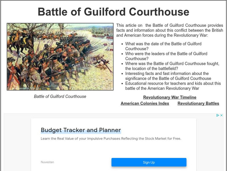
Siteseen: Land of the Brave: Battle of Guilford Courthouse
Learn about this Revolutionary War battle that took place March 15, 1781, between Great Britain and its thirteen colonies in North America that ended in a victory for the British.
Ducksters
Ducksters: Australia History and Timeline Overview
Kids learn about the history and timeline of the country of Australia including Captain James Cook, early settlers, British penal colony, independence, and recent events.
Curated OER
Statue of Bussa Represents Slavery, Revolt and Emancipation in Barbados
History of slavery and sugar cultivation practices on the island colony.
Other
The History of Tobacco Part Ii
Extensive timeline (1492-1997) of tobacco cultivation--in three parts. Click links at bottom of pages to view Parts I, III, and IV.
Curated OER
Unesco: Australia: Australian Convict Sites
The property includes a selection of eleven penal sites, among the thousands established by the British Empire on Australian soil in the 18th and 19th centuries. The sites are spread across Australia, from Fremantle in Western Australia...
Khan Academy
Khan Academy: Copley, Paul Revere
Paul Revere's fame can be attributed Henry Wadsworth Longfellow's poem "Paul Revere's Ride" and to the remarkable portrait John Singleton Copley painted of the artisan in 1768. View the picture and read the background of this portrait in...
Khan Academy
Khan Academy: Copley, Watson and the Shark
"Watson and the Shark" is an energetic and emotional work by John Singleton Copley. It retains a special place within the history of late-eighteenth-century English Romanticism. View the picture and read the details of this painting in...
Curated OER
Educational Technology Clearinghouse: Maps Etc: Africa, 1906
A map of the African continent in 1906 showing European land claims such as British East Africa, German East Africa, Portuguese East Africa, Italian Somalia, and others, and European colonies and corporate states such as Cape Colony,...
Curated OER
Educational Technology Clearinghouse: Maps Etc: Eastern North America, 1812
A map of eastern North America in 1812 subtitled 'The War of Independence and the War of 1812-1814.’ The map is color-coded to show the territories of the original thirteen colonies, the territory to the west that was ceded to the...
Curated OER
Educational Technology Clearinghouse: Maps Etc: Colonial Africa, 1904
A map of Africa shortly after the Berlin Conference of 1885, which established the European colonial territory claims on the continent. These European and independent boundaries include Algeria and the Saharan Sphere of French Influence,...
Curated OER
Educational Technology Clearinghouse: Maps Etc: Post Wwi Africa, 1918
This map is of Africa after World War I. The scramble by Italy, Belgium, and Germany to create colonies in order to keep up with the British, French, and Spanish Empires was played out in Africa, the last remaining continent yet to be...
Curated OER
Educational Technology Clearinghouse: Maps Etc: Africa, 1920
A map of Africa in 1920 showing colonial possessions of the British, French, Italian, Portuguese, Spanish, and Belgians, including the former German colonies, lost after WWI, to French and British control per the Treaty of Versailles.
Curated OER
Etc: Maps Etc: Sketch Map of Mid Century Africa, Circa 1850
A map of Africa around the middle of the nineteenth century showing European interests on the continent prior to the Berlin Conference of 1885, which established their territorial claims. The majority of the continent was unexplored at...
Curated OER
Etc: Maps Etc: Post Wwi Central and Southern Africa, 1920
A map of central and southern Africa in 1920 showing colonial possessions of the British, French, Italian, Portuguese, Spanish, and Belgians, including the former German colonies, lost after WWI, to French and British control per the...
Curated OER
Etc: Maps Etc: Greene's Campaign in the South, 1781
A map of the southern Colonies showing the area of General Nathaneal Greene's campaign (1781) against the British under Charles Cornwallis in the closing years of the American Revolution. The map shows the important sites of Cowpens,...
Curated OER
Etc: Claims of Various European Countries to the Us, 1643 1655
A map of the eastern coast of North America showing territorial claims of Europeans and the development of the United Colonies of New England (New England Confederation) in 1643, and the territorial changes between the Dutch and British...
Curated OER
Etc: N America Illustrating the Conquest of Canada and War of Indep, 1757 1783
A map of eastern North America illustrating the Conquest of Canada and the War of Independence (1757-1783). The map shows major cities of the time, major river ways, topography and political boundaries. The map is color-coded to show the...
Curated OER
Map
The original text of the British Royal Proclamation, 1763 - the document that dealt with the governance of the new colonies of British North America. The author of the site has published the text of the document as well as an annotation...
Curated OER
Educational Technology Clearinghouse: Maps Etc: Post Wwi Africa, 1920
A political map of Africa in 1920 showing colonial possessions of the British, French, Italian, Portuguese, Spanish, and Belgians, including the former German colonies, lost after WWI, per the Treaty of Versailles.
Curated OER
Educational Technology Clearinghouse: Maps Etc: Post Wwi Africa, 1920
A map of Africa in 1920 showing colonial possessions of the British, French, Italian, Portuguese, Spanish, and Belgians, including the former German colonies, lost after WWI, per the Treaty of Versailles. This map shows major cities and...
Curated OER
Educational Technology Clearinghouse: Maps Etc: Pre Colonial Africa, 1872
A map of Africa showing the continent prior to the Berlin Conference of 1885, when the most powerful countries in Europe at the time convened to make their territorial claims on Africa and establish their colonial borders at the start of...
Other popular searches
- British Colonies in Canada
- 13 British Colonies
- New England British Colonies
- Early British Colonies
- British Colonies Self Rule
- Migrating British Colonies
- French and British Colonies
- Non British Colonies
- Earlly British Colonies
- The 13 British Colonies
- Non British Colonies


