Curated OER
Volcanoes
Third graders study the concept of plate tectonics. In the process they embark in research and construction of a volcano. They complete a web quest while assessing how to research, give oral reports, and create a product.
Curated OER
The 50 States and its Holidays
Though the format of this ELL lesson is confusing (the standards listed are for plate tectonics, yet the objectives are for American geography and holidays), a teacher could glean some ideas from the main idea. Here, pupils complete a...
Curated OER
The Gifts of the Nile
Get your class thinking about the geography that shaped the Egyptian landscape and culture. They compare ancient climate zones and geogrpahical fetures, locate evidence of plate tectonics, take and quiz, and write a short essay. The...
Curated OER
Who Built That NYS Thruway Bridge Anyway?
Students discover how engineers determine the best designs for bridge construction. They see how bridge constructions relates Engineering to Geometry. They see the implications and consequences of bridge design on your community/world.
Curated OER
Give me Food!
Students study the food guide pyramid and use it to create their own eating program.In this health lesson plan students visit websites to calculate their BMR, activity level and weight then create a nutrition plan
Curated OER
Zoo Welcomes Baby Animals
Students engage in activities to gain a better understanding of endangered animals. In these animal lessons, students use vocabulary and comprehension skills to gain a better understanding of endangered animals. They also watch video...
Curated OER
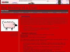
The Making of a Coat
Learners read the story A New Coat For Anna and discuss their knowledge on how to make a coat. In this reading and coat making lesson plan, students discuss coat making and listen to a speaker that spins thread to make coats.
Curated OER
Volcanoes and Urban Planning
Students analyze satellite image data of Volcan Villarica. In this earth science lesson, students identify dangerous areas surrounding the volcano. They propose a new safe location for the town.
Curated OER
Effects Of Natural Disasters On Environment
Students investigate the concept of how natural disasters effect the environment. They conduct research using a variety of resources. They are given a scenario that needs a defensive speech. Students take a position and defend it by...
Curated OER
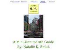
Social Studies: Exploring Japan
Fourth graders examine the culture and environment of Japan, beginning with a KWL chart. They use clay and cups of water to construct representations of the Japanese Islands. After designing flags representing farming and food, 4th...
Curated OER
Stem and Leaf Plots
In this math worksheet, students organize data into stem and leaf plots. They select the correct stem to use to organize the data. Students analyze the data on a given stem and leaf plot.
American Geosciences Institute
American Geosciences Institute: Earth Science Week: Geologic Maps & Earthquakes
This activity is designed to give students practice using a geologic map to assess the likelihood and location of a particular natural hazard- earthquakes- in California.
Science Education Resource Center at Carleton College
Serc: Bot Ec: The San Andreas Fault's Rate of Movement
The San Andrea is an active fault zone, marked by frequent earthquake activity. The crust southwest of this strike-slip fault (including Los Angeles) is sliding to the northwest relative to the other side. It is possible to estimate the...


