Curated OER
Oak Ridges Moraine: Southern Ontario's Sponge
Students examine the characteristics of the Oak Ridge Moraine in Canada. Using a map, the locate the moraine and present and defend a position on how the resources found there should be used. They must use proper geography terminology...
Curated OER
NAFTA Trade Unit
Middle schoolers research the geography, economics and government of Canada and how that affects US/Canadian trade relations. In this NAFTA lesson, students play a game, read about Canadian history, and creat a graph.
Curated OER
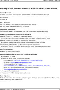
Underground Sleuths Discover Riches Beneath the Plains
Students identify Alberta, Saskatchewan, and Manitoba on map, and use Canadian Atlas to locate regions of natural resources in Central Plains, which have vital impact upon the economy. Students then complete scavenger hunt worksheet.
Curated OER
Who We Are
Students analyze population data and trends in Canada over a given amount of time. As a class, they are introduced to the concept of dependency load and use a population pyramid to calculate the figure. Using the internet, they...
Curated OER
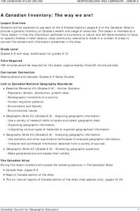
A Canadian Inventory: The Way We Are!
Students use the Canadian Atlas to discover an inventory of Canada's wealth and usage of resources. Using charts and graphs, they produce a wall of selected data of importance to the country and identify one issue of sustainability. ...
Curated OER
From North to South...Quebec's Forest Regions
Middle schoolers identify and describe the different regions of Canada. With a focus on the forest regions, they use an atlas to locate the ecozones. They identify the characterstics of the climate and vegetation and the relationship...
Curated OER
Getting to Know My World
Students participate in hands-on activities using maps and globes to identify geographical features. Students use map legends to identify direction. Students locate oceans, continents, countries, states and cities. Handouts and...
Curated OER
Polar Day: Comparing My Community to a Northern Community
Third graders practice their geography skills. In this Polar Day-themed lesson, 3rd graders use their research skills to compare and contrast the place, regions, and human systems in their community to a Canadian northern polar region...
Curated OER
CLIL: A Lesson Plan
Students explore Vancouver. In this Vancouver geography and English language building lesson, students brainstorm what they know about Vancouver and predict what their text will cover. Students listen to the informational content of...
Curated OER
Nina Bonita: Culture and Beauty
Students read Nina Bonita by Ana Maria Machado. In this reading comprehension/ geography lesson, students recall various parts of the story and create a map of where the rabbit traveled throughout the story. They participate in group...
Curated OER
Diversity Geography
Students research another country and its people. In this diversity instructional activity, students work in groups to research an assigned country and develop a short oral report. Students use diversity beans to represent the people...
Curated OER
Historical Research on Explorers of Canada
Eighth graders navigate an online Atlas of Canada to research an explorer. They examine the areas that were explored.
Curated OER
Historical Research on Explorers of Canada
Eighth graders study an online atlas of Canada to research an early explorer.
Curated OER
First You Take an Ecumene
Although this was written regarding Canadian agriculture, it can be used in any agriculture or environmental science class. Learners evaluate agricultural and economic activity maps and consider land use competition. Activities that get...
Curated OER
Corn Exports Visually
Students study imports and exports and the countries that import the most corn from the U.S. They construct mini paper corn plants and label a map with these plants to represent the amount of corn the U.S. exports to countries around the...
Curated OER
Landscape Diversity in the Yukon Territory
Pupils review and analyze a satellite image of the Yukon territory.
Curated OER
Canada's Forests and Resource Management
Students are introduced to the Canadian forest industry so that they may assess the economic and environmental sustainability of the industry.
Curated OER
Nunavut, Our Communities
Students locate the communities of Nanavut on a territorial map and identify community characteristics. They research the online Atlas of Canada
Curated OER
Aboriginal Peoples And The Universals of Culture
Sixth graders research specific features of a province or territory of Canada. In this Canadian history lesson, 6th graders identify aboriginal culture areas on a map, identify cultural features represented in their region, and create...
Curated OER
Deportation of the Acadians
Students use an online atlas to identify the presence of Acadian culture in the Maritime provinces of Canada and explore the deportation.
Curated OER
Migrating Across Borders
Young scholars research and map the migratory patterns of the golden-winged warbler. They develop a strategy to protect this species and, in teams representing different countries, negotiate treaties with each other to protect the bird.
Curated OER
Where In the World is the Dominican Republic?
Students begin the lesson by discussing how where they live affects how they live. As a class, they add examples to each category such as home types, clothing, jobs and food. Using those categories, they write about their life in the...
Curated OER
Mapping the changes in Canada's population
High schoolers find and analyze data found in the census. They compare the population from 1996 to 2001. They explore the type of data they can find in the Census of Population.
Curated OER
Past v. Present: Using Geography & Anthropology
Students examine artifacts and documents from their Canadian community. They analyze early Canadian history and make predictions about the future of the country.


