Curated OER
We've got the whole world in our hands
Students explore spatial sense in regards to maps about the globe. In this maps lesson plan, students label oceans, locate the continents and poles, follow directions, and explain the symbols on a map.
Curated OER
The Boreal Forest "In the News"
Students examine and discuss the current issues surrounding the deforestation of Canada's boreal forest. They also explore the issue through the eyes of the forestry industry.
Curated OER
Who We Are: To Know the Characteristics of a Population Within Certain Domains
Students, through research, discover the characteristics of the population of Quebec and compare them to those of Canada as a whole. They create a class presentation about information they found.
Curated OER
Underground Sleuths Discover Riches Beneath the Plains
Young scholars identify Alberta, Saskatchewan, and Manitoba on map, and use Canadian Atlas to locate regions of natural resources in Central Plains, which have vital impact upon the economy. Students then complete scavenger hunt worksheet.
Curated OER
Who We Are
Students analyze population data and trends in Canada over a given amount of time. As a class, they are introduced to the concept of dependency load and use a population pyramid to calculate the figure. Using the internet, they...
Curated OER
Provincial Showdown
Students read an article that compares the provinces of Canada and asks students to suggest reasons why other countries should invest in Canada.
Curated OER
Treasure of the Tar
Students use the Canadian Atlas to discover the natural resources available in various areas of the country. Using the region known as the "Tar Sands", they identify the area's characteristics and develop hypothesis about the future...
Curated OER
The Economics of Conflict
Seventh graders examine how economics can empower or disempowers people of a nation. In groups, they analyze how commodities for economic power have changed and the trends that might affect future empowerment. They describe Canada's...
Curated OER
A Canadian Inventory: The Way We Are!
Young scholars use the Canadian Atlas to discover an inventory of Canada's wealth and usage of resources. Using charts and graphs, they produce a wall of selected data of importance to the country and identify one issue of...
Curated OER
Polar Day: Comparing My Community to a Northern Community
Third graders practice their geography skills. In this Polar Day-themed instructional activity, 3rd graders use their research skills to compare and contrast the place, regions, and human systems in their community to a Canadian northern...
Curated OER
CLIL: A Lesson Plan
Students explore Vancouver. In this Vancouver geography and English language building lesson plan, students brainstorm what they know about Vancouver and predict what their text will cover. Students listen to the informational content of...
Curated OER
Nina Bonita: Culture and Beauty
Young scholars read Nina Bonita by Ana Maria Machado. In this reading comprehension/ geography lesson, students recall various parts of the story and create a map of where the rabbit traveled throughout the story. They participate in...
Curated OER
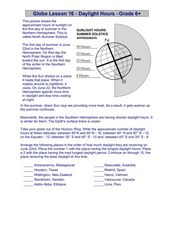
Globe Lesson 16 - Daylight Hours
In this geography skills worksheet, students read an instructional passage regarding daylight hours and then respond to 5 short answer questions.
Curated OER
Historical Research on Explorers of Canada
Eighth graders navigate an online Atlas of Canada to research an explorer. They examine the areas that were explored.
Curated OER
Historical Research on Explorers of Canada
Eighth graders study an online atlas of Canada to research an early explorer.
Curated OER
Words in the News Canada Elects New Government - 25 January 2006
Students complete vocabulary and word work before reading an article about Canada. They work with word families by completing worksheets and complete a quiz after reading the article.
Curated OER
From North to South...Quebec's Forest Regions
Learners identify and describe the different regions of Canada. With a focus on the forest regions, they use an atlas to locate the ecozones. They identify the characterstics of the climate and vegetation and the relationship between...
Curated OER
Buffalo Hide Paintings
To the Native American people living on the plains, the buffalo represented culture, art, sustenance, and survival. Explore the history of the buffalo with a social studies lesson, in which learners create a buffalo hide painting in the...
Curated OER
How Cultures Differ - Two Different Perspectives on the Same Even
Students explore the effects of culture through the story Running by Peter Hessler. In this geography and cultural lesson, students act as newspaper reporters covering the story of the race. Students write newspaper articles as reporters...
Curated OER
Alberta And Saskatchwan: the View in 1905
Students analyze the differences between maps 1905 and current maps of Alberta and Saskatchewan. They use maps from the Canadian Council for Geographic Education to complete a guided inquiry. This lesson also has many extension activities.
Curated OER
Canada's Forests and Resource Management
Students are introduced to the Canadian forest industry so that they may assess the economic and environmental sustainability of the industry.
Curated OER
Nunavut, Our Communities
Students locate the communities of Nanavut on a territorial map and identify community characteristics. They research the online Atlas of Canada
Curated OER
Aboriginal Peoples And The Universals of Culture
Sixth graders research specific features of a province or territory of Canada. In this Canadian history lesson, 6th graders identify aboriginal culture areas on a map, identify cultural features represented in their region, and...
Curated OER
Tornado Alley-- Night of the Twisters
In this science and geography worksheet, students read 2 pages of background information about Tornado Alley which may help them understand Night of the Twisters by Ivy Ruckman.


