Curated OER
Holidays; Canada Day
In this foreign language worksheet, learners fill in the blanks with the most natural sounding of two choices given for the blank in each of 10 sentences. Each of the sentence has to do with Canada Day.
Curated OER
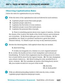
Observing Capitalization Rules
In this capitalization worksheet, students complete three activities that help them follow the rules for capitalization in their writing.
Curated OER
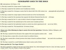
GEOGRAPHY GOES TO THE DOGS
Students use countries and dogs from around the world to answer the questions.
Other
Canadian Tourism Commission: Maps canada.travel
This interactive map is an excellent student and teacher resource. Select Places to Go to show regions, provinces or territories and capital cities. Hover over the area to get links to more detailed information. Get up to the minute...
Other
Office of the Prime Minister: Capital Scramble
Drag the provinces and territories to their locations on the map of Canada in this interactive game. Then unscramble the letters to identify the capital cities of each of the provinces. A paper pencil version may be printed.
Other
Ottawa, Canada: So Much to Discover
Find out all about living in and visiting Ottawa. A quick fact list and frequently asked questions makes learning about Ottawa easy. Great site to experience the capital city of Canada.
Lizard Point Quizzes
Lizard Point: Canada: Provincial Capitals Quiz
Try this interactive geography quiz which tests your knowledge about the provincial capitals of Canada.
Curated OER
Educational Technology Clearinghouse: Maps Etc: Ontario, 1914
A map from 1914 of the province of Ontario with an inset map of the western part of the province. The map shows the Canadian capital of Ottawa, the province capital of Toronto, county boundaries, major cities and towns, railways with...
Curated OER
Educational Technology Clearinghouse: Maps Etc: Ontario, 1909
A map from 1909 of the province of Ontario with an inset map of the northwestern part of the province. The map shows the Canadian capital of Ottawa, the province capital of Toronto, major cities and towns, existing and proposed railways,...
Other
Virtual Heritage Winnipeg
The Exchange District of Winnipeg has been declared a National Historic Site of Canada. Take a virtual tour inside many of the district's buildings. Search through more than 3000 historic images and explore the history of many of...
Curated OER
Etc: Maps Etc: Dominion of Canada, Newfoundland, and Greenland, 1916
A map from 1916 of the Dominion of Canada, Newfoundland (Newfoundland and Labrador were not part of the Canadian Confederation until 1949), Greenland, and Iceland. This map uses color-contouring to show general land elevations from sea...
Curated OER
Educational Technology Clearinghouse: Maps Etc: Alberta, 1922
A map from 1922 of the Canadian province of Alberta showing the provincial capital of Edmonton, major cities and towns, existing and proposed railways, lakes, and rivers of the province.
Curated OER
Educational Technology Clearinghouse: Maps Etc: Newfoundland, 1903
A map from 1903 of the Canadian province of Newfoundland, showing cities, towns and ports, railways, lakes, rivers, and coastal features, as well as the coastal districts of White Bay, Bonne Bay, Bay of Exploits, Bonavista Bay, St....
Curated OER
Educational Technology Clearinghouse: Maps Etc: The Dominion of Canada, 1919
A map from 1919 of the Dominion of Canada and Newfoundland (Newfoundland and Labrador were not part of the Canadian Confederation until 1949), showing the provinces at the time, provincial capitals, major cities, towns, and settlements,...
Curated OER
Educational Technology Clearinghouse: Maps Etc: The Dominion of Canada, 1901
A map from 1901 of the Dominion of Canada and Newfoundland (Newfoundland and Labrador were not part of the Canadian Confederation until 1949), showing the provinces at the time, provincial capitals, major cities, towns, and settlements,...
Curated OER
Educational Technology Clearinghouse: Maps Etc: The Dominion of Canada, 1899
A map from 1899 of the Dominion of Canada and Newfoundland (Newfoundland and Labrador were not part of the Canadian Confederation until 1949), showing the provinces at the time, provincial capitals, major cities, towns, and settlements,...
Curated OER
Etc: Maps Etc: Maritime Provinces of Canada, 1922
A map from 1922 of the Canadian Maritime Provinces of New Brunswick, Nova Scotia, and Prince Edward Island, with an inset map of Newfoundland. The map shows the provincial capitals of Fredericton (New Brunswick), Halifax (Nova Scotia),...
Curated OER
Etc: Maps Etc: Maritime Provinces of Canada, 1920
A map from 1920 of the Canadian Maritime Provinces of New Brunswick, Nova Scotia, and Prince Edward Island, with an inset map of Newfoundland. The map shows the county boundaries within the provinces, the provincial capitals of...
Curated OER
Etc: Maps Etc: Maritime Provinces and Quebec, 1920
A map from 1920 of the Canadian Maritime Provinces of New Brunswick, Nova Scotia, and Prince Edward Island, and the southern portion of Quebec from Montreal to the Gulf of St. Lawrence and Anticosti Island. The map shows the provincial...
Curated OER
Etc: Maps Etc: The Dominion of Canada and Newfoundland, 1910
A map from 1910 of the Dominion of Canada and Newfoundland (Newfoundland and Labrador were not part of the Canadian Confederation until 1949), showing the provinces at the time, provincial capitals, major cities, towns, and settlements,...
Curated OER
Etc: Maps Etc: The Dominion of Canada and Newfoundland , 1920
A map from 1920 of the Dominion of Canada and Newfoundland (Newfoundland and Labrador were not part of the Canadian Confederation until 1949), showing the provinces at the time, provincial capitals, major cities, towns, and settlements,...
Curated OER
Etc: Maps Etc: The Dominion of Canada and Newfoundland, 1920
A map from 1920 of the Dominion of Canada and Newfoundland (Newfoundland and Labrador were not part of the Canadian Confederation until 1949), showing the provinces at the time, provincial capitals, major cities, towns, and settlements,...
Curated OER
Etc: Maps Etc: New Brunswick, Nova Scotia, and Prince Edward Island, 1911
A map from 1911 of the Canadian Maritime Provinces of New Brunswick, Nova Scotia, and Prince Edward Island, showing the provincial capitals of Fredericton (New Brunswick), Halifax (Nova Scotia), and Charlottetown (Prince Edward Island),...


