Curated OER
Louisiana Outline Map
In this Louisiana outline map learning exercise, students examine political boundaries of the state and the placement its capital city as well as its major cities. This map is not labeled.
Curated OER
Maryland Outline Map
In this Maryland outline map worksheet, students examine political boundaries of the state and the placement its capital city as well as its major cities. This map is not labeled.
Curated OER
Massachusetts Outline Map
In this Massachusetts outline map instructional activity, students examine political boundaries of the state and the placement its capital city as well as its major cities. This map is not labeled.
Curated OER
Michigan Outline Map
In this Michigan outline map learning exercise, students examine political boundaries of the state and the placement its capital city as well as its major cities. This map is not labeled.
Curated OER
Missouri Outline Map
For this Missouri outline map worksheet, students examine political boundaries of the state and the placement its capital city as well as its major cities. This map is not labeled.
Curated OER
Pennsylvania Outline Map
In this Pennsylvania outline map worksheet, students examine political boundaries of the state and the placement its capital city as well as its major cities. This map is not labeled.
Curated OER
Oregon Outline Map
For this Oregon outline map worksheet, students examine political boundaries of the state and the placement its capital city as well as its major cities. This map is not labeled.
Curated OER
Ohio Outline Map
In this Ohio outline map activity, students examine political boundaries of the state and the placement its capital city as well as its major cities. This map is not labeled.
Curated OER
North Dakota Map
In this North Dakota outline map instructional activity, students examine political boundaries of the state and the placement its capital city as well as its major cities. This map is not labeled.
Curated OER
New Jersey Outline Map
In this New Jersey outline map worksheet, students examine political boundaries of the state and the placement its capital city as well as its major cities. This map is not labeled.
Curated OER
New Hampshire Outline Map
In this New Hampshire outline map worksheet, students examine political boundaries of the state and the placement its capital city as well as its major cities. This map is not labeled.
Curated OER
Nevada Outline Map
In this Nevada outline map instructional activity, students examine political boundaries of the state and the placement its capital city as well as its major cities. This map is not labeled.
Curated OER
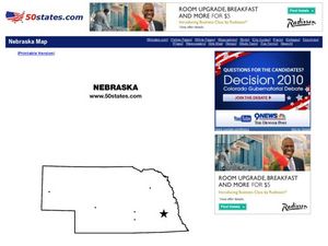
Nebraska Outline Map
In this Nebraska outline map worksheet, students examine political boundaries of the state and the placement its capital city as well as its major cities. This map is not labeled.
Curated OER
Wyoming Outline Map
In this Wyoming outline map worksheet, students examine political boundaries of the state and the placement its capital city as well as its major cities. This map is not labeled.
Curated OER
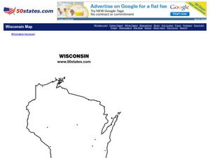
Wisconsin Outline Map
In this Wisconsin outline map worksheet, students examine political boundaries of the state and the placement its capital city as well as its major cities. This map is not labeled.
Curated OER
West Virginia Outline Map
In this West Virginia outline map worksheet, students examine political boundaries of the state and the placement its capital city as well as its major cities. This map is not labeled.
Curated OER
Washington Map
In this Washington state outline map worksheet, students examine political boundaries of the state and the placement its capital city as well as its major cities. This map is not labeled.
Curated OER
Utah Outline Map
In this Utah outline map instructional activity, students examine political boundaries of the state and the placement its capital city as well as its major cities. This map is not labeled.
Curated OER
Tennessee Outline Map
In this Tennessee outline map worksheet, students examine political boundaries of the state and the placement its capital city as well as its major cities. This map is not labeled.
Curated OER
South Dakota Outline Map
In this South Dakota outline map worksheet, students examine political boundaries of the state and the placement its capital city as well as its major cities. This map is not labeled.
Curated OER
Rhode Island Outline Map
In this Rhode Island outline map worksheet, students examine political boundaries of the state and the placement its capital city as well as its major cities. This map is not labeled.
Curated OER
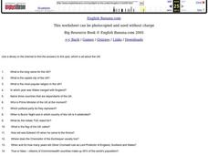
United Kingdom
In this ESL worksheet, students answer 20 questions about the United Kingdom. For example, "What is the capital city of the UK?"
Curated OER
United Kingdom
In this ESL worksheet, students answer 20 questions about the United Kingdom. For example, "What is the capital city of the UK?"
Curated OER
United Kingdom 4
In this ESL worksheet, learners answer 20 questions about the United Kingdom. For example, "What is the capital city of Wales?"
Other popular searches
- Capital Cities and States
- European Capital Cities
- Canadian Capital Cities
- Capital Cities Europe
- Capital Cities Canada
- Us Capital Cities
- Francophone Capital Cities
- Capital Cities United States
- Capital Cities Africa
- Middle East Capital Cities
- Capital Cities in Asia
- Capital Cities of Alabama


