Curated OER
US: Midwest Region Map
For this U. S. outline map worksheet, students examine boundaries of the Midwest Region states and the placement of the capital cities. This map is labeled.
Curated OER
Southeast Asia and the South Pacific: Political
In this Southeast Asia and the South Pacific political map worksheet, students examine boundaries of each of the countries and the placement of the capital cities. The major bodies of water are labeled.
Curated OER
South east Asia and the South Pacific: Political: Labeled Map
In this Asia and the South Pacific map worksheet, students examine the boundaries of the nations in this region of the world. Students also note the location of capital cities as they are denoted by stars. This map is labeled.
Curated OER
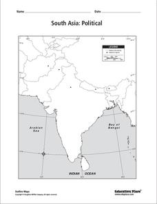
South Asia: Political Map
In this South Asia outline map worksheet, students & examine boundaries of each of the countries in the region. This map is labeled with the country and capital city names.
Curated OER
South Asia: Political Map
In this South Asia political map worksheet, students examine the national boundaries. The map also highlights each country's capital city.
Curated OER
South US Region Map
In this United States regional outline map, students examine the state boundaries of the states in the Southern Region. Capital cities are denoted with stars.
Curated OER
Central America: Unlabeled Map
For this Central American political map worksheet, students examine the boundaries of the countries and capital cities located in this region of the world.
Curated OER
Asia and the South Pacific : Political Map
In this Asia and the South Pacific map worksheet, learners examine the boundaries of the nations in this region of the world. Students also note the location of capital cities as they are denoted by stars. Major bodies of water are labeled.
Curated OER
US: Western Region Map
In this U. S. Western Region outline map worksheet, students examine boundaries of each of the states and the placement of the capital cities. This map is not labeled.
Curated OER
Map of India
In this map of India worksheet, students label the capital city, the bodies of water and the compass points, then color the surrounding colors according to directions.
Curated OER
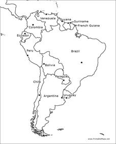
South America Outline Map
In this outline map worksheet, students discover and investigate the physical boundaries of the countries in South America. The names of countries and a star to mark the capital city are included.
Curated OER
Mexico and Central America Map
In this blank outline map worksheet, students study the political boundaries of Mexico and Central America. Each of the counties is labeled and the capital cities are starred.
Curated OER
South America Outline Map
In this blank outline map worksheet, students explore the political boundaries of South America and the nations there. This map may be used in a variety of classroom activities. The location of the capital cities are denoted with...
National First Ladies' Library
Capital Monuments: Exploring Washington, DC Frances Cleveland: Law, Politics and Government
Students, working in small groups, research seven of the most famous monuments found in Washington, DC. They design brochures based on the information they gather from Internet and print resources. Upon completion, they share the...
Curated OER
A "Capital" Idea
Eighth graders prepare for a field trip to Washington, DC by researching landmark, monument, or building in Washington. They use the information in small groups to design a multimedia presentation. They include a spreadsheet that shows...
Curated OER
The Modernization of Seoul
High schoolers explore the history of Seoul, South Korea. In this Seoul lesson plan, students read and analyze handouts regarding the political and social history of the city of Seoul. High schoolers collaborate in small groups and...
Curated OER
European Capital of Culture 2008
Students explore the meaning of culture. They read and discuss news stories concerning cultural cities. Students design and create a campaign poster and text that demonstrates why a particular city should be known as a place of culture.
Curated OER
A New, Capital Idea#141
Students design a pamphlet which explains where a capital for a new country, which is comprised of the New England region, should be located. They include the reasons for their decision based on where physical and human features are...
Curated OER
Ybor City Historic District
Students analyze the role cigar making played in Ybor City. They examine how cigars are made and the different societies who helped immigrants keep their identify. They compare and contrast their own community to Ybor City.
Curated OER
Rhode Island State Map
In this geography of Rhode Island worksheet, students color and label a map with the major cities and physical features. Students also study a U.S. map to learn the location of the state of Rhode Island.
Curated OER
Vermont
In this Vermont instructional activity, students fill in the cities in Vermont into a map with dots on it for where the cities are located. Students fill in 7 cities including the capital.
Curated OER
Maine
In this Maine worksheet, students fill in the cities next to the dots in the map of the state of Maine. Students fill in 5 cities including the capital.
Curated OER
North Carolina
In this North Carolina worksheet, students fill in the cities in North Carolina next to the dots on the map. Students fill in 8 cities including the capital.
Curated OER
Africa Puzzle
In this geography learning exercise, students complete a crossword puzzle about Africa. They identify the capitals of various countries located in Africa, the most fertile area, the largest desert, and the longest river. There are 19...
Other popular searches
- Capital Cities and States
- European Capital Cities
- Canadian Capital Cities
- Capital Cities Europe
- Capital Cities Canada
- Us Capital Cities
- Francophone Capital Cities
- Capital Cities United States
- Capital Cities Africa
- Middle East Capital Cities
- Capital Cities in Asia
- Capital Cities of Alabama


