Curated OER
Rhode Island Map
In this recognizing the shape of the state of Rhode Island worksheet, students fill in the state capital, major cities, and other attractions or follow their teacher made directions. Students write at least 7 answers.
Curated OER
Texas Map
In this Texas worksheet, students explore the state of Texas. Students look at a blank map of Texas and add the state capital, major cities, and any other major attractions of the state of Texas on the blank map.
Curated OER
Geography A to Z: Letter O
The world is full of places that start with the letter O. It's true! Your class can use what they know about geography to answer seven curious questions related to world locations that all begin with letter O. Like Ohio, Ottowa, and...
Curated OER
Where in the United States Are We?
Young scholars spend the lesson identifying the location of the fifty states and the capitals. Using a software program, they retrace te outline of each state numerous times. To end the lesson, they write a story about a state and city...
Curated OER
Weather Watchers
Students are introduced to an Underground Weather Stations. In groups, they use the internet to research the weather in different parts of the United States locating each city. To end the lesson, they summarize the information they...
Curated OER
Mystery State #45
In this mystery state worksheet, students answer five questions about this state in an effort to identify it. Students then locate and mark the state on a map.
Curated OER
Urbanization As Seen Through Late 19c - Early 20c Architecture
Incorporating the cultures, architecture, and ethnic populations of several American cities (namely Chicago and New York), this presentation displays vivid photographs of buildings and people in 19th - 20th century urban America. The...
Curated OER
Exploring South Carolina
If you are having your students conduct a State study this presentation could be a nice example to show them. This resource provides general information about the geography, animals, and city life one may find in South Carolina. Web...
Curated OER
Puerto Rico: The 51st State?
Students research the history of Puerto Rico, its culture, and geography. In this Puerto Rico lesson, students find Puerto Rico on a map and find specific regions or cities. Students discuss Puerto Rico's statehood and listen to salsa...
Curated OER
Wisconsin Word Search
In this Wisconsin word search worksheet, students locate and identify 24 cities in the word bank within the word search puzzle.
Curated OER
Finding River Cities
Using a wall map, students will find major rivers in the four regions of the United States. Then they answer questions about how people use natural resources, such as rivers.
Curated OER
Microsoft Publisher Country Brochure
Students explore geographic information. In this geography and technology lesson, students choose a county and answer related questions on a Webquest. Students create a word web and design a country brochure.
Curated OER
Bioethics of Eugenics
Students research and discuss the ethical aspects of Nazi racial ideology, including sterilization, marriage prohibitions, and euthanasia. They develop codes of ethics regarding reproductive rights, euthanasia, and the death penalty.
Curated OER
Cultural Maps
Fifth graders examine map elements. In small groups they create a map of an imaginary country that includes a title, legend, directional indicator, scale, boundaries, capital cities, country name, and icons of five natural resources. ...
Curated OER
Australian Geography
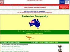
In this map reading worksheet, students label a map of Australia by adding the names of states and cities. They answer eight questions about the map.
Curated OER
People And Places To Know
In this social studies worksheet, students learn pertinent facts about where they live (city, state, country) and who governs them (mayor, governor, president.) Students write their answers on the cards which could be cut apart and used...
Curated OER
In Search of Al Qaeda
Students locate the Middle Eastern countries and capitals visited by Frontline reporters. They read online dispatches by the journalists, and complete a student assignment sheet.
Curated OER
Europe To The Max DVD: Four Great Cities of Europe Questions
In this geography skills worksheet, students watch the video "Europe to the Max." Students then respond to 18 short answer questions about London, Amsterdam, Brussels, and Paris.
Curated OER
Cities as Transportation Centers
Students work in small groups to identify some of the major transportation centers, recommending two as possible sites for a national political convention, based on population density and the travel networks available in 1835.
Happy Housewife
State Notebooking Pages
When learning about US geography, it can hard to remember facts about 50 different states. Help your young scholars organize all of this information with a collection of easy-to-use note-taking guides.
A to Z Teacher Stuff
Facts About Australia
Here is a quick printable with some basic facts about Australia, such as its population, area, type of government, and currency, as well as a simple drawing of an outline of the country.
Curated OER
Inverness and Highlands Heritage box
Students explore, experience and study the rich cultural heritage that Inverness and the Highlands has to offer to young people and takes a look into the future. They assess certain aspects of Highland culture through the expressive arts...
Curated OER
Mystery State # 24
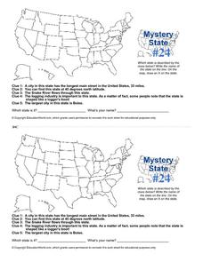
Prepare those brains for a rousing day of learning with a fun geography activity. Your pupils use five different clues to determine the name of mystery state number 24. Where do all those potatoes come from? Idaho!
Curated OER
California Map
In this California blank outline map learning exercise, students examine the political boundaries of the state and then mark the state capital, other cities, and other state attractions on the map.
Other popular searches
- Capital Cities and States
- European Capital Cities
- Canadian Capital Cities
- Capital Cities Europe
- Capital Cities Canada
- Us Capital Cities
- Francophone Capital Cities
- Capital Cities United States
- Capital Cities Africa
- Middle East Capital Cities
- Capital Cities in Asia
- Capital Cities of Alabama


