Curated OER
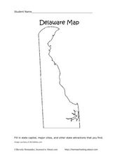
Delaware Map
In this state maps worksheet, students identify the state of Delaware, and fill in the state capital, major cities, and other attractions in the state.
Curated OER
Idaho Map
In this outline state map of Idaho worksheet, students fill in the map with the state capital, major cities, and other state attractions or teacher created directions. Students draw at least 7 answers.
Curated OER
Connecticut Map
In this state maps worksheet, students identify the state of Connecticut, and fill in the state capital, major cities, and other major attractions.
Curated OER
Colorado Map
In this state maps worksheet, students identify the state of Colorado, and fill in the state capital, major cities, and other attractions for the state.
Curated OER
North Carolina Map
In this state maps worksheet, students identify the state map of North Carolina. Students fill in the state capital, the major cities, and other state attractions.
Curated OER
New Mexico Map
In this state maps instructional activity, students identify the state of New Mexico. Students fill in the state capital, major cities, and other state attractions.
Curated OER
Ohio Map
In this Ohio worksheet, 4th graders explore the state of Ohio. Students look at the map of Ohio and fill in the state capital, major cities, and any other important landmark or site on the map.
Curated OER
Vermont Map
In this state maps worksheet, students identify the map of Vermont. Students fill in the state capital, the major cities, and other state attractions.
Curated OER
Wyoming Map
In this blank outline map learning exercise, students fill in the state capital, major cities, landforms, and other places of interest on this map of Wyoming.
Curated OER
Tennessee Map
In this Tennessee outline map, students examine the political boundaries of the state. Students mark the state capital, major cities, and other state attractions.
Curated OER
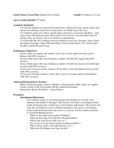
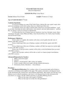
Indiana Travel Guide
Fourth graders create a travel guide about the state of Indiana with 100% accuracy. They label the capital within the travel guide with 100% accuracy. Students label one major river in the right location with 100% accuracy. They circle...
Curated OER
Oklahoma Worksheet
In this Oklahoma learning exercise, students examine a flag of the state. After doing their own research, students fill in information about Oklahoma: capital city, motto, tree, flower, date of statehood.
Curated OER
Name Those States!
In this state worksheet, students see how fast they can accurately name all 50 states, then do the same for the capital cities of all states.
Curated OER
4-H Citizenship Activity Page
In order to understand how our government works, students need to delve into the intricacies at both the local and federal level. Using this 20 question activity learners explore how government affects their daily life.
Curated OER
Kabul's Troubles
Students investigate the many political changes that Afghanistan has endured over the past century in order to better assess the impact of the recent fleeing of the Taliban from the capital of Kabul.
Curated OER
Social Studies - State Riddle Lesson Plan
Students make distinctions between the states, their cities, and capitals, and create riddles for classmates to solve.
Curated OER
Remembering to Never Forget
Students discover how the history of a place or event affects one's present perceptions of that place or event. They examine the current tensions caused by the decision to make Weimar, Germany Europe's cultural capital.
Curated OER
Our 50 States
Students identify the location of the 50 states using an interactive map. They practice geography skills by playing a fun game. Pupils become familiar with the state abbreviations for the US states. Students become familiar with the...
Curated OER
The Middle East: Land of Contrasts
Students explore the ancient city of Petra. In this Middle East lesson, students watch "The Royal Tour of Jordan," and then discuss the history of Petra. Students conduct research on selected sites in the city and use their findings to...
Curated OER
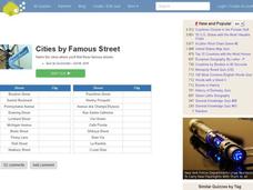
Famous Streets Quiz
In this online interactive geography quiz worksheet, students examine the chart that includes the names of 18 famous streets in the world. Students have 4 minutes to identify the names of the cities where the streets...
Curated OER
Indiana Travel Guide
Fourth graders, after exploring and researching the state of Indiana, create a travel guide about the state of Indiana including its capital, major rivers, governors and two famous people from the state. They utilize a variety of art...
Curated OER
Getting to Know Austria- Map Skills
In this Austria map skills worksheet, students apply map skills to answer 14 fill in the blank questions about the country. They determine border countries, identify regions, find the capitol, and name rivers. They draw a map of Austria...
Curated OER
Bratislava Old and New
Students explore the capital of Slovak. In this World History lesson, students read an article that describes specific details about Bratislava, Slovak, then complete numerous activities that are centered around the article, such...
Curated OER
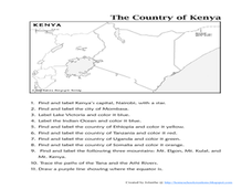
The Country of Kenya
In this map completion worksheet, students observe a map and map scale of Kenya to find and label bodies of water, cities, countries, and the equator. Students answer 11 questions.
Other popular searches
- Capital Cities and States
- European Capital Cities
- Canadian Capital Cities
- Capital Cities Europe
- Capital Cities Canada
- Us Capital Cities
- Francophone Capital Cities
- Capital Cities United States
- Capital Cities Africa
- Middle East Capital Cities
- Capital Cities in Asia
- Capital Cities of Alabama


