Curated OER
The Country of Venezuela
In this map skills of Venezuela activity, students use an outline map to find an label important cities landforms, and bodies of water. Students label and color code 10 answers.
Curated OER
The 50 States and its Holidays
Though the format of this ELL lesson is confusing (the standards listed are for plate tectonics, yet the objectives are for American geography and holidays), a teacher could glean some ideas from the main idea. Here, pupils complete a...
Curated OER
Geography: Where on Earth Are the Postage Stamp Countries?
Seventh graders research the six European "postage stamp" (small) countries and research interesting facts about them. In groups, they are assigned to one of the six countries of Andorra, Liechtenstein, Malta, Monaco, San Marino, or...
Owl Teacher
Imaginary Nation: Constructing a Map
Your young geographers will combine what they have learned about the five themes of geography and their inner creativity to design a physical map for an imaginary nation.
Curated OER
ESL- Capital Letters/Nouns
For this ESL nouns/capital letters worksheet, students choose the correct spelling of given nouns, selecting the one capitalized correctly, then correct capitalization errors in a set of sentences.
Curated OER
School-Home Link: Maps
In this atlas and parent communication form learning exercise, students use an atlas to find several things: the capitol city of Japan, the number of countries in Africa, where to buy a newspaper, the names of Presidents of the United...
Curated OER
Congressional Travel
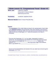
Students determine the distances traveled by the members of the legislative branch of the US Government. For this travel distance lesson, students locate Washington, DC on a globe using the longitude and latitude of the city. They...
Curated OER
The Weather Page: Comparing Data
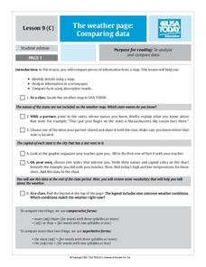
Students analyze data from maps. For this comparing data lesson, students use comparative and superlative statements to draw comparisons among the weather in different American cities based on USA Today weather maps.
Curated OER
Central and Northern Asia: Political
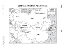
In this Central and Northern Asia map worksheet, students examine national political boundaries and national capitals in this region of the world. The map is labeled.
Curated OER
Beijing: An Important City in China
Students investigate Beijing by reading an essay. In this Chinese Geography lesson, students read an essay written about Beijing and answer questions on a comprehension worksheet. Students may research Beijing further by...
Curated OER
Indiana State Map
For this state maps worksheet, students identify the state of Indiana and fill in the state capital, major cities, and other attractions in the state.
Curated OER
New York Map
In this state map worksheet, students identify the state map of New York. Students fill in the state capital, major cities, and other state attractions.
Curated OER
Nebraska Map
In this Nebraska worksheet, students explore the state of Nebraska. Students are given a blank map of the state of Nebraska and are to fill in the capital, major cities, and any other state attractions on the map.
Curated OER
Pennsylvania Map
For this state maps worksheet, students identify the map of Pennsylvania. Students fill in the state capital, the major cities, and other state attractions.
Curated OER
Missouri Map
In this Missouri blank outline map worksheet, students examine the political boundaries of the state and then mark the state capital, other cities, and other state attractions on the map.
Curated OER
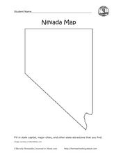
Nevada Map
In this state maps instructional activity, students identify the state of Nevada. Students then fill in the state capital, major cities, and other state attractions for the state.
Curated OER
Wisconsin Map Activity
In this Wisconsin map worksheet, students fill in the capital, major cities and other state attractions on a blank map of Wisconsin. A reference web site is given for additional activities.
Curated OER
Europe Crossword
In this geography worksheet, students fill in twenty-two blanks about European countries. They identify the names of countries, capitals, and mountains.
Curated OER
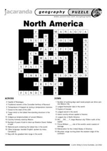
North America Puzzle Answer Sheet
In this geography worksheet, students name the capitals of various countries found in North America. They also identify the various weather patterns across the continent and specific bodies of water. There are 21 descriptions and 21...
Curated OER
Getting To Know Germany
In this getting to know Germany activity, students use map skills (map not included) to answer 14 questions, then draw a map of Germany labeling the capital and major cities.
Curated OER
Indianapolis Government
Students read about a girl who takes a trip during the time of the State Capital moving to Indianapolis and then write their own essay about a trip that they took. In this Indianapolis Government lesson plan, students use maps and...
Curated OER
Coast to Coast Virtual Trip
Students complete a variety of exercises and activities as they plan a coast to coast trip across America. They keep a journal that includes where they went, what they did, what they saw, etc. They compare two cities they visited along...
Curated OER
Pardon Me, Please
Students research capital punishment policies supported by leaders who have issued pardons, then reflect on how executive pardons might affect the balance of power between the branches of government.
Curated OER
Hot, Wet, and Cold
Students research climate data for a city in each of the 5 major geographic sections of Texas. They use data to describe the climate and what influence the geography of that section has on the weather.
Other popular searches
- Capital Cities and States
- European Capital Cities
- Canadian Capital Cities
- Capital Cities Europe
- Capital Cities Canada
- Us Capital Cities
- Francophone Capital Cities
- Capital Cities United States
- Capital Cities Africa
- Middle East Capital Cities
- Capital Cities in Asia
- Capital Cities of Alabama


