Curated OER
North Dakota Map
In this North Dakota learning exercise, students study an outline map of North Dakota with the capital city marked. Students color the map and add other important cities and landmarks.
Curated OER
Utah Map
In this Utah worksheet, students analyze an outline map of the state of Utah. The capital city is marked. Students add other important cities, bodies of water or other important features. Students color the map.
Curated OER
State Names
For this state names worksheet, students are given the capital cities and fill in the names of the corresponding states. Students fill in fifty states' names.
Curated OER
Asia Crossword
In this geography activity, students complete a crossword puzzle on the continent of Asia. They answer 21 questions related to the type of government systems found, capital cities, deepest lake, and lowest population density.
Curated OER
United States Map: Capitals
In this United States outline map worksheet, learners make note of the political divisions of 50 states of the nation. This map is labeled with the 50 state capitals.
Curated OER
Geography Puzzles
Students study the continents of the world. In this Internet geography lesson, students connect to online mapping games. Students collaborate in order to develop their understanding of world geography, including countries and capital...
Curated OER
Edinburgh- Scotland's Capital City
In this geography of Scotland worksheet, students examine a pictorial map of Edinburgh. The map is unlabeled but shows the parks, waterfront and residential areas of the city.
Curated OER
Computer Activities: Countries of the World
Students research a country. In this research and computers lesson, students select a country and research various aspects about it including the capital city, the flag and fun facts. Students create slides about their country and then...
Curated OER
Global Connections: Internet Research
In this geography Internet research instructional activity, students find out facts about the capital cities of 12 nations. Students then research facts about Australia, and also find out the country of origin for 4 prominent...
Curated OER
The UK and the Republic of Ireland
In this maps activity, students label the cities and countries of the United Kingdom and the Republic of Ireland and answer a short answer questions. Students complete 4 activities.
Curated OER
Fifty States
Fifth graders find each state and its capital city on a map before memorizing the information. They work in small groups after watching a modeled lesson by the teachers. They write a statement about their assigned states and capital...
Curated OER
Europe Puzzle
In this geography instructional activity, learners complete a crossword puzzle in reference to the geography of Europe. They identify the capital cities of various countries and the bodies of water which surround specific countries of...
Curated OER
Carl Sandburg's "Chicago": Bringing a Great City Alive
Students examine the historical and cultural context in Sandburg's poem. The poetic devices of personification and apostrophe are utilized in the poem and identified by Students.
Curated OER
Texas Outline Map
In this outline map worksheet, students see the state of Texas with a star located at the capital city. There are no directions given for the use of this page.
Curated OER
Mapping New Zealand
In this New Zealand learning exercise, students label the map of New Zealand with oceans, cities, mountains and more. Students label 9 items.
Curated OER
Pile 'em High?
Students explore the concept of architectural heritage. In this architecture lesson, students visit selected websites to compare and contrast the architectural features in world cities.
Curated OER
Mapping Tanzania
In this Tanzania worksheet, students label countries, cities, landmarks, rivers, and more that make up Tanzania. Students label 10 items.
Curated OER
State Visual Report
In this state report worksheet, teachers choose a developmental appropriate report for students to complete about a particular state. This worksheet has a template for Texas. Students research the state to tell it capital, cities,...
Curated OER
Mapping Spain
For this map labeling worksheet, students follow directions to label 10 items on a map of Spain. They label the capital city of Madrid, the Pyrenees Mountains, surrounding water bodies and countries. They trace the flow of the Duero River.
Curated OER
U.S. State Capitals Vocabulary Wheel
In this recognizing the state capitals worksheet, students observe a wheel divided into the four states of Georgia, Massachusetts, Ohio and Virginia with no capital cities or directions. Students provide four answers.
Curated OER
Keeping Up With Capitals
Students engage in a class discussion where they identify the situations where capitalization is necessary. They complete worksheets embedded in the plan where they capitalize proper nouns such as names, holidays, and special events...
Curated OER
United States Map
In this United States political map worksheet, students examine national and state boundaries. The map also highlights the location of each of the state capitals and the national capital.
Curated OER
Kansas State Map
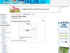
In this map of Kansas learning exercise, students color and label major cities and physical features of this state. Students also study the location of Kansas in relation to the other states in the U.S. by studying the background map.
Curated OER
Indiana State Map
In this Indiana state map instructional activity, students color and label the important cities and physical features on this outline map. Students also learn of Indiana's location in the U.S. by studying the background map.
Other popular searches
- Capital Cities and States
- European Capital Cities
- Canadian Capital Cities
- Capital Cities Europe
- Capital Cities Canada
- Us Capital Cities
- Francophone Capital Cities
- Capital Cities United States
- Capital Cities Africa
- Middle East Capital Cities
- Capital Cities in Asia
- Capital Cities of Alabama


