Curated OER
United States Identifier
Fifth graders examine and research a major region of the Unites States in groups of four. In addition, they locate the states, capitals, mammals and two bodies of water or mountain ranges found within their region. After the research,...
Curated OER
Fifty States
Fifth graders find each state and its capital city on a map before memorizing the information. They work in small groups after watching a modeled lesson by the teachers. They write a statement about their assigned states and capital...
Curated OER
The 50 States and its Holidays
Though the format of this ELL lesson is confusing (the standards listed are for plate tectonics, yet the objectives are for American geography and holidays), a teacher could glean some ideas from the main idea. Here, pupils complete a...
Curated OER
U.S. State Capitals Quick Vocabulary Reviews Worksheet
For this state capitals worksheet, students write the state that each capital city belongs to and define the word. Students write 15 states.
Curated OER
Geography A to Z: The Letter J
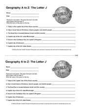
How many states, capitals, countries, and locations do your kids know that begin with the letter J? Hopefully they know seven of them, because that's the number of questions on the fun and fast worksheet.
Curated OER
4-H Citizenship Activity Page - Beginning Level
This is a 4-H citizenship activity that asks learners to examine county government, city councils, the three branches of the United States government, and complete a community service project. It also includes a word search,...
Freecloud Design
Stack the States™
Kids have fun learning US geography and state facts, including capitals, nicknames, major cities, and landmarks. They can choose between the game, or informational flashcards for each state.
Curated OER
United States Map- State Capitals
Students explore the state capitals. In this geography lesson, students use a political map to identify the state capitals and place post-it notes on various capitals.
Curated OER
Indiana State Map
For this state maps worksheet, students identify the state of Indiana and fill in the state capital, major cities, and other attractions in the state.
Curated OER
South Dakota Map
In this South Dakota map worksheet, students fill in the state capital, major cities and other state attractions in an outline map of South Dakota.
Curated OER
American States and Their Capital- Test Your Research Skills Worksheet
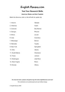
In this geography skills worksheet, students match the American state listed on the left with its capital city listed on the right by drawing a line from one to the other.
Curated OER
States and Capitals - Lesson 4 - U.S. Political Map
For this U.S. state capitals worksheet, students identify the capital cities of the 50 states using the latitude and longitude coordinates provided.
Curated OER
Country Capitals
Young scholars locate country capitals on a world map. In this map skills lesson, students review the definition of the word country and discuss what a capital is. Young scholars locate and label capital cities on a world map using a map...
Curated OER
U.S. State Capitals Vocabulary Decoder Worksheet
In this state capitals worksheet, learners match the city names to the states they go to. Students match 15 cities to 15 different states.
Curated OER
European Capitals Quiz
For this online interactive geography quiz worksheet, learners respond to 45 identification questions about the capitals cities of European countries. Students have 5 minutes to complete the quiz.
Curated OER
World Capitals Quiz
In this online interactive geography quiz worksheet, students respond to 195 identification questions about the capital cities of countries in the world. Students have 12 minutes to complete the quiz.
Curated OER
New Mexico cities
In this New Mexico worksheet, students write the cities of New Mexico inside the state including the capital. Students write 8 cities in New Mexico.
Curated OER
Kansas State Map
In this map of Kansas learning exercise, students color and label major cities and physical features of this state. Students also study the location of Kansas in relation to the other states in the U.S. by studying the background map.
Curated OER
Iowa State Map
In this Iowa state map worksheet, students color and label the important cities and physical features. Students also study the background map that shows the location of Iowa in the United States.
Curated OER
Virginia State Map
In this geography of Virginia worksheet, students color the map and label major cities and physical features. Students also study a second map showing the location of the state of Virginia in the United States.
Curated OER
Georgia State Map
In this geography of Georgia worksheet, students color the map and label major cities and physical features. Students also study a second map showing the location of the state of Georgia in the United States.
Curated OER
Florida State Map
In this geography of Florida activity, students color the map and label major cities and physical features. Students also study a second map showing the location of the state of Florida in the United States.
Curated OER
Indiana State Map
In this Indiana state map instructional activity, students color and label the important cities and physical features on this outline map. Students also learn of Indiana's location in the U.S. by studying the background map.
Curated OER
United States Map- State Capitals
Young scholars explore map skills. In this state capital lesson, students view a United States Political Map and identify and use post-it notes to label the state capitals.


