Curated OER
Tools of the Explorers
Fifth graders examine the history of the European exploration of the New World. They research and create replicas of many of the tools used by the explorers including a compass, quadrant, hourglass, log and map.
Curated OER
America Will Be
High schoolers work together to research and create different types of maps of the United States to be used as part of a geography trivia game.Groups research North American annual rainfall, climate, mountain ranges major rivers and...
Curated OER
Mapping With MapPoint
The class is engaged through a discussion of mapping. They determine what they believe makes a good map and what the essential elements of a map are. Students work independently to complete a worksheet on mapping. They follow clear...
Curated OER
Satellite Maps
Students examine contemporary satellite and digital maps. They explore new mapping technologies have transformed the field of cartography. At the same time and analyze how mapmakers' 'interests' are still present in digital maps.
Curated OER
"Trails, Rails, and Roads" Lesson 2: Road Tripping
Students practice map skills and take a virtual road trip through Maine examining the history of transportation. They create questions from the information they learned and play a game against other groups.
Curated OER
Where Is Japan? What Direction Is It?
First graders locate countries on maps and globes and learn about the hemispheres and the cardinal directions. They listen to books read out loud and dicuss geography.
Curated OER
Exploring Wyoming Species Habitats
Students are introduced to the concept of species habitats and ranges. They introduced to ArcView GIS as a tool for mapping. Pupils use query data for species withina county, elevation, range, rivers and streams, land cover, and etc....
Curated OER
Community Cartography
Learners use an inflatable globe which they wrap in plastic wrap. They use a permanent marker and outline the continents, and label major oceans and trace the equator. Students bring heir globes and use their projection for a discussion...
Curated OER
The 21st Century Lewis and Clark Trail
Students create a better route through the Rocky Mountains for the Lewis and Clark expedition after tracing the original path.
Curated OER
Create a Community Tree Tour
Students study tree identification. In this tree identification instructional activity, students design and assemble a tree tour booklet describing 5 trees found in their community. The booklet should feature common and Latin names of...
Curated OER
Oh Canada!!
Fifth graders become familiar with the people, culture, government and geography of Canada. For this Canadian people and places lesson, 5th graders research and create a map of Canada reflecting their gathered information. Students...
Curated OER
A Special Relationship: Connecticut and Its Settlers
Students study both geological and geographical features of Connecticut and the New Haven area. They focus on map works and rock formation.
Curated OER
People and Places
Fifth graders investigate how the geography of the land effected the human experience of the Lewis and Clark Expedition. They research using primary and secondary sources, design a map.
Curated OER
You Can Do It, Mr. And Mrs. Mallard!
Students watch the video "Make Way for Ducklings" by Robert Mc Closkey. They write letters to Mr. and Mrs. Mallard and make a map for the mallards. They talk about the importance of animal habitats.
Curated OER
Whole Language Approach to Map Making
Fifth graders, after reading Island of the Blue Dolphins, explore map making using the Whole Language Approach.
Curated OER
On the Road with Marco Polo: Marco Polo in China
Students investigate who the Mongols were and where their empire was located. They research Kublai Khan and the region he ruled. They study the major products of 13th Century China.
Aurora Trust
Journey Under the Sea
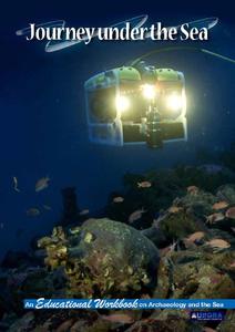
Discover the interesting world of maritime archaeology and explorations under the sea with this nice set of worksheets, which cover such topics as search tools and techniques of underwater archaeology, carbon dating, vessel types, and...
Curated OER
Geography: Analyzing the Local Environment
Students, in groups, explore the school grounds and organize their findings according to the five themes of geography. They take notes and sketch the grounds. Students divide the school and grounds into regions based on use.
Curated OER
In Celebration of the Silk Road
Sixth graders explore the ancient trade routes of the Silk Road with a focus on a province in China to identify artifacts and research how these items arrived in the city of Turpan.
Curated OER
Polar Day: Living in the Canadian North
Pupils study the Canadian North. In this Canadian North lesson, students study the physical characteristics and the lifestyles of people in that region. Pupils complete map making and creative activities that help them learn about...
Curated OER
Back-to-school ESL Ideas
Pupils share their countries and languages, flags, cultural identity, and pride in home culture.
Curated OER
Connections Between World Events, Geography and the Human Quest for Knowledge
Students examine the relationship between innovations in geography and world events. Using maps, they report different information from a spatial perspective. They develop hypothesis about how man's quest for knowledge has impacted the...
Curated OER
Context for Exploration
Young scholars examine watershed maps from the Columbia River. They practice using maps and create their own watershed map. They share their map with the class.
Curated OER
the Bronze Bow By Elizabeth George Speare
Sixth graders learn about how Rome occupied ancient Palestine around 35 BC to 35 AD through cartography mathematics, creative writing and art.


