Curated OER
America and the Sino-Japanese Conflict, 1933-1939
Students examine the U.S. stance regarding the Sino-Japanese conflict. In this diplomacy lesson, students analyze the sanctions employed by United States on Japan when they took over Manchuria. Students determine how actions by the...
California Academy of Science
Rapid Brainstorming: How Can We Improve Our Global Food System?
In 2018, the average fast food burger cost $2.64 while a salad averaged $4.14. Does the price difference matter to public health? Scholars consider that question and others in a brainstorming session about improving our global food...
Curated OER
Tooling Around Arizona: Reading Arizona Maps
Students research Arizona maps. In this map lesson, students discuss map titles, scales, directions, elevation, and symbols. The class will examine topography, landforms, and rivers found on an Arizona map.
Curated OER
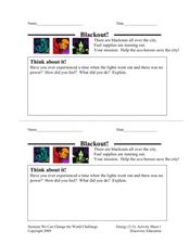
Blackout!
For this blackout situational worksheet, students recall an experience when there was no power, share their feelings and reactions, and explain their answers. Students write three answers.
Curated OER
The Persian Empire
In this the Persian empire worksheet, students read a two page passage about Persia, then answer 5 multiple choice and 7 short answer questions requiring research about the topic.
Curated OER
Tolerating Diversity
Students examine the meanings of tolerance and intolerance and participate in a "town hall meeting". They analyze quotations about tolerance and connect them to their personal experiences.
Curated OER
Trade in the Ancient Mediterranean
Students begin the lesson by locating cities and other points of interest in the ancient world. In groups, they use the internet to research the types of ships used during this time period and discuss the reasons why trade was used. ...
Curated OER
Archaeology For Kids Quiz 13
In this archaeology for kids quiz 13 learning exercise, learners interactively answer 5 multiple choice questions about ancient / old things as part of an online magazine.
Curated OER
The Code of Hammurabi
Students use the guiding questions to accomplish the lesson plan objectives. They will know the purposes for the establishing of The Codes and how they were distributed throughout the ancient empire of Babylonia.
Curated OER
Geography: Intro to Canada
Students investigate the geography of Canada by analyzing a map of the country. In this North American geography lesson, students identify the 13 provinces of Canada and their locations by examining a Canadian map. Students may use...
Curated OER
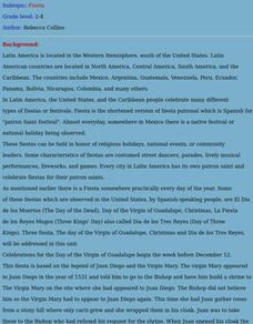
Fiesta
Students demonstrate an understanding of what a fiesta is by participating in various activities and conducting research.
Curated OER
Bison or Buffalo?
Students discover the difference between the terms of Bison and Buffalo and the history of the animal in the early years of the country. They uncover the difference in species depending on the area of the country where the Bison were...
Curated OER
Ancient Civilizations
For this social studies worksheet, 3rd graders find the words that are related to different civilizations and the answers are found at the bottom of the page.
Curated OER
Africa Puzzle
In this geography worksheet, learners complete a crossword puzzle about Africa. They identify the capitals of various countries located in Africa, the most fertile area, the largest desert, and the longest river. There are 19 questions...
Curated OER
Countries and Capitals Word Puzzle
In this countries and capitals worksheet, students search for the 21 capital cities from around the world that are listed at the bottom of the word puzzle.
Curated OER
South east Asia and the South Pacific: Political: Labeled Map
In this Asia and the South Pacific map worksheet, students examine the boundaries of the nations in this region of the world. Students also note the location of capital cities as they are denoted by stars. This map is labeled.
Curated OER
Central America: Unlabeled Map
In this Central American political map instructional activity, students examine the boundaries of the countries and capital cities located in this region of the world.
Curated OER
Asia and the South Pacific : Political Map
In this Asia and the South Pacific map worksheet, learners examine the boundaries of the nations in this region of the world. Students also note the location of capital cities as they are denoted by stars. Major bodies of water are labeled.
Curated OER
Picture Quiz: Famous Landmarks
In this picture quiz: famous landmarks worksheet, students look at 12 color photographs of famous landmarks around the world and identify the structure, the city and the country for each one.
Curated OER
Grade 5: Elementary Social Studies Test: Multiple Choice and Constructed-Response Questions
In this 5th grade social studies standardized test practice worksheet, students examine documents and tables. Students respond to 35 multiple choices and 11 short answer questions that require them to review their knowledge of ...
Curated OER
Grade 5: Elementary Social Studies Test: Multiple Choice and Constructed-Response Questions 2008
In this 5th grade social studies standardized test practice activity, students examine documents and tables. Students respond to 35 multiple choices and 11 short answer questions that require them to review their knowledge of ...
Curated OER
Grade 5: Elementary Social Studies Test: Document 2, 2008
In this 5th grade social studies standardized test practice worksheet, students examine documents and tables. Students respond to 1 essay and 5 short answer questions that require them to review their knowledge of social studies.
Curated OER
Grade 5: Elementary Social Studies Test: Multiple Choice and Constructed-Response Questions 2004
In this 5th grade social studies standardized test practice instructional activity, students examine documents and tables. Students respond to 35 multiple choices and 11 short answer questions that require them to review their...
Curated OER
Central America Outline Map
In this Central American political map activity, students make note of national boundaries and capitals in this region of the world. National capital city locations are noted with stars.


