Curated OER
Invent It!
Learners explore invention and unveiling of world's first Ferris wheel, analyze photographs and poster of first Ferris wheel, and discuss engineering achievements of Ferris wheel, including how it worked, how it was built, and its...
Curated OER
Coordinate Plane Transformations
Geometric transformations are explored by high schoolers. They will create a set of instructions for plotting coordinates representing an original transformation of a real-world figure. These instructions are shared with middle...
Curated OER
Money: Bucks, Banks, and Business
Put economics and currency exchange rates into a real-world application kids can understand. They'll compare bus fares from various cities around the world. Each child selects three international cities to research. They determine the...
Alabama Department of Archives and History
Inside the Wire: Internment of Prisoners of War in Alabama during World War II
Create an open environment of discussion and collaboration with several exercises in a thought-provoking resource. Pupils conduct a gallery walk and lead a discussion before filling out a question sheet and chart during the learning...
Radford University
Parallel Lines Cut By a Transversal
Perhaps planning a city isn't so difficult after all. Scholars first perform geometric constructions and investigate how parallel lines are useful in real-world situations. They then work on a city design project, drawing street maps,...
Curated OER
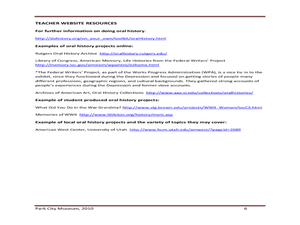
Oral History: Park City Museum
Bring U.S. history to your language arts class with this activity. Middle schoolers complete an interview for an oral history project, and discuss the importance of oral histories - and how they embellish written accounts. They write...
Center for History Education
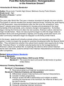
Post-War Suburbanization: Homogenization
The results of World War II made waves all the way to suburban life today. Examine the flight from the cities using images and documents from the 1950s building boom, including a quote analysis and political cartoons. The resource...
Curated OER
We've got the whole world in our hands
Students explore spatial sense in regards to maps about the globe. In this maps lesson plan, students label oceans, locate the continents and poles, follow directions, and explain the symbols on a map.
Curated OER
World War II
Sixth graders read Under the Blood Red Sun (UBRS), V is for Victory (V), and Number the Stars(NS). They examine WWII through the eyes of Japanese, Danish, and American students and complete at least two projects: a radio broadcast and a...
Curated OER
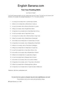
Is It Hot, Or Not?
In this reading worksheet, students answer 20 true/false questions about cities around the world. If an answer is false, students write the correct answer.
Curated OER
Urban Ecosystems 2: Why are There Cities? A Historical Perspective
Second in a series of five lessons, this lesson encourages preteens to consider cities as urban ecosystems. First, they keep a food diary for a few days. They visit the Natrional Agricultural Statistics Service website for current data...
Curated OER
Outsourcing City Hall
Students examine how some city halls around the country are using private companies to run them. After watching a video, they write a reaction paper to some part of it. They write an article for their school newspaper discussing whether...
Curated OER
Latitude on World Maps - World Map Activity 2
Students explore the concept of latitude. In this geography instructional activity, students discover the global grid system and complete a map activity which require them to record the latitude of various cities in the world.
Curated OER
The City-States of Greece
A background on ancient Greece and its city-states is the focus of this presentation. With facts about Greek geography, politics, and culture, these slides would be a good way to strengthen a lecture on ancient Greece or world cultures.
Curated OER
Akron: This City Reads
High schoolers write their thoughts about the value of reading and of Akron launching a city wide reading campaign. Students also research literacy in their own community, finding out how it compares to Akron's statistics where it has...
Curated OER
Module 3--Around the World
In this writing module worksheet, students fill out the opposites of eight adjectives describing towns/cities, fill in seven blanks in seven sentences with words from the word bank and write a paragraph comparing themselves to a friend...
Curated OER
Pets Around the World
Students communicate via e-mail with other students to learn about pets, animals of interest , and geography from different parts of the world. Vocabulary focuses on rural, urban, and suburban areas.
Curated OER
Stores and Shops: ESL Powerpoint
What kinds of stores and shops are in your town? Use this ESL presentation to reinforce the names of various stores, such as ice cream shop, meat market, and shoe store. Your English learners will see the world with new eyes the next...
Curated OER
Transportation from Around the World
Take a look at how people around the world get from here to there. Each slide provides an image and description of various types of transportation found around the globe. In Venice they use a boat, in San Francisco they use a Trolley...
Curated OER
The Spread of Printing
Document the spread of printing, which occurred in the 1500s. Use the provided list of water ways, countries, and cities to label specified locations on the map.
Curated OER
The Crimean War
Use the list of cities, countries, and water ways to correctly label a map of the regions associated with the Crimean War. There are approximately 20 locations to locate and identify.
Curated OER
Location of Cities 201
Students work in pairs to locate the ancient cities on a world atlas using the longitude and latitude measurements. They examine the physical and human futures that explain their locations.
Mrs. Burke's Math Page
The Amazing Pi Race
Add a sense of excitement to your math class with this race across the country. Using their knowledge of all things circular, young mathematicians work in pairs answering a series of pi-related word problems as they hop from one city to...
It's About Time
Present-Day Climate in Your Community
So what exactly is climate? This first installment of a six-part series introduces the concept of climate using real-world data tables and topographic maps. The timely lesson includes a comprehensive overview of climate, as well as...


