Curated OER
Meteorologist for the Day
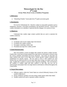
Fourth graders examine the symbols used on weather maps. They analyze a newspaper weather forecast and identify and discuss the various symbols used on the map. Next, they prepare a weather map for their own city using the symbols...
Curated OER
Interpreting Your Data
In this water quality sampling learning exercise, students organize and analyze their data from samples they have collected. After analyzing based on 9 guide questions, they complete 18 short answer questions about fish, benthic, and...
Curated OER
Probing Under the Surface
Eighth graders use a measuring stick to determine the shape of the inside of the bottom of a box, then apply their knowledge to an additional situation. This task assesses students' abilities to make simple observations, collect and...
Curated OER
Sunlight & Soil
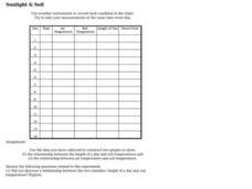
In this earth science worksheet on sunlight and soil, learners use data collected in a chart to construct two graphs. Following, they answer five questions as they relate to the experiment performed.
Curated OER
Jumping to Conclusions
Students decide as a class what their data is going to be to graph. In this math lesson, students organize data so that it will be easier to display in a graph. Students are guided through the process by their teachers, and helped with...
Curated OER
Lead Detection
Students explore one method for the detection of lead in soil. The detection of the presence of lead in soil can be determined sensitively using inexpensive swabs. Pupils collect several spoonfuls of soil from various parts of their...
Curated OER
Ready, Set, Drift!
Students define data, recover data from the Internet, and use information they obtain to solve problems. In this investigative instructional activity students answer questions on a worksheet and demonstrate the use of a maneuvering...
Curated OER
Formation of Rain
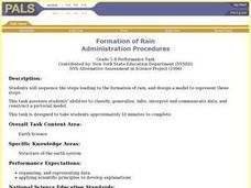
Students sequence the steps leading to the formation of rain, and design a model to represent these steps. This task assesses students' abilities to classify, generalize, infer, interpret and communicate data, and construct a pictorial...
Curated OER
Range, Mean, Median, and Mode
Eighth graders find the range, median, mean, and mode of a data set. In this finding the range, median, mean, and mode of a data set lesson, 8th graders collect data about the high and low temperature for 10 different cities. Students...
Curated OER
Dripping Wet or Dry as a Bone?
Students use a sponge and water model to explore the concept of relative humidity and create a percent scale. They define humidity and saturation, build a simple humidity/saturation model, collect, predict and interpret data, and create...
Curated OER
Creating Station Models
Learners review weather conditions at various cities and create station models on a weather map.
Curated OER
Good News - We're on the Rise!
Students build and observe a simple aneroid barometer to discover changes in barometric pressure and weather forecasting. They graph changes in barometric pressure for two weeks and make weather predictions.
Curated OER
Scatter Plots
Seventh graders investigate how to make and set up a scatter plot. In this statistics lesson, 7th graders collect data and plot it. They analyze their data and discuss their results.
Curated OER
Land Erosion - Does Vegetation Matter?
Young learners explore erosion, deposition, weather and climate in this science instructional activity. They discuss the cause of erosion, collect data and analyze it suing the TI Explorer. They can also use the TI CBL or Vernier LabPro...
Curated OER
Gathering Weather Information
Students watch a video of a recent weather disaster. Using the internet, they work together to examine the weather forecast for tomorrow and next week and discuss why it is important to know the weather. In groups, they use weather...
Curated OER
Weather
Learners collect daily weather types throughout the school year using a spreadsheet program and Meteorologist freeware in order to predict weather changes and compare seasons. An Appleworks worksheet is included.
Curated OER
What's up with the weather?
Students use the weather as a context for collecting data and making interpretations based upon the observations. The scientific method is also taught to give them a way to conduct the data collection.
Curated OER
Earth's Weather
Seventh graders learn how solar radiation, latitude, and other factors affect weather. They break into six groups and are assigned a topic to research and to present their findings orally.
Curated OER
Record the Data and Find the Averages
Pupils record the daily outdoor temperature as well as the number of minutes of sunlight per day over a determined period. They calculate the average temperature and minutes of sunlight per day and post their data on the project website.
Discovery Education
Sonar & Echolocation
A well-designed, comprehensive, and attractive slide show supports direct instruction on how sonar and echolocation work. Contained within the slides are links to interactive websites and instructions for using apps on a mobile device to...
National Wildlife Federation
Citizen Science to the Rescue!
You don't have to be a scientist or even out of high school to contribute to scientific research. In the 12th lesson in the series of 21, scholars use this opportunity to add to the growing body of scientific knowledge and consider the...
National Wildlife Federation
What is DBH?
When measuring the circumference of a tree, does it matter how high you place the measuring tape? Most scholars have never considered this question, but scientists know that measurement techniques must be standardized. The 13th...
Science 4 Inquiry
Temperature of Inner Planets
Mars, Earth, and Venus contain atmospheres that generate weather. Young scientists explore the temperature of inner planets. They create a model simulating the greenhouse effect before researching and answering guided questions to...
Curated OER
Using Radiosonde Data From a Weather Balloon Launch
Student use radiosonde data from a weather balloon launch to distinguish the characteristics of the lower atmosphere. They learn the layers of the atmosphere. They graph real atmospheric data.


