NASA
Tools to Study Tornadoes and Galaxies
Take your class on an intergalactic journey as they explore the galaxy and various meteorological events taking place in our atmosphere each day. Learners investigate electromagnetic waves and the Doppler Effect before gathering radar...
Curated OER
How Does Water Cause Weathering?
Fourth graders explore the weathering process of water on rocks. They observe how water and friction from other rocks cause them to weather. Students discuss examine and discuss various rocks found on the playground, beach, etc. They...
Curated OER
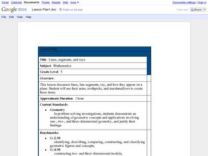
Lines, Segments, and Rays
Fifth graders use their arm, toothpicks, and marshmallows to create lines, segments, and rays. In this lines, segments, and rays lesson plan, 5th graders learn how these appear on a plane.
Curated OER
Four Seasons
Students investigate the four seasons in a year. In this seasons lesson, students explore the weather during each season. Students illustrate each season with pictures.
Curated OER
Properties of Soil
Fourth graders conduct investigations to test different types of soil from different regions of Texas. They make comparisons and identify the characteristics of the soil. The end product of the inquiry is a student report.
Curated OER
Rock Around the World
Students take pictures and write a paragraph about a rock they have found. In this rock lesson plan, students also send their information to the Mars Space Flight Facility.
Curated OER
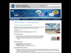
A Comparison of Land and Water Temperature
Young scholars examine NASA satellite observations of surface temperature and investigate the seasonal changes of land and water temperature.
Curated OER
Stick-Slip Movement
Ninth graders operate a model to observe the type of motion that occurs at a fault during an earthquake. They explore the effects of several variables. Students measure movement, calculate averages and plot and graph information.
Curated OER
Go To The Head of the Cloud
Young scholars pretend they are water droplets traveling through the water cycle. Using their text, they discover the steps in the cycle and the different paths water can take. They write a report about their journey through the water...
Curated OER
Developing, Developing, Developed!
High schoolers differentiate among and explain various levels of economic development around the world. They see that levels of economic development vary greatly in different countries according to many different measures.
Curated OER
Deep Gardens
Marine biology beginners read about the 2005 Florida Coast Deep Corals expedition, research phylum Cnidaria, and then report on a specific coral deep-sea coral group. There is an abundance of background information and internet resources...
NASA
Solar System Scale & Size
Use a variety of whole fruits to represent the different planets in the solar system to introduce scale sizes to your math or space science class. They follow suit by creating a non-scaled model of the solar system using specific-colored...
Wild BC
The Greenhouse Effect: The Role of CO2
Though this is meant to be second in a two-part lesson, the two are not dependent on each other. Pupils play the roles of visible light rays, light or dark surfaces, and carbon dioxide molecules. They interact and react according to...
Curated OER
Using Different Kinds of Maps
Third graders explore the landforms and population diversity. They read maps and examine geographic terms. Students create their own map of the United States and answer questions about the location of people. After exploring the map, 3rd...
Curated OER
Vocabulary: Multiple Meaning Words in Context
Learners use context clues to define words with multiple meanings. After extensive practice with their teacher, learners read through six sentences, they then identify a word with a multiple meaning, and determine its meaning based on...
University of Colorado
Phases of Charon
Charon, the largest of Pluto's moons, was discovered in 1978. Lesson is a walk through of how to solve for the phases of Charon. It uses two different points on Pluto and takes into account the tilt of the pole, the rotational axis, and...
Curated OER
Apple Energy
Ninth graders evaluate the energy associated with the production of five different forms of apple products. They develop a poster to advertise one of the five apple products to the class. Students provide additional examples of consumer...
Curated OER
The Hudson's Ups and Downs
Even rivers have tides. Older elementary schoolers will discuss the Hudson River and how weather, water craft, and the ocean cause tidal fluctuation. They will examine a series of line graphs that depict tidal fluctuation, then analyze...
Curated OER
Crystal Growing
Students grow crystals and document their observations by recording timeing and growth. Additional characteristics of crystals are observed under a black light, by growing under different conditions and mineral content is determined.
Curated OER
Proportions and Scale Factor for Measurement
Students explore the concept of proportion. In this proportion lesson, students use google maps to find the distance the their school is from home. Students discuss what a scale factor is through teacher led discussion. Students...
Curated OER
Geography and our Family Favorites
Students talk with older family members about favorite family foods and where they have originated. They learn the process that went into the preparation and cooking of these foods and contrast how technology has affected food...
Curated OER
Wow! You're Eating Geography
Students examine patterns of food producing areas, and identify foods that are grown locally, in the U.S., and around the world. They map and graph the major food crops of their local area, the U.S., and other countries, and discuss the...
Curated OER
Chart Making for Navigators
Students discuss the importance and function of nautical maps for sailors. They, in groups, take soundings of a simulated bay in a shoebox and develop a nautical chart that enable them to navigate the shoebox safely.
Curated OER
Charting Neptune's Realm: Profiles
Students identify and describe the importance of nautical profiles in early navigation. They draw a profile of a street or mall and explore the effectiveness of different types of directions.


