Curated OER
Exercise 23--the Regular Pentagon on a Given Side
Pupils examine and study how to recognize the characteristics of a regular pentagon and demonstrate how to construct one. They become aware of associating a regular pentagon to its term of a double map and practice the concept of line...
Curated OER
Blowing in the Wind
Students identify and interpret maps, graphs, charts, tables and political cartoons. Students identify what a compass rose is and review its meaning in relation to standard directions. Students design their own weathervanes. Students...
Curated OER
Blue Jazz Scale
Students engage in a study of music that includes the Blue Jazz scale. They listen to pieces of music in the targeted style while becoming familiar with the scale. Students then describe how the scale is built and demonstrate by playing...
Curated OER
How Did This Happen?
Students use websites and discussion to investigate the 2004 Asian Tsunami. Students identify the Indian Ocean coastline's physical, political and human geography features and consider how they affected loss of life and property in those...
Curated OER
Geography: Map Making
Students, working in groups, share notes and maps collected during a study of the Lewis and Clark Expedition. They draw large composite maps of the western United States on butcher paper including land formations, bodies of water, and...
Curated OER
State Research
Learners apply previous knowledge of the United States to label a classroom map and then work independently to complete an online scavenger hunt. This lesson is intended for an upper-elementary classroom studying American History and/or...
Curated OER
Mini-Squares of Life
Students brainstorm to decide the best way to mark off square areas (that they will later study) that are smaller than one meter. They compare the suitability of different designs and create "mini-square markers." Finally, they test...
Curated OER
Visual Arts
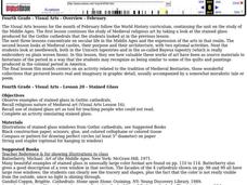
Fourth graders study the stained glass produced for the Gothic cathedrals, needlework, castles, and tapestry of the Middle Ages.
Curated OER
Chinese Inventions A Selected History of Science and Invention in China
Pupils study the history of Chinese technology by identifying when and where items were invented or discovered.
Curated OER
Exploring the Various Regions of Boyle Heights: Continuity and Change
Student study the local landscape of Boyle Heights, California and draw a sketch of the area. Students use map making skills in this activity. Studient make a portfolio of information and photographs they accumulate over time on the area.
Curated OER
Make Your Own "Weather" Map
High schoolers create their own "weather" map using data from x-ray sources. They analyze and discuss why it is important to organize data in a fashion in which is easy to read. They compare and contrast different x-ray sources using a...
Curated OER
Math: a World of Symmetry
Young scholars expand their knowledge of quadrilaterals and identify basic symmetrical forms. Over three weeks, they explore the math, application, and discussion of symmetry. After conducting Internet research, students create...
Curated OER
Making a Region Map of a State
Fourth graders create salt maps of a state and indicate its regions. They include topographical elements including mountains, valleys, lowlands and major water bodies and a compass rose.
Curated OER
Draw A Coastline
Learners identify, locate and draw at least ten different geographical features on a map. Using the map, they must make it to scale and include their own legend and compass rose. They share their map with the class and answer questions.
Curated OER
Mapping With MapPoint
The class is engaged through a discussion of mapping. They determine what they believe makes a good map and what the essential elements of a map are. Students work independently to complete a worksheet on mapping. They follow clear...
Curated OER
Navigating Your Community
Students draw a map from memory describing the route between their classroom and the gym including a legend, a compass rose, a map scale, symbols, and a landmark at every change of direction. They then retrace their steps in their maps...
Curated OER
Outdoor Education
Students participate in various outdoor activities to teach them about the environment. In this outdoor education lesson plan, students participate in activities such as compass direction, conservation, forestry, wildlife, and...
Curated OER
Weather Conditions During the Spring Monarch Migration
High schoolers keep a detailed record of weather patterns during the spring migration of the monarch butterfly. The use of weather reports is used to form a class data sheet. This lesson connects to the skills of graphing and critical...
Curated OER
Student Weather Journal
Students recognize different types of cloud patterns and associate these patterns with certain types of weather. They predict the weather for the next 6 to 24 hours. They then improve their observation skills as they check on the weather...
Curated OER
Exploration Activities
Students examine the stages in finding, removing, and processing mineral resources. They participate in the "Exploration Hunt" and "Leasing Mineral Rights" activities to better get a handle on their studying.
Curated OER
Chart Interpretation
Learners study the use of a nautical chart and how to obtain information from it. They describe and differentiate the basic topographic characteristics of a chart and demonstrate the use of nautical tools used to plot fixed points on a...
Curated OER
The Importance of Trade Routes
In this cultural diffusion study guide worksheet, students read a brief overview pertaining to the significance of trade routes and then respond to a reflection question.
Curated OER
Wilderness Training
Students explore how to prepare for a wilderness journey. In this wilderness survival lesson, students construct a compass from a magnet and a sewing needle.
Curated OER
Cartography
Young scholars research about cartography and how to be a cartographer. In this math lesson, students draw a map of their classroom. They use a robot to explore navigation using a compass rose.
Other popular searches
- Compass Skills Worksheets
- Compass Skills 3rd Grade
- Compass Skills First Grade
- Compass Skills Elementary
- Map and Compass Skills
- Compass Skills Lesson Plans
- Map Compass Skills
- Math Compass Skills
- Tecahing Compass Skills
- Decaying Compass Skills
- Compass Skills Yr 10
- Math Compass Skills Triangle


